Login
Register


JYR
York Municipal Airport
Official FAA Data Effective 2026-02-19 0901Z
Chart Supplement

VFR Chart of KJYR
Sectional Charts at SkyVector.com
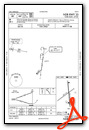
IFR Chart of KJYR
Enroute Charts at SkyVector.com
Location Information for KJYR
Coordinates: N40°53.79' / W97°37.44'Located 01 miles NW of York, Nebraska on 467 acres of land. View all Airports in Nebraska.
Surveyed Elevation is 1669 feet MSL.
Operations Data
|
|
Airport Communications
| AWOS-3: | 124.175 Tel. 402-362-3785 |
|---|---|
| CTAF: | 122.800 |
| UNICOM: | 122.800 |
| AWOS-3 at AUH (16.8 W): | 121.225 402-694-5472 |
| ASOS at GRI (31.4 W): | 308-314-0825 |
| ATIS at GRI (31.4 W): | 127.4 |
- APCH/DEP SVC PRVDD BY MINNEAPOLIS ARTCC ON FREQ 119.4/278.8 (HASTINGS RCAG).
Nearby Navigation Aids
|
| ||||||||||||||||||||||||||||||||||||||||||||||||||||||||||||


Runway 17/35
| Dimensions: | 5900 x 100 feet / 1798 x 30 meters | |
|---|---|---|
| Surface: | Concrete in Good Condition | |
| Weight Limits: | S-30, D-38 | |
| Edge Lighting: | Medium Intensity | |
| Runway 17 | Runway 35 | |
| Coordinates: | N40°54.29' / W97°37.43' | N40°53.32' / W97°37.31' |
| Elevation: | 1664.8 | 1669.7 |
| Runway Heading: | 175° True | 355° True |
| Displaced Threshold: | 400 Feet | |
| Declared Distances: | TORA:5900 TODA:5900 ASDA:5500 LDA:5900 | TORA:5900 TODA:5900 ASDA:5900 LDA:5500 |
| Markings: | Non-Precision Instrument in good condition. | Non-Precision Instrument in good condition. |
| Glide Slope Indicator | P2L (3.00° Glide Path Angle) | P2L (3.00° Glide Path Angle) |
| REIL: | Yes | Yes |
| Obstacles: | 46 ft Pole 1437 ft from runway, 172 ft left of center RWY 35 APCH SLOPE 50:1 DUE TO 12 FT ROAD 1020 FT FROM DSPLCD THLD. |
12 ft Road 620 ft from runway |
Runway 05/23
NOT PLOWED WINTER MONTHS. | ||
| Dimensions: | 4481 x 150 feet / 1366 x 46 meters | |
|---|---|---|
| Surface: | Turf in Good Condition | |
| Runway 05 | Runway 23 | |
| Coordinates: | N40°53.54' / W97°37.94' | N40°53.98' / W97°37.15' |
| Elevation: | 1665.2 | 1664.7 |
| Runway Heading: | 54° True | 234° True |
| Obstacles: | 50 ft Pole 1004 ft from runway, 219 ft left of center RWY 05 CNTR PIVOT ROTATES INTO APCH DURING IRRIGATION SEASON. |
40 ft Power Line 829 ft from runway, 113 ft right of center |
Services Available
| Fuel: | 100LL (blue), Jet-A |
|---|---|
| Transient Storage: | Hangars,Tiedowns |
| Airframe Repair: | MINOR |
| Engine Repair: | MINOR |
| Bottled Oxygen: | NOT AVAILABLE |
| Bulk Oxygen: | NOT AVAILABLE |
| Other Services: | CROP DUSTING SERVICES |
Ownership Information
| Ownership: | Publicly owned | |
|---|---|---|
| Owner: | CITY OF YORK | |
| PO BOX 276 | ||
| YORK, NE 68467-0276 | ||
| 402-363-2600 | ||
| Manager: | RANDY HALL | RANDY HALL AIRPORT OPS MANAGER |
| 1112 HWY 34 | ||
| YORK, NE 68467-3512 | ||
| 402-366-5876 | ||
Other Remarks
- RY 35 DESIGNATED AS CALM WIND RY.
- FOR CD CTC MINNEAPOLIS ARTCC AT 651-463-5588.
- ACTVT REIL RWY 17 & 35; PAPI RWY 17 & 35; MIRL RWY 17/35 - CTAF.
Weather Minimums


Instrument Approach Procedure (IAP) Charts


Nearby Airports with Instrument Procedures
| ID | Name | Heading / Distance | ||
|---|---|---|---|---|
 |
KAUH | Aurora Municipal/Al Potter Field Airport | 269° | 16.9 |
|
KFMZ | Fairmont State Airport | 172° | 18.8 |
|
07K | Central City Municipal/Larry Reineke Field Airport | 303° | 23.3 |
|
KSWT | Seward Municipal Airport | 094° | 23.5 |
|
08K | Harvard State Airport | 234° | 25.4 |
|
93Y | David City Municipal Airport | 048° | 30.3 |
|
KGRI | Central Nebraska Regional Airport | 278° | 31.5 |
|
KOLU | Columbus Municipal Airport | 021° | 35.5 |
|
KCEK | Crete Municipal Airport | 117° | 35.9 |
|
KLNK | Lincoln Airport | 093° | 39.5 |
|
KHSI | Hastings Municipal Airport | 244° | 40.6 |
|
KHJH | Hebron Municipal Airport | 177° | 44.7 |
Airport Images
Do you have a recent image of this airport? Upload it here!


