Login
Register


08K
Harvard State Airport
Official FAA Data Effective 2026-01-22 0901Z
Chart Supplement

VFR Chart of 08K
Sectional Charts at SkyVector.com
IFR Chart of 08K
Enroute Charts at SkyVector.com
Location Information for 08K
Coordinates: N40°39.08' / W98°4.79'Located 02 miles NE of Harvard, Nebraska on 1102 acres of land. View all Airports in Nebraska.
Surveyed Elevation is 1814 feet MSL.
Operations Data
|
|
Airport Communications
| CTAF: | 122.900 |
|---|---|
| AWOS-3 at AUH (15.1 N): | 121.225 402-694-5472 |
| ASOS at HSI (16.1 W): | 120.525 402-463-4029 |
| ASOS at GRI (21.7 NW): | 308-314-0825 |
- APCH/DEP SVC PRVDD BY MINNEAPOLIS ARTCC ON FREQS 119.4/278.8 (HASTINGS RCAG).
Nearby Navigation Aids
|
| ||||||||||||||||||||||||||||||||||||||||||||||||||||||||||||


Runway 14/32
| Dimensions: | 3873 x 150 feet / 1180 x 46 meters | |
|---|---|---|
| Surface: | Turf in Fair Condition | |
| Runway 14 | Runway 32 | |
| Coordinates: | N40°39.39' / W98°4.88' | N40°38.86' / W98°4.41' |
| Elevation: | 1810.1 | 1808.4 |
| Traffic Pattern: | Left | Left |
| Runway Heading: | 147° True | 327° True |
Runway 17/35
| Dimensions: | 3722 x 60 feet / 1134 x 18 meters | |
|---|---|---|
| Surface: | Asphalt in Good Condition | |
| Edge Lighting: | Medium Intensity | |
| Runway 17 | Runway 35 | |
| Coordinates: | N40°39.34' / W98°4.95' | N40°38.73' / W98°4.95' |
| Elevation: | 1814.1 | 1806.2 |
| Traffic Pattern: | Left | Left |
| Runway Heading: | 180° True | 360° True |
| Markings: | Non-Precision Instrument in good condition. | Non-Precision Instrument in good condition. |
Services Available
| Fuel: | 100LL (blue) |
|---|---|
| Transient Storage: | Tiedowns |
| Airframe Repair: | NONE |
| Engine Repair: | NONE |
| Bottled Oxygen: | NONE |
| Bulk Oxygen: | NONE |
| Other Services: | CROP DUSTING SERVICES |
Ownership Information
| Ownership: | Publicly owned | |
|---|---|---|
| Owner: | NEBR. DOT, DIVISION OF AERONAUTICS | |
| 1600 NEBRASKA PARKWAY | ||
| LINCOLN, NE 68502-4101 | ||
| 402-471-2371 | ||
| Manager: | TIM KRIENERT | |
| 13 AIRBASE ROAD, FAIRMONT STATE AIRFIELD | ||
| FAIRMONT, NE 68354-4057 | ||
| 402-266-1890 | ||
Other Remarks
- FOR CD CTC MINNEAPOLIS ARTCC AT 651-463-5588.
- 0LL CTC AMGR FOR FUEL; CASH OR CK ONLY 402-266-1890.
- ACTVT MIRL RWY 17-35 - CTAF.
Weather Minimums

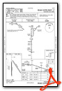
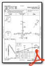
Instrument Approach Procedure (IAP) Charts
Nearby Airports with Instrument Procedures
| ID | Name | Heading / Distance | ||
|---|---|---|---|---|
 |
KAUH | Aurora Municipal/Al Potter Field Airport | 014° | 15.1 |
|
KHSI | Hastings Municipal Airport | 260° | 16.1 |
|
KGRI | Central Nebraska Regional Airport | 331° | 21.7 |
|
KFMZ | Fairmont State Airport | 099° | 23.5 |
|
KJYR | York Municipal Airport | 054° | 25.4 |
|
07K | Central City Municipal/Larry Reineke Field Airport | 002° | 27.6 |
|
12K | Superior Municipal Airport | 178° | 36.3 |
|
KHJH | Hebron Municipal Airport | 142° | 37.6 |
|
7V7 | Red Cloud Municipal Airport | 211° | 40.2 |
|
0V3 | Pioneer Village Field Airport | 258° | 40.4 |
|
KEAR | Kearney Regional Airport | 276° | 42.5 |
|
KSWT | Seward Municipal Airport | 073° | 46.1 |
Airport Images
Do you have a recent image of this airport? Upload it here!


