Login
Register
0M2
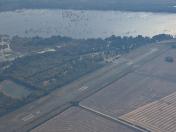
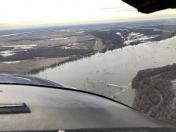
Reelfoot Lake Airport
Official FAA Data Effective 2025-12-25 0901Z
VFR Chart of 0M2
Sectional Charts at SkyVector.com
IFR Chart of 0M2
Enroute Charts at SkyVector.com
Location Information for 0M2
Coordinates: N36°28.52' / W89°20.78'Located 09 miles NE of Tiptonville, Tennessee on 98 acres of land. View all Airports in Tennessee.
Estimated Elevation is 289 feet MSL.
Operations Data
|
|
Airport Communications
| CTAF: | 122.900 |
|---|---|
| AWOS-3 at UCY (18.3 E): | 135.325 731-885-9161 |
| AWOS-3 at SIK (27.5 N): | 119.175 573-471-7371 |
| AWOS-3PT at DYR (28.9 S): | 135.625 731-287-0300 |
Nearby Navigation Aids
|
| ||||||||||||||||||||||||||||||||||||||||||||||||||||||||||||
Runway 01/19
| Dimensions: | 3500 x 75 feet / 1067 x 23 meters | |
|---|---|---|
| Surface: | Asphalt / Rubberized Friction Seal Coated in Excellent Condition | |
| Weight Limits: | S-25, D-37 | |
| Runway 01 | Runway 19 | |
| Coordinates: | N36°28.23' / W89°20.82' | N36°28.81' / W89°20.74' |
| Elevation: | 287.0 | 288.0 |
| Traffic Pattern: | Left | Right |
| Runway Heading: | 7° True | 187° True |
| Markings: | Basic in good condition. | Basic in good condition. |
| Obstacles: | 35 ft Trees 667 ft from runway, 125 ft left of center | 105 ft Fence 2294 ft from runway, 194 ft left of center |
Services Available
| Fuel: | NONE |
|---|---|
| Transient Storage: | Tiedowns PILOT PRVD OWN TIEDOWN ROPE. |
| Airframe Repair: | NOT AVAILABLE |
| Engine Repair: | NOT AVAILABLE |
| Bottled Oxygen: | NOT AVAILABLE |
| Bulk Oxygen: | NOT AVAILABLE |
| Other Services: | CROP DUSTING SERVICES |
Ownership Information
| Ownership: | Publicly owned | |
|---|---|---|
| Owner: | TDOT OFFICE OF AERONAUTICS | |
| 7335 CENTENNIAL BLVD | ||
| NASHVILLE, TN 37209 | ||
| 615-741-1680 | ||
| Manager: | BILL BURNEY | |
| 7335 CENTENNIAL BLVD | ||
| NASHVILLE, TN 37209 | ||
| 615-741-1680 | ||
Other Remarks
- MNTN 2000 FT OVR LAKE E OF ARPT.
- FOR CD CTC MEMPHIS ARTCC AT 901-368-8453/8449.
Nearby Airports with Instrument Procedures
| ID | Name | Heading / Distance | ||
|---|---|---|---|---|
 |
KEIW | County Memorial Airport | 286° | 12.8 |
 |
KUCY | Everett-Stewart Regional Airport | 108° | 18.4 |
 |
1M7 | Fulton Airport | 081° | 20.9 |
 |
KCHQ | Mississippi County Airport | 358° | 22.0 |
 |
M05 | Caruthersville Memorial Airport | 221° | 24.3 |
 |
M85 | Gideon Memorial Airport | 266° | 27.1 |
 |
KSIK | Sikeston Memorial Municipal Airport | 337° | 27.4 |
 |
KDYR | Dyersburg Regional Airport | 185° | 28.8 |
 |
KMAW | Malden Regional Airport | 283° | 32.1 |
 |
M12 | Steele Municipal Airport | 227° | 33.7 |
 |
KDXE | Dexter Municipal Airport | 302° | 33.9 |
 |
KCIR | Cairo Regional Airport | 009° | 35.8 |


