Login
Register


DXE
Dexter Municipal Airport
Official FAA Data Effective 2026-02-19 0901Z
Chart Supplement

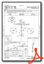
VFR Chart of KDXE
Sectional Charts at SkyVector.com
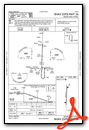
IFR Chart of KDXE
Enroute Charts at SkyVector.com
Location Information for KDXE
Coordinates: N36°46.53' / W89°56.47'Located 02 miles SE of Dexter, Missouri on 840 acres of land. View all Airports in Missouri.
Surveyed Elevation is 304 feet MSL.
Operations Data
|
|
Airport Communications
| UNICOM: | 122.700 |
|---|---|
| CTAF: | 122.700 |
| AWOS-3PT at MAW (11.1 S): | 119.825 573-276-9970 |
| ASOS at POF (18.3 W): | 124.225 573-598-8719 |
| AWOS-3 at SIK (19.7 E): | 119.175 573-471-7371 |
- APCH/DEP SVC PRVDD BY MEMPHIS ARTCC ON FREQS 133.65/292.15 (PADUCAH RCAG).
Nearby Navigation Aids
|
| ||||||||||||||||||||||||||||||||||||||||||||||||||||||||||||


Runway 18/36
| Dimensions: | 5000 x 100 feet / 1524 x 30 meters | |
|---|---|---|
| Surface: | Asphalt in Fair Condition | |
| Weight Limits: | S-30 | |
| Edge Lighting: | Medium Intensity | |
| Runway 18 | Runway 36 | |
| Coordinates: | N36°46.94' / W89°56.46' | N36°46.11' / W89°56.49' |
| Elevation: | 304.4 | 296.9 |
| Traffic Pattern: | Right | |
| Runway Heading: | 182° True | 2° True |
| Markings: | Non-Precision Instrument in poor condition. | Non-Precision Instrument in poor condition. |
| Glide Slope Indicator | P2L (2.98° Glide Path Angle) | P2L (3.01° Glide Path Angle) |
| Obstacles: | 84 ft Tree 2300 ft from runway, 275 ft left of center | |
Services Available
| Fuel: | 100LL (blue), Jet-A |
|---|---|
| Transient Storage: | Tiedowns |
| Airframe Repair: | MINOR |
| Engine Repair: | MINOR |
| Bottled Oxygen: | NONE |
| Bulk Oxygen: | NONE |
Ownership Information
| Ownership: | Publicly owned | |
|---|---|---|
| Owner: | CITY OF DEXTER | |
| 301 E STODDARD ST | ||
| DEXTER, MO 63841 | ||
| 573-624-5959 | ||
| Manager: | MIKE WILLIAMS | |
| 301 E. STODDARD STREET | ||
| DEXTER, MO 63841 | ||
| 573-624-0018 | ||
Other Remarks
- CROP DUSTING ACFT ON & INVOF ARPT.
- MODEL AIRPLANE ACTIVITY ON & INVOF ARPT.
- FOR CD CTC MEMPHIS ARTCC AT 901-368-8453/8449.
- MARKINGS SEVERLY FADED
- MARKINGS SEVERLY FADED
- 0LL 24-HR SELF-SERVICE CREDIT CARD FOR FUEL.
- 24-HR SELF-SERVICE CREDIT CARD FOR FUEL
- ACTVT PAPI RWY 18 & 36; MIRL RWY 18/36 - CTAF.
- UNICOM UNMON.
Weather Minimums

Instrument Approach Procedure (IAP) Charts
Nearby Airports with Instrument Procedures
| ID | Name | Heading / Distance | ||
|---|---|---|---|---|
 |
KMAW | Malden Regional Airport | 193° | 10.9 |
|
KPOF | Poplar Bluff Regional Business Airport | 269° | 18.5 |
|
KSIK | Sikeston Memorial Municipal Airport | 067° | 19.7 |
|
M85 | Gideon Memorial Airport | 174° | 20.0 |
|
KEIW | County Memorial Airport | 131° | 21.9 |
|
KCHQ | Mississippi County Airport | 081° | 28.3 |
|
KCGI | Cape Girardeau Regional Airport | 033° | 32.3 |
|
KTKX | Kennett Memorial Airport | 188° | 33.3 |
|
M05 | Caruthersville Memorial Airport | 160° | 38.5 |
|
KCIR | Cairo Regional Airport | 063° | 38.8 |
|
4M9 | Corning Municipal Airport | 237° | 40.8 |
|
M12 | Steele Municipal Airport | 174° | 40.9 |
Airport Images
Do you have a recent image of this airport? Upload it here!


