Login
Register


MAW
Malden Regional Airport
Official FAA Data Effective 2026-02-19 0901Z
Chart Supplement

VFR Chart of KMAW
Sectional Charts at SkyVector.com
IFR Chart of KMAW
Enroute Charts at SkyVector.com
Location Information for KMAW
Coordinates: N36°35.89' / W89°59.55'Located 03 miles N of Malden, Missouri on 2740 acres of land. View all Airports in Missouri.
Surveyed Elevation is 295 feet MSL.
Operations Data
|
|
Airport Communications
| AWOS-3PT: | 119.825 Tel. 573-276-9970 |
|---|---|
| UNICOM: | 122.800 |
| CTAF: | 122.800 |
| ASOS at POF (18.9 NW): | 124.225 573-598-8719 |
| AWOS-3PT at TKX (22.7 S): | 119.05 573-888-9640 |
| AWOS-3 at SIK (27.5 NE): | 119.175 573-471-7371 |
- APCH/DEP SVC PRVDD BY MEMPHIS ARTCC ON FREQS 133.65/292.15 (PADUCAH RCAG).
Nearby Navigation Aids
|
| ||||||||||||||||||||||||||||||||||||||||||||||||||||||||||||


Runway 18/36
| Dimensions: | 5010 x 100 feet / 1527 x 30 meters | |
|---|---|---|
| Surface: | Asphalt in Good Condition | |
| Weight Limits: | S-33, D-48 | |
| Edge Lighting: | Medium Intensity | |
| Runway 18 | Runway 36 | |
| Coordinates: | N36°36.45' / W89°59.60' | N36°35.62' / W89°59.61' |
| Elevation: | 294.6 | 292.1 |
| Traffic Pattern: | Right | |
| Runway Heading: | 181° True | 1° True |
| Markings: | Non-Precision Instrument in fair condition. | Non-Precision Instrument in fair condition. |
| Glide Slope Indicator | P4L (3.00° Glide Path Angle) | P4R (3.00° Glide Path Angle) |
| REIL: | Yes | Yes |
Runway 14/32
| Dimensions: | 5001 x 80 feet / 1524 x 24 meters | |
|---|---|---|
| Surface: | Asphalt in Fair Condition | |
| Weight Limits: | S-33, D-48 | |
| Edge Lighting: | Medium Intensity | |
| Runway 14 | Runway 32 | |
| Coordinates: | N36°36.05' / W89°59.85' | N36°35.46' / W89°59.14' |
| Elevation: | 292.9 | 291.2 |
| Traffic Pattern: | Right | Left |
| Runway Heading: | 136° True | 316° True |
| Markings: | Non-Precision Instrument in good condition. | Non-Precision Instrument in good condition. |
| Glide Slope Indicator | P4R (3.00° Glide Path Angle) | |
| REIL: | Yes | Yes |
Services Available
| Fuel: | 100LL (blue), Jet A-1+ |
|---|---|
| Transient Storage: | Hangars,Tiedowns |
| Airframe Repair: | MINOR |
| Engine Repair: | MINOR |
| Bottled Oxygen: | NONE |
| Bulk Oxygen: | NONE |
Ownership Information
| Ownership: | Publicly owned | |
|---|---|---|
| Owner: | CITY OF MALDEN | |
| 201 S. MADISON | ||
| MALDEN, MO 63863 | ||
| 573-276-4502 | ||
| Manager: | DAVID BLALOCK | |
| PO BOX 411 | ||
| MALDEN, MO 63863 | ||
| 573-276-2279 | FBO PHONE (573)-776-4406 EMERGENCY CONTACT (573)-281-0059 | |
Other Remarks
- CROP DUSTING ACFT ON & INVOF ARPT.
- FOR CD IF UNA VIA GCO CTC MEMPHIS ARTCC AT 901-368-8453/8449.
- IRRIGATION SYSTEM MAY BE OPERATING WITHIN 300 FT OF RY 18 AND RY 32 ENDS AND SIDES.
- A/G TEST FLYING.
- 24 HR ACCESS TO PILOTS LOUNGE. ENTER UNICOM ON LOCK FOR ACCESS.
- GCO AVBL ON FREQ 135.075 4 CLICKS TO MEMPHIS CENTER AND 6 CLICKS TO FSS .
- PERM AEROBATIC PRACTICE BOX SFC - 5,000 FT, WEST OF RWYS.
- + REGULAR AND AFTER HOURS, CALL IN ADVANCE FOR JET A1 573-776-4406
- ACTVT REIL RWY 14/32 & 18/36; PAPI RWY 18, 36 & 32; MIRL RWYS 14/32 & 18/36 - CTAF.
Weather Minimums


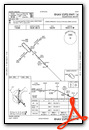
Instrument Approach Procedure (IAP) Charts


Nearby Airports with Instrument Procedures
| ID | Name | Heading / Distance | ||
|---|---|---|---|---|
 |
M85 | Gideon Memorial Airport | 155° | 10.2 |
|
KDXE | Dexter Municipal Airport | 013° | 10.9 |
|
KPOF | Poplar Bluff Regional Business Airport | 303° | 19.2 |
|
KEIW | County Memorial Airport | 101° | 19.4 |
|
KTKX | Kennett Memorial Airport | 185° | 22.4 |
|
KSIK | Sikeston Memorial Municipal Airport | 048° | 27.5 |
|
M05 | Caruthersville Memorial Airport | 149° | 29.9 |
|
M12 | Steele Municipal Airport | 167° | 30.8 |
|
4M9 | Corning Municipal Airport | 250° | 33.8 |
|
KCHQ | Mississippi County Airport | 064° | 33.8 |
|
KBYH | Arkansas International Airport | 176° | 38.1 |
|
KHKA | Blytheville Municipal Airport | 168° | 40.2 |
Airport Images
Do you have a recent image of this airport? Upload it here!


