Login
Register


CHQ
Mississippi County Airport
Official FAA Data Effective 2026-01-22 0901Z
Chart Supplement

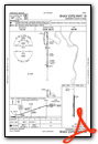
VFR Chart of KCHQ
Sectional Charts at SkyVector.com
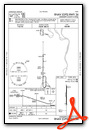
IFR Chart of KCHQ
Enroute Charts at SkyVector.com
Location Information for KCHQ
Coordinates: N36°50.53' / W89°21.58'Located 04 miles S of Charleston, Missouri on 100 acres of land. View all Airports in Missouri.
Surveyed Elevation is 313 feet MSL.
Operations Data
|
|
Airport Communications
| CTAF: | 122.900 |
|---|---|
| AWOS-3 at SIK (10.3 W): | 119.175 573-471-7371 |
| AWOS-3 at CIR (14.9 NE): | 118.025 618-734-9173 |
| ASOS at CGI (25.3 NW): | 120.55 573-335-3811 |
- APCH/DEP SVC PRVDD BY MEMPHIS ARTCC ON FREQS 133.65/292.15 (PADUCAH RCAG).
Nearby Navigation Aids
|
| ||||||||||||||||||||||||||||||||||||||||||||||||||||||||||||


Runway 18/36
| Dimensions: | 3196 x 60 feet / 974 x 18 meters | |
|---|---|---|
| Surface: | Asphalt / Aggregate Friction Seal Coated in Good Condition | |
| Weight Limits: | S-12 | |
| Edge Lighting: | Medium Intensity RWY 18/36 INCORRECT NUMBER OF THLD LGTS EACH RWY END. | |
| Runway 18 | Runway 36 | |
| Coordinates: | N36°50.79' / W89°21.58' | N36°50.27' / W89°21.58' |
| Elevation: | 313.0 | 313.0 |
| Traffic Pattern: | Left | Left |
| Runway Heading: | 180° True | 360° True |
| Markings: | Non-Precision Instrument in poor condition. | Non-Precision Instrument in poor condition. |
| Glide Slope Indicator | P2L (3.00° Glide Path Angle) OTS INDEFINITELY | P2L (3.00° Glide Path Angle) OTS INDEF |
| REIL: | Yes OTS INDEF | Yes OTS INDEF |
Services Available
| Fuel: | NONE |
|---|---|
| Transient Storage: | Tiedowns |
| Airframe Repair: | NOT AVAILABLE |
| Engine Repair: | NOT AVAILABLE |
| Bottled Oxygen: | NONE |
| Bulk Oxygen: | NONE |
| Other Services: | CROP DUSTING SERVICES |
Ownership Information
| Ownership: | Publicly owned | |
|---|---|---|
| Owner: | MISSISSIPPI COUNTY COMMISSION | |
| PO BOX 369 | ||
| CHARLESTON, MO 63834 | ||
| 573-683-2146 | ||
| Manager: | MISSISSIPPI COUNTY COMMISSION | |
| PO BOX 369 | ||
| CHARLESTON, MO 63834 | ||
| 573-683-2146 | ||
Other Remarks
- THIS AIRPORT HAS BEEN SURVEYED BY THE NATIONAL GEODETIC SURVEY.
- ULTRALIGHT & CROP DUSTING ACFT ON & INVOF ARPT.
- FOR CD CTC MEMPHIS ARTCC AT 901-368-8453/8449.
- RWY 18 MARKINGS FADED.
- RWY 36 MARKINGS FADED.
- ACTVT REIL RWY 18 & 36; MIRL NSTD RWY 18/36 PRESET MED INTST; TO INCR INTST - CTAF. PAPI RWY 18 & 36 ON CONSLY.
Weather Minimums

Instrument Approach Procedure (IAP) Charts
Nearby Airports with Instrument Procedures
| ID | Name | Heading / Distance | ||
|---|---|---|---|---|
 |
KSIK | Sikeston Memorial Municipal Airport | 289° | 10.3 |
|
KCIR | Cairo Regional Airport | 026° | 14.9 |
|
KEIW | County Memorial Airport | 212° | 21.7 |
|
KCGI | Cape Girardeau Regional Airport | 336° | 25.1 |
|
KDXE | Dexter Municipal Airport | 262° | 28.3 |
|
1M7 | Fulton Airport | 131° | 28.5 |
|
KPAH | Barkley Regional Airport | 064° | 31.1 |
|
KUCY | Everett-Stewart Regional Airport | 146° | 33.1 |
|
KMAW | Malden Regional Airport | 244° | 33.8 |
|
M85 | Gideon Memorial Airport | 227° | 35.5 |
|
M25 | Mayfield Graves County Airport | 096° | 37.6 |
|
M05 | Caruthersville Memorial Airport | 200° | 43.1 |
Airport Images
Do you have a recent image of this airport? Upload it here!


