Login
Register
0P8
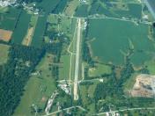
Lazy B Ranch Airport
Official FAA Data Effective 2026-02-19 0901Z
VFR Chart of 0P8
Sectional Charts at SkyVector.com
IFR Chart of 0P8
Enroute Charts at SkyVector.com
Location Information for 0P8
Coordinates: N40°1.47' / W76°48.92'Located 03 miles E of Dover, Pennsylvania on 24 acres of land. View all Airports in Pennsylvania.
Estimated Elevation is 476 feet MSL.
Operations Data
|
|
Airport Communications
| CTAF: | 122.900 |
|---|---|
| ASOS at THV (7.0 SW): | 119.275 717-792-5529 |
| ATIS at MDT (10.4 N): | 118.8 |
| ASOS at MDT (10.5 N): | 717-944-1372 |
Nearby Navigation Aids
|
| ||||||||||||||||||||||||||||||||||||||||||||||||||||||||||||
Runway 05/23
| Dimensions: | 2400 x 60 feet / 732 x 18 meters | |
|---|---|---|
| Surface: | Asphalt-Concrete in Poor Condition LARGE PATCHES OF CONC ON EDGES OF RWY WITH SFC CRACKING AND VEGETATION GROWTH. | |
| Edge Lighting: | Low Intensity | |
| Runway 05 | Runway 23 | |
| Coordinates: | N40°1.31' / W76°49.07' | N40°1.62' / W76°48.76' |
| Elevation: | 476.0 | 445.0 |
| Traffic Pattern: | Left | Left |
| Runway Heading: | 37° True | 217° True |
| Markings: | Basic in good condition. | Basic in good condition. |
| Obstacles: | 31 ft Trees 490 ft from runway, 150 ft left of center | |
Services Available
| Fuel: | NONE |
|---|---|
| Transient Storage: | Buoys,Tiedowns |
| Airframe Repair: | NONE |
| Engine Repair: | NONE |
| Bottled Oxygen: | NOT AVAILABLE |
| Bulk Oxygen: | NOT AVAILABLE |
Ownership Information
| Ownership: | Privately Owned | |
|---|---|---|
| Owner: | LAZY B PROPERTIES, LLC | |
| 2035 MILL CREEK ROAD | ||
| DOVER, PA 17317 | ||
| 717-577-8827 | ||
| Manager: | HARRIET T. GRAY | |
| 3883 BULL ROAD | ||
| DOVER, PA 17315 | ||
| 717-577-8827 | ||
Other Remarks
- TURF AREA PARALLEL TO RWY 5/23, FOR TAXI ONLY.
- FOR CD CTC HARRISBURG APCH AT 800-932-0712.
- DEER INVOF ARPT.
- FOR LIRL RY 05/23 KEY 122.9 5 TIMES.
Nearby Airports with Instrument Procedures
| ID | Name | Heading / Distance | ||
|---|---|---|---|---|
 |
KTHV | York Airport | 202° | 7.0 |
 |
KMDT | Harrisburg International Airport | 013° | 10.4 |
 |
KCXY | Capital City Airport | 351° | 11.7 |
 |
N71 | Donegal Springs Airpark Airport | 069° | 11.8 |
 |
58N | Reigle Field Airport | 034° | 19.2 |
 |
N94 | Carlisle Airport | 300° | 19.2 |
 |
W05 | Gettysburg Regional Airport | 242° | 23.9 |
 |
KLNS | Lancaster Airport | 076° | 24.7 |
 |
KDMW | Carroll County Regional/Jack B Poage Field Airport | 199° | 26.5 |
 |
08N | Keller Brothers Airport | 054° | 27.5 |
 |
9D4 | Deck Airport | 048° | 29.7 |
 |
74N | Bendigo Airport | 020° | 34.1 |


