Login
Register
0PS3
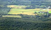
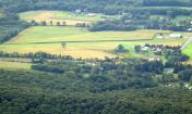
Carsonville Airport
Official FAA Data Effective 2025-11-27 0901Z
VFR Chart of 0PS3
Sectional Charts at SkyVector.com
IFR Chart of 0PS3
Enroute Charts at SkyVector.com
Location Information for 0PS3
Coordinates: N40°29.42' / W76°46.00'Located 00 miles N of Carsonville, Pennsylvania on 7 acres of land. View all Airports in Pennsylvania.
Estimated Elevation is 800 feet MSL.
Operations Data
|
|
Airport Communications
| ASOS at MUI (9.8 E): | 124.175 717-861-6493 |
|---|---|
| ASOS at CXY (16.8 S): | 717-770-0880 |
| ATIS at CXY (16.9 S): | 134.95 |
Nearby Navigation Aids
|
| ||||||||||||||||||||||||||||||||||||||||||||||||||||||
Runway 06/24
| Dimensions: | 1800 x 100 feet / 549 x 30 meters | |
|---|---|---|
| Surface: | Turf | |
| Runway 06 | Runway 24 | |
Ownership Information
| Ownership: | Privately Owned | |
|---|---|---|
| Owner: | GREGORY L. GUSLER | |
| 3245 POWELLS VALLEY ROAD | ||
| HALIFAX, PA 17032 | ||
| 717-362-8655 | ||
| Manager: | GREGORY L. GUSLER | |
| 3245 POWELLS VALLEY ROAD | ||
| HALIFAX, PA 17032 | ||
| 717-362-8655 | ||
Other Remarks
- RWY 06/24 DISPLD THLDS AT EACH RWY END.
- FOR CD CTC HARRISBURG APCH AT 800-932-0712.
Nearby Airports with Instrument Procedures
| ID | Name | Heading / Distance | ||
|---|---|---|---|---|
 |
74N | Bendigo Airport | 066° | 10.3 |
 |
58N | Reigle Field Airport | 144° | 15.0 |
 |
KCXY | Capital City Airport | 193° | 16.8 |
 |
KMDT | Harrisburg International Airport | 179° | 17.8 |
 |
KSEG | Penn Valley Airport | 347° | 20.3 |
 |
9D4 | Deck Airport | 112° | 21.7 |
 |
KZER | Schuylkill County/Joe Zerbey Airport | 054° | 22.2 |
 |
N79 | Northumberland County Airport | 025° | 23.0 |
 |
08N | Keller Brothers Airport | 120° | 23.3 |
 |
N71 | Donegal Springs Airpark Airport | 159° | 25.5 |
 |
N94 | Carlisle Airport | 226° | 26.1 |
 |
8N8 | Danville Airport | 011° | 28.0 |


