Login
Register


22S
Paisley Airport
Official FAA Data Effective 2025-11-27 0901Z
Chart Supplement

VFR Chart of 22S
Sectional Charts at SkyVector.com
IFR Chart of 22S
Enroute Charts at SkyVector.com
Location Information for 22S
Coordinates: N42°43.08' / W120°33.77'Located 03 miles NW of Paisley, Oregon on 340 acres of land. View all Airports in Oregon.
Estimated Elevation is 4395 feet MSL.
Operations Data
|
|
Airport Communications
| CTAF: | 122.900 |
|---|---|
| AWOS-3PT at LKV (34.2 S): | 135.525 541-947-5069 |
| ATIS at LMT (61.9 SW): | 263.0 |
| ASOS at LMT (61.9 SW): | 541-883-8127 |
Nearby Navigation Aids
|
| ||||||||||||||||||||||||||||||||||||


Runway 13/31
| Dimensions: | 4300 x 60 feet / 1311 x 18 meters | |
|---|---|---|
| Surface: | Asphalt in Good Condition | |
| Edge Lighting: | Low Intensity | |
| Runway 13 | Runway 31 | |
| Coordinates: | N42°43.38' / W120°34.02' | N42°42.78' / W120°33.51' |
| Elevation: | 4376.0 | 4395.0 |
| Traffic Pattern: | Left | Left |
| Runway Heading: | 148° True | 328° True |
| Markings: | Basic in good condition. | Basic in good condition. |
Services Available
| Fuel: | NONE |
|---|---|
| Transient Storage: | Tiedowns |
| Airframe Repair: | NONE |
| Engine Repair: | NONE |
| Bottled Oxygen: | NONE |
| Bulk Oxygen: | NONE |
Ownership Information
| Ownership: | Publicly owned | |
|---|---|---|
| Owner: | LAKE COUNTY | |
| 513 CENTER STREET | ||
| LAKEVIEW, OR 97630 | ||
| 541-947-6006 | ||
| Manager: | TRISTAN WITHAM | |
| 513 CENTER STREET | ||
| LAKEVIEW, OR 97603 | ||
| 541-947-4222 | ||
Other Remarks
- TRAFFIC PATTERN ALTITUDE 1000' AGL.
- 4 FT FENCE, 40 FT FROM RY EDGE ALONG NE SIDE OF RY.
- FOR CD CTC SEATTLE ARTCC AT 253-351-3694.
- RWY HAS AIMING POINTS
Nearby Airports with Instrument Procedures
| ID | Name | Heading / Distance | ||
|---|---|---|---|---|
 |
62S | Christmas Valley Airport | 351° | 31.4 |
|
KLKV | Lake County Airport | 167° | 34.2 |
|
KLMT | Crater Lake/Klamath Regional Airport | 237° | 62.0 |
|
KAAT | Alturas Municipal Airport | 180° | 74.1 |
|
S21 | Sunriver Airport | 330° | 79.7 |
|
KBDN | Bend Municipal Airport | 341° | 87.2 |
|
KBNO | Burns Municipal Airport | 052° | 87.9 |
|
S39 | Prineville Airport | 351° | 95.4 |
|
KRDM | Roberts Field Airport | 344° | 95.7 |
|
KMFR | Rogue Valley International/Medford Airport | 259° | 104.5 |
|
O46 | Weed Airport | 229° | 112.4 |
|
S33 | Madras Municipal Airport | 347° | 119.9 |
Airport Images
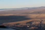
By: skitheo

By: skitheo


