Login
Register


2F7
Commerce Municipal Airport
Official FAA Data Effective 2025-12-25 0901Z
Chart Supplement

VFR Chart of 2F7
Sectional Charts at SkyVector.com
IFR Chart of 2F7
Enroute Charts at SkyVector.com
Location Information for 2F7
Coordinates: N33°17.57' / W95°53.79'Located 03 miles N of Commerce, Texas on 132 acres of land. View all Airports in Texas.
Surveyed Elevation is 515 feet MSL.
Operations Data
|
|
Airport Communications
| CTAF: | 122.900 |
|---|---|
| AWOS-3 at GVT (16.0 SW): | 133.425 903-455-7703 |
| AWOS-3 at SLR (16.0 SE): | 118.35 903-885-9605 |
| AWOS-3PT at F00 (24.1 NW): | 118.05 903-583-2082 |
- APCH/DEP SVC PRVDD BY FORT WORTH ARTCC (ZFW) ON FREQS 132.025/317.75 (CUMBY RCAG).
Nearby Navigation Aids
|
| ||||||||||||||||||||||||||||||||||||||||||||||||||||||||||||


Runway 18/36
| Dimensions: | 3907 x 60 feet / 1191 x 18 meters | |
|---|---|---|
| Surface: | Asphalt in Good Condition | |
| Weight Limits: | S-13 | |
| Edge Lighting: | Medium Intensity | |
| Runway 18 | Runway 36 | |
| Coordinates: | N33°17.89' / W95°53.77' | N33°17.25' / W95°53.80' |
| Elevation: | 515.5 | 506.0 |
| Traffic Pattern: | Left | Left |
| Runway Heading: | 183° True | 3° True |
| Markings: | Non-Precision Instrument in poor condition. | Non-Precision Instrument in poor condition. |
| Glide Slope Indicator | P2L (3.00° Glide Path Angle) | P2L (3.00° Glide Path Angle) |
| Obstacles: | 23 ft Trees 687 ft from runway, 200 ft right of center | 38 ft Tree 800 ft from runway, 260 ft right of center 8 FT TREE, 30 FT DSTC, 247 L. |
Services Available
| Fuel: | 100LL (blue) |
|---|---|
| Transient Storage: | Tiedowns |
| Airframe Repair: | MAJOR 904-461-1374 |
| Engine Repair: | MAJOR |
| Bottled Oxygen: | NONE |
| Bulk Oxygen: | NONE |
Ownership Information
| Ownership: | Publicly owned | |
|---|---|---|
| Owner: | CITY OF COMMERCE | |
| 1119 ALAMO | ||
| COMMERCE, TX 75428 | ||
| 903-886-1101 | ||
| Manager: | JON HARPER | DIRECTOR OF COMMUNITY DEVELOPMENT. |
| 1119 ALAMO | ||
| COMMERCE, TX 75428 | ||
| 903-886-1101 | ||
Other Remarks
- FOR CD CTC FORT WORTH ARTCC AT 817-858-7584.
- RWY MKGS FADED.
- RWY MKGS FADED.
- 0LL SELF SERVE FUEL.
- MIRL RWY 18/36 PRESET TO LOW INTST; TO INCR INTST AND ACTVT - CTAF.
Weather Minimums
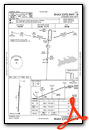
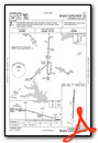
Instrument Approach Procedure (IAP) Charts
Nearby Airports with Instrument Procedures
| ID | Name | Heading / Distance | ||
|---|---|---|---|---|
 |
KGVT | Majors Airport | 212° | 15.9 |
|
KSLR | Sulphur Springs Municipal Airport | 119° | 16.0 |
|
7F3 | Caddo Mills Municipal Airport | 228° | 23.3 |
|
F00 | Jones Field Airport | 323° | 23.9 |
|
KPRX | Cox Field Airport | 047° | 30.4 |
|
F53 | Franklin County Airport | 097° | 33.5 |
|
F46 | Ralph M Hall/Rockwall Municipal Airport | 231° | 34.8 |
|
KTKI | Mckinney Ntl Airport | 258° | 35.5 |
|
F51 | Winnsboro Municipal Airport | 124° | 37.7 |
|
KJDD | Wood County/Collins Field Airport | 148° | 38.7 |
|
KTRL | Terrell Municipal Airport | 208° | 39.7 |
|
KSWI | Sherman Municipal Airport | 300° | 39.9 |
Airport Images
Do you have a recent image of this airport? Upload it here!


