Login
Register


F53
Franklin County Airport
Official FAA Data Effective 2026-02-19 0901Z
Chart Supplement

VFR Chart of F53
Sectional Charts at SkyVector.com
IFR Chart of F53
Enroute Charts at SkyVector.com
Location Information for F53
Coordinates: N33°12.92' / W95°14.23'Located 02 miles NW of Mount Vernon, Texas on 159 acres of land. View all Airports in Texas.
Surveyed Elevation is 412 feet MSL.
Operations Data
|
|
Airport Communications
| CTAF: | 123.000 |
|---|---|
| UNICOM: | 123.000 |
| AWOS-3 at OSA (15.7 SE): | 119.775 903-575-4027 |
| AWOS-3 at SLR (19.6 W): | 118.35 903-885-9605 |
| AWOS-3PT at PRX (27.5 N): | 119.675 903-737-8784 |
- APCH/DEP SVC PRVDD BY FORT WORTH ARTCC (ZFW) ON FREQS 132.025/317.75 (CUMBY RCAG).
Nearby Navigation Aids
|
| ||||||||||||||||||||||||||||||||||||||||||||||||||||||||||||


Runway 13/31
| Dimensions: | 3900 x 60 feet / 1189 x 18 meters | |
|---|---|---|
| Surface: | Asphalt in Excellent Condition | |
| Weight Limits: | S-12 | |
| Edge Lighting: | Medium Intensity | |
| Runway 13 | Runway 31 | |
| Coordinates: | N33°13.15' / W95°14.50' | N33°12.69' / W95°13.97' |
| Elevation: | 395.9 | 412.1 |
| Runway Heading: | 136° True | 316° True |
| Markings: | Non-Precision Instrument in good condition. | Non-Precision Instrument in good condition. |
| Glide Slope Indicator | P2L (3.00° Glide Path Angle) | P2L (3.00° Glide Path Angle) |
| Obstacles: | 36 ft Trees 400 ft from runway, 250 ft right of center | 46 ft Trees 1587 ft from runway, 100 ft right of center |
Services Available
| Fuel: | NONE |
|---|---|
| Transient Storage: | Tiedowns |
| Airframe Repair: | NOT AVAILABLE |
| Engine Repair: | NOT AVAILABLE |
| Bottled Oxygen: | NOT AVAILABLE |
| Bulk Oxygen: | NOT AVAILABLE |
Ownership Information
| Ownership: | Publicly owned | |
|---|---|---|
| Owner: | FRANKLIN COUNTY | |
| 200 N. KAUFMAN | ||
| MOUNT VERNON, TX 75457 | ||
| 903-537-2342 | ||
| Manager: | JOHN GANDY | |
| PO BOX 989 | ||
| MOUNT VERNON, TX 75457 | ||
| 903-588-2643 | ||
Other Remarks
- FOR CD CTC FORT WORTH ARTCC AT 817-858-7584.
Weather Minimums

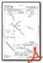
Instrument Approach Procedure (IAP) Charts

Nearby Airports with Instrument Procedures
| ID | Name | Heading / Distance | ||
|---|---|---|---|---|
 |
KOSA | Mount Pleasant Regional Airport | 116° | 15.6 |
|
F51 | Winnsboro Municipal Airport | 187° | 16.7 |
|
KSLR | Sulphur Springs Municipal Airport | 260° | 19.6 |
|
KPRX | Cox Field Airport | 337° | 27.4 |
|
KJDD | Wood County/Collins Field Airport | 204° | 31.2 |
|
2F7 | Commerce Municipal Airport | 278° | 33.5 |
|
KJXI | Fox Stephens Field/Gilmer Municipal Airport | 154° | 34.2 |
|
KGVT | Majors Airport | 258° | 42.6 |
|
07F | Gladewater Municipal Airport | 161° | 43.2 |
|
4O4 | Mc Curtain County Regional Airport | 024° | 45.7 |
|
KHHW | Stan Stamper Municipal Airport | 342° | 51.3 |
|
7F3 | Caddo Mills Municipal Airport | 258° | 51.8 |
Airport Images
Do you have a recent image of this airport? Upload it here!


