Login
Register
2L1
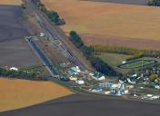
Larimore Municipal Airport
Official FAA Data Effective 2025-12-25 0901Z
VFR Chart of 2L1
Sectional Charts at SkyVector.com
IFR Chart of 2L1
Enroute Charts at SkyVector.com
Location Information for 2L1
Coordinates: N47°54.40' / W97°38.46'Located 01 miles W of Larimore, North Dakota on 15 acres of land. View all Airports in North Dakota.
Estimated Elevation is 1130 feet MSL.
Operations Data
|
|
Airport Communications
| CTAF: | 122.900 |
|---|---|
| D-ATIS at RDR (10.2 E): | 273.45 |
| ASOS at GFK (18.6 E): | 701-772-3486 |
| ATIS at GFK (18.9 E): | 119.4 |
Nearby Navigation Aids
|
| ||||||||||||||||||||||||||||||||||||||||||||||||
Runway 12/30
| Dimensions: | 2914 x 50 feet / 888 x 15 meters | |
|---|---|---|
| Surface: | Asphalt in Good Condition | |
| Weight Limits: | S-4 | |
| Edge Lighting: | Low Intensity | |
| Runway 12 | Runway 30 | |
| Coordinates: | N47°54.57' / W97°38.71' | N47°54.23' / W97°38.21' |
| Elevation: | 1130.0 | 1130.0 |
| Traffic Pattern: | Right | Left |
| Displaced Threshold: | 87 Feet | |
| Markings: | Non-Standard in fair condition. | Non-Standard in fair condition. |
| Obstacles: | 17 ft Road 200 ft from runway, 40 ft left of center 25 FT POLE 650 FT FM THR & 140 FT R OF EXTDD CNTRLN; APCH RATIO 18:1. 15 FT PKD ACFT 150 FT FM THR 50 FT R ON APRON AREA; 17 FT ROAD AT THR 100 FT L; 36 FT WINDSOCK/BLDG 170 FT FM THR & 120 R OF EXTDD CNTRLN. |
|
Services Available
| Fuel: | NONE |
|---|---|
| Transient Storage: | Tiedowns |
| Airframe Repair: | NONE |
| Engine Repair: | NONE |
| Bottled Oxygen: | NONE |
| Bulk Oxygen: | NONE |
| Other Services: | CROP DUSTING SERVICES,PILOT INSTRUCTION,AIRCRAFT SALES |
Ownership Information
| Ownership: | Publicly owned | |
|---|---|---|
| Owner: | LARIMORE ARPT AUTHORITY | |
| 1837 THOMAS DR. | ||
| LARIMORE, ND 58251 | ||
| 218-779-1171 | TODD YAHNE - CHAIRMAN: 218-779-1171 | |
| Manager: | JESSE MORTEN | ADDL CTC JOHN MORTEN 701-343-6211. |
| 1546 37TH ST NE | ||
| LARIMORE, ND 58251 | ||
| 218-779-4244 | AMGR'S CELL PHONE AT 218-779-4244. | |
Other Remarks
- SNOW REMOVAL IREG OCT THRU MAY. FOR CONDITIONS REPORT CONTACT AMGR AT 701-343-2065 OR CELL 218-779-4244
- FOR CD CTC MINNEAPOLIS ARTCC AT 651-463-5588.
Nearby Airports with Instrument Procedures
| ID | Name | Heading / Distance | ||
|---|---|---|---|---|
 |
KRDR | Grand Forks AFB Airport | 071° | 10.2 |
 |
4V4 | Northwood Municipal/Vince Field Airport | 169° | 11.1 |
 |
KGFK | Grand Forks International Airport | 082° | 18.9 |
 |
5L0 | Lakota Municipal Airport | 285° | 28.6 |
 |
KGAF | Hutson Field Airport | 019° | 31.8 |
 |
S32 | Cooperstown Municipal Airport | 213° | 34.6 |
 |
3H4 | Hillsboro Municipal Airport | 144° | 40.4 |
 |
D37 | Warren Municipal Airport | 065° | 41.1 |
 |
KCKN | Crookston Municipal/Kirkwood Field Airport | 095° | 41.3 |
 |
KDVL | Devils Lake Regional Airport | 284° | 52.7 |
 |
2C8 | Cavalier Municipal Airport | 000° | 52.7 |
 |
KHCO | Hallock Municipal Airport | 028° | 58.0 |


