Login
Register
2M1
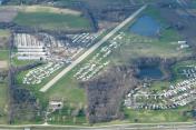
Harry S Truman Regional Airport
Official FAA Data Effective 2025-11-27 0901Z
VFR Chart of 2M1
Sectional Charts at SkyVector.com
IFR Chart of 2M1
Enroute Charts at SkyVector.com
Location Information for 2M1
Coordinates: N39°1.18' / W94°5.19'Located 02 miles NW of Bates City, Missouri on 160 acres of land. View all Airports in Missouri.
Estimated Elevation is 860 feet MSL.
Operations Data
|
|
Airport Communications
| CTAF: | 122.800 |
|---|---|
| UNICOM: | 122.800 |
| ASOS at LXT (13.8 W): | 124.175 816-347-9807 |
| AWOS-3PT at RCM (19.2 SE): | 119.575 660-422-7010 |
| AWOS-3P at GPH (21.5 NW): | 120.275 816-407-3399 |
Nearby Navigation Aids
|
| ||||||||||||||||||||||||||||||||||||||||||||||||||||||||||||
Runway 03/21
| Dimensions: | 4400 x 70 feet / 1341 x 21 meters WIDTH VARIANCE 70-80 FT. | |
|---|---|---|
| Surface: | Gravel in Fair Condition | |
| Runway 03 | Runway 21 | |
| Coordinates: | N39°0.86' / W94°5.42' | N39°1.49' / W94°4.96' |
| Elevation: | 851.0 | 860.0 |
| Traffic Pattern: | Left | Left |
| Obstacles: | 35 ft Tree 80 ft from runway, 75 ft left of center | 25 ft Trees 0 ft from runway, 100 ft left of center |
Services Available
| Fuel: | NONE |
|---|---|
| Transient Storage: | NONE |
| Airframe Repair: | NOT AVAILABLE |
| Engine Repair: | NOT AVAILABLE |
| Bottled Oxygen: | NOT AVAILABLE |
| Bulk Oxygen: | NOT AVAILABLE |
| Other Services: | AIRCRAFT SALES USED ACFT PARTS. |
Ownership Information
| Ownership: | Privately Owned | |
|---|---|---|
| Owner: | BRANSON SHORES, LLC. | |
| 1013 NORTH OUTER ROAD | ||
| BATES CITY, MO 64011 | ||
| 816-690-8800 | ||
| Manager: | MATTHEW BREWE | |
| 1013 NORTH OUTER ROAD | ||
| BATES CITY, MO 64011 | ||
| 816-690-8800 | ||
Other Remarks
- MIGATORY BIRDS ON & INVOF ARPT DURING FALL AND WINTER.
- RY 03/21 INSUFFICIENT RY SAFETY AREA LENGTHS BEYOND EACH RY END. RY 3 END HAS STEEP SLOPE WITH FENCE, TREES, & ROAD. RY 21 END HAS FENCE, TREES, & ROAD.
- PAEW INVOF ARPT.
- FOR CD CTC KANSAS CITY APCH AT 816-329-2710.
Nearby Airports with Instrument Procedures
| ID | Name | Heading / Distance | ||
|---|---|---|---|---|
 |
3GV | East Kansas City Airport | 267° | 6.0 |
 |
KLXT | Kansas City/Lee's Summit Regional Airport | 254° | 13.8 |
 |
KHIG | Higginsville Industrial Municipal Airport | 080° | 19.4 |
 |
KRCM | Skyhaven Airport | 136° | 19.4 |
 |
3EX | Excelsior Springs Memorial Airport | 344° | 19.7 |
 |
KGPH | Midwest Ntl Air Center Airport | 331° | 21.5 |
 |
KMKC | Kansas City Downtown/Wheeler Field Airport | 284° | 24.5 |
 |
KLRY | Lawrence Smith Memorial Airport | 206° | 27.3 |
 |
KSZL | Whiteman AFB Airport | 124° | 30.6 |
 |
KOJC | Johnson County Exec Airport | 251° | 32.2 |
 |
KMCI | Kansas City International Airport | 299° | 33.7 |
 |
KIXD | New Century Aircenter Airport | 253° | 39.3 |


