Login
Register


HIG
Higginsville Industrial Municipal Airport
Official FAA Data Effective 2025-11-27 0901Z
Chart Supplement

VFR Chart of KHIG
Sectional Charts at SkyVector.com
IFR Chart of KHIG
Enroute Charts at SkyVector.com
Location Information for KHIG
Coordinates: N39°4.35' / W93°40.64'Located 02 miles E of Higginsville, Missouri on 200 acres of land. View all Airports in Missouri.
Surveyed Elevation is 840 feet MSL.
Operations Data
|
|
Airport Communications
| WHITEMAN APPROACH: | 127.45 284.0 |
|---|---|
| WHITEMAN DEPARTURE: | 125.925 343.65 |
| CTAF: | 122.800 |
| UNICOM: | 122.800 |
| AWOS-3PT at RCM (18.2 S): | 119.575 660-422-7010 |
| ATIS at SZL (21.4 S): | 239.025 |
| AWOS-3PT at MHL (22.2 E): | 118.675 660-886-9130 |
- APCH/DEP SVC PRVDD BY KANSAS CITY ARTCC ON FREQS 135.575/323.15 (KNOB NOSTER RCAG) WHEN WHITEMAN APCH CTL CLSD.
Nearby Navigation Aids
|
| ||||||||||||||||||||||||||||||||||||||||||||||||||||||||||||


Runway 16/34
| Dimensions: | 4400 x 75 feet / 1341 x 23 meters | |
|---|---|---|
| Surface: | Asphalt in Good Condition | |
| Weight Limits: | S-12, D-16 | |
| Edge Lighting: | Medium Intensity | |
| Runway 16 | Runway 34 | |
| Coordinates: | N39°4.70' / W93°40.76' | N39°4.00' / W93°40.53' |
| Elevation: | 840.0 | 796.0 |
| Traffic Pattern: | Left | Left |
| Runway Heading: | 165° True | 345° True |
| Declared Distances: | TORA:4400 TODA:4400 ASDA:4400 LDA:4400 | TORA:4400 TODA:4400 ASDA:4400 LDA:4400 |
| Markings: | Non-Precision Instrument in good condition. | Non-Precision Instrument in good condition. |
| Glide Slope Indicator | P4L (3.00° Glide Path Angle) | P4L (3.00° Glide Path Angle) |
| REIL: | Yes | Yes |
| Obstacles: | 27 ft Tree 750 ft from runway, 320 ft right of center | |
Services Available
| Fuel: | 100LL (blue) |
|---|---|
| Transient Storage: | Hangars,Tiedowns |
| Airframe Repair: | NONE |
| Engine Repair: | NONE |
| Bottled Oxygen: | NONE |
| Bulk Oxygen: | NONE |
| Other Services: | AVIONICS,AIRCRAFT SALES |
Ownership Information
| Ownership: | Publicly owned | |
|---|---|---|
| Owner: | CITY OF HIGGINSVILLE | |
| 1922 MAIN ST BOX 110 | ||
| HIGGINSVILLE, MO 64037 | ||
| 660-584-2106 | ||
| Manager: | SCOTT MCCORMICK | |
| 11667 AIRPORT ROAD | ||
| HIGGINSVILLE, MO 64037 | ||
| 618-420-9046 | ||
Other Remarks
- WILDLIFE ON & INVOF ARPT.
- EXTENSIVE HELICOPTER OPERATIONS.
- FOR CD CTC WHITEMAN APCH AT 660-687-3132. WHEN WHITEMAN APCH IS CLSD, CTC KANSAS CITY ARTCC AT 913-254-8508.
- 0LL FOR SVC AFT HRS, CALL NBRS POSTED ON TERMINAL DOOR.
- ACTVT MIRL RY 16/34; PAPI & REIL RYS 16 & 34 - CTAF.
Weather Minimums

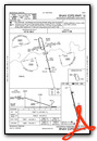
Instrument Approach Procedure (IAP) Charts

Nearby Airports with Instrument Procedures
| ID | Name | Heading / Distance | ||
|---|---|---|---|---|
 |
KRCM | Skyhaven Airport | 198° | 18.3 |
|
KSZL | Whiteman AFB Airport | 163° | 21.4 |
|
KMHL | Marshall Memorial Municipal Airport | 086° | 22.2 |
|
3GV | East Kansas City Airport | 262° | 25.4 |
|
3EX | Excelsior Springs Memorial Airport | 303° | 29.0 |
|
KDMO | Sedalia Regional Airport | 132° | 32.1 |
|
KLXT | Kansas City/Lee's Summit Regional Airport | 258° | 33.2 |
|
KGPH | Midwest Ntl Air Center Airport | 298° | 33.4 |
|
KLRY | Lawrence Smith Memorial Airport | 228° | 41.7 |
|
KMKC | Kansas City Downtown/Wheeler Field Airport | 274° | 42.9 |
|
KGLY | Clinton Regional Airport | 180° | 43.0 |
|
KCHT | Chillicothe Municipal Airport | 011° | 43.4 |
Airport Images
Do you have a recent image of this airport? Upload it here!


