Login
Register


3AZ8
High Mesa Airpark Airport
Official FAA Data Effective 2026-02-19 0901Z
VFR Chart of 3AZ8
Sectional Charts at SkyVector.com
IFR Chart of 3AZ8
Enroute Charts at SkyVector.com
Location Information for 3AZ8
Coordinates: N32°45.74' / W109°39.20'Located 03 miles W of Solomon, Arizona on 50 acres of land. View all Airports in Arizona.
Estimated Elevation is 3080 feet MSL.
Operations Data
|
|
Airport Communications
| UNICOM: | 122.700 |
|---|---|
| ASOS at SAD (5.7 N): | 124.175 928-235-2373 |
| AWOS-3 at CFT (25.2 NE): | 119.05 928-687-1116 |
| AWOS-3PT at P33 (33.4 S): | 119.025 520-384-9221 |
Nearby Navigation Aids
|
| ||||||||||||||||||||||||||||||||||||||||||||||||


Runway 08/26
| Dimensions: | 3300 x 60 feet / 1006 x 18 meters | |
|---|---|---|
| Surface: | Gravel | |
| Runway 08 | Runway 26 | |
| Displaced Threshold: | 120 Feet | |
Ownership Information
| Ownership: | Privately Owned | |
|---|---|---|
| Owner: | D. BROOKS & EMORY SMITH | |
| PO BOX 184 | ||
| SOLOMON, AZ 85551 | ||
| 602-428-7173 | ||
| Manager: | EMORY SMITH | |
| PO BOX 184 | ||
| SOLOMON, AZ 85551 | ||
| 602-428-7173 | ||
Other Remarks
- FOR CD CTC ALBUQUERQUE ARTCC AT 505-856-4861.
Nearby Airports with Instrument Procedures
| ID | Name | Heading / Distance | ||
|---|---|---|---|---|
 |
KSAD | Safford Regional/1lt Duane Spalsbury Field Airport | 009° | 5.5 |
|
KCFT | Greenlee County Airport | 062° | 25.2 |
|
P33 | Cochise County Airport | 201° | 33.3 |
|
P13 | San Carlos Apache Airport | 304° | 62.2 |
|
KDMA | Davis Monthan AFB Airport | 240° | 71.9 |
|
KTUS | Tucson International Airport | 239° | 76.0 |
|
KSVC | Grant County Airport | 095° | 76.2 |
|
KDUG | Bisbee Douglas International Airport | 178° | 77.5 |
|
KFHU | Sierra Vista Municipal-Libby AAF Airport | 206° | 78.6 |
|
KAVQ | Marana Regional Airport | 255° | 82.1 |
|
KJTC | Springerville Municipal Airport | 011° | 83.7 |
|
KRYN | Ryan Field Airport | 244° | 85.7 |
Airport Images
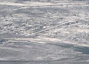
By: Big Orange Bird


