Login
Register


DUG
Bisbee Douglas International Airport
Official FAA Data Effective 2026-02-19 0901Z
Chart Supplement

VFR Chart of KDUG
Sectional Charts at SkyVector.com
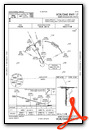
IFR Chart of KDUG
Enroute Charts at SkyVector.com
Location Information for KDUG
Coordinates: N31°28.14' / W109°36.23'Located 08 miles NW of Douglas Bisbee, Arizona on 3000 acres of land. View all Airports in Arizona.
Surveyed Elevation is 4150 feet MSL.
Operations Data
|
|
Airport Communications
| ASOS: | 119.275 Tel. 520-364-7208 |
|---|---|
| UNICOM: | 123.000 |
| CTAF: | 123.000 |
| AWOS-2 at P03 (7.4 SW): | 119.925 520-417-4114 |
| ATIS at FHU (38.6 W): | 134.75 |
| ASOS at FHU (38.6 W): |
- COMMUNICATIONS PRVDD BY PRESCOTT RADIO ON FREQ 122.6 (DOUGLAS RCO).
- APCH/DEP SVC PRVDD BY ALBUQUERQUE ARTCC (ABQ) ON 134.45/327.15 (SILVER CITY RCAG & 133.0/281.5 TUCSON RCAG).
Nearby Navigation Aids
|
| ||||||||||||||||||||||||||||||||||||||||||||||||


Runway 17/35
| Dimensions: | 6430 x 100 feet / 1960 x 30 meters | |
|---|---|---|
| Surface: | Asphalt / Rubberized Friction Seal Coated in Good Condition RFSC 100 FT WIDE. | |
| Weight Limits: | S-30, D-160, ST-250 | |
| Edge Lighting: | Medium Intensity | |
| Runway 17 | Runway 35 | |
| Coordinates: | N31°28.43' / W109°36.27' | N31°27.37' / W109°36.26' |
| Elevation: | 4124.5 | 4088.9 |
| Traffic Pattern: | Left | Left |
| Runway Heading: | 180° True | 360° True |
| Markings: | Non-Precision Instrument in good condition. | Non-Precision Instrument in good condition. |
| Glide Slope Indicator | V2L (3.25° Glide Path Angle) | |
Runway 08/26
RY 08/26 VFR OPNS ONLY; DAYLIGHT USE ONLY. | ||
| Dimensions: | 4966 x 60 feet / 1514 x 18 meters | |
|---|---|---|
| Surface: | Asphalt in Fair Condition | |
| Weight Limits: | S-12 | |
| Runway 08 | Runway 26 | |
| Coordinates: | N31°28.44' / W109°36.65' | N31°28.44' / W109°35.69' |
| Elevation: | 4115.6 | 4150.0 |
| Runway Heading: | 90° True | 270° True |
| Markings: | Basic in fair condition. | Basic in fair condition. |
| Obstacles: | 4 ft Brush 264 ft from runway, 44 ft right of center CONTROLLING OBSTRUCTION EXCEEDS A 45 DEGREE SLOPE RWY 08, 1-8 FT SCATTERED BRUSH, 40-200 FT FM THR, 45-125 FT BOTH SIDES OF CNTRLN. |
5 ft Brush 201 ft from runway, 70 ft left of center RWY 26, 4-6 FT BRUSH 20-200 FT FM THR, 75 FT BOTH BOTH SIDES OF CNTRLN. |
Services Available
| Fuel: | 100LL (blue), Jet A-1+ |
|---|---|
| Transient Storage: | Tiedowns |
| Airframe Repair: | NONE |
| Engine Repair: | NONE |
| Bottled Oxygen: | NONE |
| Bulk Oxygen: | NONE |
Ownership Information
| Ownership: | Publicly owned | |
|---|---|---|
| Owner: | COCHISE COUNTY | |
| 1415 WEST MELODY LANE BLDG F | ||
| BISBEE, AZ 85603 | ||
| (520) 432-9268 | ||
| Manager: | DANIEL COXWORTH | |
| 1415 W. MELODY LANE , BUILDING F, BUILDING E | ||
| BISBEE, AZ 85603 | ||
| (520) 432-9268 | EMERGENCY NUMBER 520-432-9268. | |
Other Remarks
- WILDLIFE ON OR INVOF ARPT.
- FOR CD IF UNA TO CTC ON FSS FREQ, CTC ALBUQUERQUE ARTCC AT 505-856-4561.
- 0LL SELF-SERVE FUEL, PHONE 520-432-9268.
- ACTVT VASI RWY 17; MIRL RWY 17/35 - CTAF.
Weather Minimums


Instrument Approach Procedure (IAP) Charts


Nearby Airports with Instrument Procedures
| ID | Name | Heading / Distance | ||
|---|---|---|---|---|
 |
KFHU | Sierra Vista Municipal-Libby AAF Airport | 280° | 38.6 |
|
P33 | Cochise County Airport | 342° | 48.8 |
|
KOLS | Nogales International Airport | 267° | 63.9 |
|
KDMA | Davis Monthan AFB Airport | 302° | 77.6 |
|
KTUS | Tucson International Airport | 299° | 78.6 |
|
KSAD | Safford Regional/1lt Duane Spalsbury Field Airport | 358° | 82.9 |
|
KRYN | Ryan Field Airport | 297° | 89.9 |
|
KCFT | Greenlee County Airport | 012° | 91.3 |
|
KAVQ | Marana Regional Airport | 304° | 99.8 |
|
KSVC | Grant County Airport | 046° | 101.7 |
|
KDMN | Deming Municipal Airport | 063° | 107.4 |
|
P13 | San Carlos Apache Airport | 334° | 125.1 |
Airport Images
 from the northwest")
By: keeganm


Comments
Correct phone Number
New Number is: 520-508-3603 or 520-364-2771