Login
Register


49A
Gilmer County Airport
Official FAA Data Effective 2026-02-19 0901Z
Chart Supplement

VFR Chart of 49A
Sectional Charts at SkyVector.com
IFR Chart of 49A
Enroute Charts at SkyVector.com
Location Information for 49A
Coordinates: N34°37.69' / W84°31.59'Located 04 miles S of Ellijay, Georgia on 89 acres of land. View all Airports in Georgia.
Estimated Elevation is 1485 feet MSL.
Operations Data
|
|
Airport Communications
| AWOS-3: | 118.075 Tel. 706 276-4513 |
|---|---|
| UNICOM: | 123.000 |
| CTAF: | 123.000 |
| AWOS-AV at JZP (11.0 S): | 120.025 706-253-9008 |
| AWOS-3PT at DNN (18.0 W): | 127.65 706-278-7010 |
| AWOS-3PT at CNI (19.8 S): | 119.825 678-454-2065 |
- APCH/DEP SVC PRVDD BY ATLANTA ARTCC (MOUNT OGLETHORPE RCAG) ON FREQS 133.1/342.425
Nearby Navigation Aids
|
| ||||||||||||||||||||||||||||||||||||||||||||||||||||||||||||


Runway 03/21
| Dimensions: | 3507 x 75 feet / 1069 x 23 meters | |
|---|---|---|
| Surface: | Asphalt in Good Condition | |
| Weight Limits: | S-30, D-41 | |
| Edge Lighting: | Medium Intensity | |
| Runway 03 | Runway 21 | |
| Coordinates: | N34°37.44' / W84°31.76' | N34°37.95' / W84°31.43' |
| Elevation: | 1457.7 | 1485.5 |
| Traffic Pattern: | Left | Left |
| Markings: | Non-Precision Instrument in good condition. | Non-Precision Instrument in good condition. |
| Obstacles: | 41 ft Trees 282 ft from runway, 239 ft right of center | 56 ft Trees 704 ft from runway, 201 ft right of center |
Services Available
| Fuel: | 100LL (blue) |
|---|---|
| Transient Storage: | Tiedowns |
| Airframe Repair: | NONE |
| Engine Repair: | NONE |
| Bottled Oxygen: | NONE |
| Bulk Oxygen: | NONE |
Ownership Information
| Ownership: | Publicly owned | |
|---|---|---|
| Owner: | GILMER COUNTY | |
| 1 BROAD STREET, SUITE 106 | ||
| ELLIJAY, GA 30540 | ||
| 706-635-4361 | ||
| Manager: | JIM SMITH | |
| 455 SUNLIGHT ROAD | ||
| ELLIJAY, GA 30540 | ||
| 706-889-2108 | ||
Other Remarks
- FOR CD CTC ATLANTA ARTCC AT 770-210-7692.
- RWY IS USED TO BACK TAXI, ACFT MUST CLEAR THE RWY TO TWY BEFORE ADDNL ACFT CAN LAND.
- WILDLIFE IN AND AROUND THE ARPT.
- 0LL 24 HR CREDIT CARD SVC AVBL.
- ACTVT RWY 03/21 MIRL - CTAF.
Weather Minimums


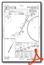
Instrument Approach Procedure (IAP) Charts

Nearby Airports with Instrument Procedures
| ID | Name | Heading / Distance | ||
|---|---|---|---|---|
 |
KJZP | Pickens County Airport | 161° | 11.0 |
|
KDNN | Dalton Municipal Airport | 288° | 17.9 |
|
KCNI | Cherokee County Regional Airport | 164° | 19.6 |
|
KCZL | Tom B David Field Airport | 243° | 22.9 |
|
1A3 | Martin Campbell Field Airport | 020° | 24.9 |
|
KDZJ | Blairsville Airport | 062° | 29.5 |
|
KVPC | Cartersville Airport | 207° | 34.2 |
|
KRMG | Richard B Russell Regional - J H Towers Field Airport | 242° | 35.5 |
|
KRYY | Cobb County International/Mccollum Field Airport | 185° | 37.0 |
|
KRZR | Cleveland Regional Jetport Airport | 339° | 37.5 |
|
9A5 | Barwick Lafayette Airport | 275° | 38.0 |
|
KGVL | Lee Gilmer Memorial Airport | 121° | 40.6 |
Airport Images
 from S")
By: 2flaps
 from ~1nm E")
By: 2flaps


