Login
Register
JZP
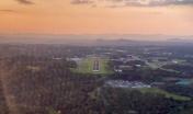
Pickens County Airport
Official FAA Data Effective 2026-01-22 0901Z
VFR Chart of KJZP
Sectional Charts at SkyVector.com
IFR Chart of KJZP
Enroute Charts at SkyVector.com
Location Information for KJZP
Coordinates: N34°27.21' / W84°27.43'Located 02 miles SW of Jasper, Georgia on 137 acres of land. View all Airports in Georgia.
Surveyed Elevation is 1535 feet MSL.
Operations Data
|
|
Airport Communications
| AWOS-AV: | 120.025 Tel. 706-253-9008 |
|---|---|
| CTAF: | 122.725 |
| UNICOM: | 122.725 |
| AWOS-3PT at CNI (8.8 S): | 119.825 678-454-2065 |
| AWOS-3 at 49A (11.2 N): | 118.075 706 276-4513 |
| AWOS-3PT at CZL (23.7 W): | 119.975 706-578-1205 |
- APCH/DEP SVC PRVDD BY ATLANTA ARTCC (MOUNT OGLETHORPE RCAG) ON FREQS 133.1/342.425
Nearby Navigation Aids
|
| ||||||||||||||||||||||||||||||||||||||||||||||||||||||||||||
Runway 16/34
| Dimensions: | 5000 x 100 feet / 1524 x 30 meters | |
|---|---|---|
| Surface: | Asphalt in Fair Condition | |
| Weight Limits: | S-60, D-95 | |
| Edge Lighting: | Medium Intensity | |
| Runway 16 | Runway 34 | |
| Coordinates: | N34°27.59' / W84°27.61' | N34°26.83' / W84°27.25' |
| Elevation: | 1500.5 | 1535.1 |
| Traffic Pattern: | Left | Left |
| Runway Heading: | 159° True | 339° True |
| Markings: | Non-Precision Instrument in good condition. | Non-Precision Instrument in good condition. |
| Glide Slope Indicator | P2R (3.00° Glide Path Angle) PAPI UNUSBL BYD 4 DEG LEFT OF CNTRLN. | P2L (3.00° Glide Path Angle) |
| Obstacles: | 37 ft Trees 980 ft from runway, 365 ft right of center | 23 ft Trees 527 ft from runway, 139 ft left of center |
Services Available
| Fuel: | 100LL (blue), Jet A+ |
|---|---|
| Transient Storage: | Tiedowns |
| Airframe Repair: | MAJOR |
| Engine Repair: | MINOR |
| Bottled Oxygen: | NONE |
| Bulk Oxygen: | NONE |
| Other Services: | AVIONICS,PILOT INSTRUCTION |
Ownership Information
| Ownership: | Publicly owned | |
|---|---|---|
| Owner: | PICKENS COUNTY | |
| 1266 EAST CHURCH STREET, SUITE 201 | ||
| JASPER, GA 30143 | ||
| 706-253-8817 | ||
| Manager: | STACY MCCLURE | |
| 193 AIRPORT ROAD | ||
| JASPER, GA 30143 | ||
| 706-253-8967 | ||
Other Remarks
- DEER & WILDLIFE ON & INVOF ARPT.
- FOR CD CTC ATLANTA ARTCC AT 770-210-7692.
- PAPI RWY 16 & 34; MIRL RWY 16/34 - OPR CONSLY.
Weather Minimums
Instrument Approach Procedure (IAP) Charts
Nearby Airports with Instrument Procedures
| ID | Name | Heading / Distance | ||
|---|---|---|---|---|
 |
KCNI | Cherokee County Regional Airport | 168° | 8.6 |
 |
49A | Gilmer County Airport | 341° | 11.0 |
 |
KCZL | Tom B David Field Airport | 270° | 23.9 |
 |
KDNN | Dalton Municipal Airport | 308° | 26.1 |
 |
KRYY | Cobb County International/Mccollum Field Airport | 194° | 27.3 |
 |
KVPC | Cartersville Airport | 224° | 27.8 |
 |
KMGE | Dobbins Arb Airport | 185° | 32.4 |
 |
KGVL | Lee Gilmer Memorial Airport | 109° | 33.0 |
 |
KDZJ | Blairsville Airport | 043° | 33.1 |
 |
1A3 | Martin Campbell Field Airport | 009° | 34.1 |
 |
KRMG | Richard B Russell Regional - J H Towers Field Airport | 260° | 35.4 |
 |
KPDK | Dekalb-Peachtree Airport | 167° | 35.4 |


Comments
Great little airport!
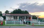
Great little airport! Friendly folks, cheap gas and nice area. Try the Last Catch for dinner, call ahead for camping.
Thanks Tim for all your hospitality! -T and ED
EDWARD E EUBANKS
Pages