Login
Register


4D8
Fuller Airport
Official FAA Data Effective 2026-01-22 0901Z
Chart Supplement

VFR Chart of 4D8
Sectional Charts at SkyVector.com
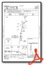
IFR Chart of 4D8
Enroute Charts at SkyVector.com
Location Information for 4D8
Coordinates: N43°20.00' / W95°9.55'Located 01 miles NW of Milford, Iowa on 48 acres of land. View all Airports in Iowa.
Surveyed Elevation is 1439 feet MSL.
Operations Data
|
|
Airport Communications
| CTAF: | 122.900 |
|---|---|
| ASOS at SPW (10.3 S): | 126.625 712-262-8885 |
| ASOS at EST (18.6 E): | 121.425 712-362-7250 |
| AWOS-3 at MJQ (20.4 N): | 118.1 507-847-5810 |
- APCH/DEP SVC PRVDD BY MINNEAPOLIS ARTCC ON FREQS 127.75/257.7 (FAIRMONT RCAG).
Nearby Navigation Aids
|
| ||||||||||||||||||||||||||||||||||||||||||||||||||||||||||||


Runway 09/27
| Dimensions: | 2873 x 50 feet / 876 x 15 meters | |
|---|---|---|
| Surface: | Asphalt in Good Condition | |
| Edge Lighting: | Low Intensity | |
| Runway 09 | Runway 27 | |
| Coordinates: | N43°20.09' / W95°9.80' | N43°20.09' / W95°9.15' |
| Elevation: | 1437.0 | 1436.0 |
| Traffic Pattern: | Left | Right |
| Runway Heading: | 90° True | 270° True |
| Displaced Threshold: | 60 Feet RWY 9 APCH SLP 5:1 TO DTHR. |
360 Feet |
| Markings: | Basic in fair condition. | Basic in fair condition. |
| Obstacles: | 41 ft Trees 200 ft from runway, 143 ft right of center RWY 27 APCH SLP 15:1 TO DTHR. CONTROLLING OBSTN EXCEEDS A 45 DEG SLP. 41 FT TREES 190 FT FM RWY END 143 FT R ON APCH 0:1 CLEARANCE. |
59 ft Tree 550 ft from runway, 173 ft right of center RY 27 APCH SLOPE 24:1 TO DSPLCD THLD. |
Runway 18/36
| Dimensions: | 2200 x 100 feet / 671 x 30 meters | |
|---|---|---|
| Surface: | Turf in Fair Condition | |
| Edge Lighting: | Low Intensity | |
| Runway 18 | Runway 36 | |
| Coordinates: | N43°20.08' / W95°9.63' | N43°19.72' / W95°9.63' |
| Elevation: | 1436.0 | 1429.0 |
| Traffic Pattern: | Right | Left |
| Runway Heading: | 180° True | 0 |
| Displaced Threshold: | 700 Feet | |
| Obstacles: | 26 ft Tree 208 ft from runway, 145 ft left of center | 50 ft Tree 633 ft from runway, 87 ft right of center RY 36 APCH SLOPE 20:1 TO DSPLCD THLD. |
Services Available
| Fuel: | 100LL (blue) |
|---|---|
| Transient Storage: | Tiedowns |
| Airframe Repair: | NONE |
| Engine Repair: | NONE |
| Bottled Oxygen: | NONE |
| Bulk Oxygen: | NONE |
Ownership Information
| Ownership: | Publicly owned | |
|---|---|---|
| Owner: | CITY OF MILFORD | |
| PO BOX 536 | ||
| MILFORD, IA 51351 | ||
| 712-260-4335 | ||
| Manager: | CHRISTOPHER STEIN | |
| P.O. BOX 463 | ||
| MILFORD, IA 51351 | ||
| 712-260-4335 | ||
Other Remarks
- THIS AIRPORT HAS BEEN SURVEYED BY THE NATIONAL GEODETIC SURVEY.
- RY 27 IS CALM WIND RY.
- FOR CD CTC MINNEAPOLIS ARTCC AT 651-463-5588.
- NO SNOW REMOVAL RWY 18/36. RWY CLSD WHEN SNOW CONDS EXIST.
- 18/36 MARKED WITH YELLOW CONES.
- 0LL SELF SERVE 100LL.
Weather Minimums

Instrument Approach Procedure (IAP) Charts

Nearby Airports with Instrument Procedures
| ID | Name | Heading / Distance | ||
|---|---|---|---|---|
 |
KSPW | Spencer Municipal Airport | 190° | 10.2 |
|
KEST | Estherville Municipal Airport | 076° | 18.6 |
|
KMJQ | Jackson Municipal Airport | 021° | 20.5 |
|
KEGQ | Emmetsburg Municipal Airport | 124° | 24.3 |
|
KISB | Sibley Municipal Airport | 274° | 26.4 |
|
KOTG | Worthington Municipal Airport | 316° | 26.6 |
|
KSHL | Sheldon Regional Airport | 255° | 30.5 |
|
KMWM | Windom Municipal Airport | 003° | 34.9 |
|
KFRM | Fairmont Municipal Airport | 059° | 37.4 |
|
KCKP | Cherokee County Regional Airport | 205° | 40.1 |
|
KAXA | Algona Municipal Airport | 111° | 41.8 |
|
KPOH | Pocahontas Municipal Airport | 147° | 42.0 |
Airport Images
Do you have a recent image of this airport? Upload it here!


