Login
Register


SHL
Sheldon Regional Airport
Official FAA Data Effective 2026-02-19 0901Z
Chart Supplement

VFR Chart of KSHL
Sectional Charts at SkyVector.com
IFR Chart of KSHL
Enroute Charts at SkyVector.com
Location Information for KSHL
Coordinates: N43°12.50' / W95°50.01'Located 02 miles NE of Sheldon, Iowa on 121 acres of land. View all Airports in Iowa.
Surveyed Elevation is 1419 feet MSL.
Operations Data
|
|
Airport Communications
| AWOS-3: | 119.775 Tel. 712-324-5159 |
|---|---|
| CTAF: | 122.800 |
| UNICOM: | 122.800 |
| AWOS-3P at SXK (19.6 SW): | 120.075 712-567-1005 |
| ASOS at SPW (27.7 E): | 126.625 712-262-8885 |
| AWOS-3PT at OTG (29.0 NE): | 121.075 507-376-9441 |
- COMMUNICATIONS PRVDD BY FORT DODGE RADIO ON FREQ 122.5 (SPENCER RCO).
- APCH/DEP SVC PRVDD BY MINNEAPOLIS ARTCC (ZMP) ON FREQ 125.025/235.625 (SIOUX CITY RCAG).
Nearby Navigation Aids
|
| ||||||||||||||||||||||||||||||||||||||||||||||||||||||||||||


Runway 15/33
| Dimensions: | 4199 x 75 feet / 1280 x 23 meters | |
|---|---|---|
| Surface: | Concrete in Fair Condition | |
| Weight Limits: | 7 /R/C/W/U, S-28 | |
| Edge Lighting: | Medium Intensity | |
| Runway 15 | Runway 33 | |
| Coordinates: | N43°12.82' / W95°50.20' | N43°12.19' / W95°49.81' |
| Elevation: | 1419.2 | 1412.6 |
| Traffic Pattern: | Left | Left |
| Runway Heading: | 155° True | 335° True |
| Markings: | Non-Precision Instrument in fair condition. | Non-Precision Instrument in fair condition. |
| Glide Slope Indicator | P2L (3.00° Glide Path Angle) | P2L (3.00° Glide Path Angle) |
| REIL: | Yes | Yes |
| Obstacles: | 15 ft Road 500 ft from runway, 165 ft left of center | 38 ft Trees 1490 ft from runway, 400 ft right of center |
Services Available
| Fuel: | 100LL (blue), Jet-A |
|---|---|
| Transient Storage: | Hangars,Tiedowns |
| Airframe Repair: | MAJOR |
| Engine Repair: | MAJOR |
| Bottled Oxygen: | NONE |
| Bulk Oxygen: | NONE |
| Other Services: | CHARTER SERVICE,PILOT INSTRUCTION,AIRCRAFT RENTAL,AIRCRAFT SALES |
Ownership Information
| Ownership: | Publicly owned | |
|---|---|---|
| Owner: | CITY OF SHELDON | |
| 416 9TH ST BOX 276 | ||
| SHELDON, IA 51201 | ||
| 712-324-4651 | ||
| Manager: | LYLE VUST | |
| 3020 NORTHWEST BOULEVARD | ||
| SHELDON, IA 51201-7508 | ||
| 712-324-4005 | ||
Other Remarks
- RY 33 IS CALM WIND RY.
- FOR CD CTC MINNEAPOLIS ARTCC AT 651-463-5588.
- ACTVT MIRL RY 15/33; PAPI AND REIL RYS 15 & 33 - CTAF.
Weather Minimums


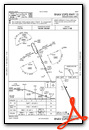
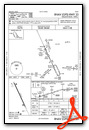
Instrument Approach Procedure (IAP) Charts
Nearby Airports with Instrument Procedures
| ID | Name | Heading / Distance | ||
|---|---|---|---|---|
 |
KISB | Sibley Municipal Airport | 018° | 10.2 |
|
KSXK | Sioux County Regional Airport | 227° | 19.6 |
|
KRRQ | Rock Rapids Municipal Airport | 314° | 21.1 |
|
KSPW | Spencer Municipal Airport | 095° | 27.8 |
|
KOTG | Worthington Municipal Airport | 022° | 29.0 |
|
KLYV | Quentin Aanenson Field Airport | 325° | 29.7 |
|
KLRJ | Le Mars Municipal Airport | 211° | 30.3 |
|
4D8 | Fuller Airport | 075° | 30.5 |
|
KCKP | Cherokee County Regional Airport | 156° | 31.1 |
|
KSLB | Storm Lake Municipal Airport | 144° | 45.0 |
|
KMJQ | Jackson Municipal Airport | 054° | 45.6 |
|
KFSD | Joe Foss Field Airport | 299° | 45.6 |
Airport Images
Do you have a recent image of this airport? Upload it here!


