Login
Register


4TX6
Kilgore Airport
Official FAA Data Effective 2026-02-19 0901Z
VFR Chart of 4TX6
Sectional Charts at SkyVector.com
IFR Chart of 4TX6
Enroute Charts at SkyVector.com
Location Information for 4TX6
Coordinates: N32°24.76' / W94°49.10'Located 03 miles NE of Kilgore, Texas on 13 acres of land. View all Airports in Texas.
Estimated Elevation is 365 feet MSL.
Operations Data
|
|
Airport Communications
| ATIS at GGG (5.7 E): | 119.65 |
|---|---|
| ASOS at GGG (5.7 E): | 903-643-4029 |
| AWOS-3 at RFI (16.2 S): | 119.375 903-657-0384 |
Nearby Navigation Aids
|
| ||||||||||||||||||||||||||||||||||||||||||||||||||||||||||||


Runway 18/36
| Dimensions: | 2780 x 100 feet / 847 x 30 meters | |
|---|---|---|
| Surface: | Turf | |
| Runway 18 | Runway 36 | |
| Traffic Pattern: | Left | Left |
| Obstacles: | ft Fence 0 ft from runway | ft Other 0 ft from runway HOUSE |
Services Available
| Fuel: | NONE |
|---|---|
| Transient Storage: | NONE |
| Airframe Repair: | MINOR |
| Engine Repair: | MINOR |
| Bottled Oxygen: | NOT AVAILABLE |
| Bulk Oxygen: | NOT AVAILABLE |
Ownership Information
| Ownership: | Privately Owned | |
|---|---|---|
| Owner: | DANA L SNEED | |
| 884 NORRIS RD | ||
| KILGORE, TX 75662 | ||
| 903-984-4413 | ||
| Manager: | DANA L. SNEED | |
| 884 NORRIS RD | ||
| KILGORE, TX 75662 | ||
| 903-984-4413 | ||
Other Remarks
- ARPT IN FAIR CONDITION-LAND AT OWN RISK.
- FOR CD CTC FORT WORTH ARTCC AT 817-858-7584.
Nearby Airports with Instrument Procedures
| ID | Name | Heading / Distance | ||
|---|---|---|---|---|
 |
KGGG | East Texas Regional Airport | 107° | 5.7 |
|
07F | Gladewater Municipal Airport | 311° | 10.4 |
|
KRFI | Rusk County Airport | 185° | 16.3 |
|
KJXI | Fox Stephens Field/Gilmer Municipal Airport | 338° | 18.3 |
|
KASL | Harrison County Airport | 075° | 26.7 |
|
KTYR | Tyler Pounds Regional Airport | 263° | 29.9 |
|
4F2 | Panola County-Sharpe Field Airport | 118° | 30.0 |
|
KJSO | Cherokee County Airport | 212° | 38.4 |
|
F51 | Winnsboro Municipal Airport | 323° | 39.2 |
|
KJDD | Wood County/Collins Field Airport | 300° | 39.6 |
|
KOSA | Mount Pleasant Regional Airport | 349° | 41.6 |
|
F17 | Center Municipal Airport | 135° | 48.5 |
Airport Images
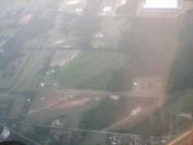
By: davolino


