Login
Register


TYR
Tyler Pounds Regional Airport
Official FAA Data Effective 2026-01-22 0901Z
From the Flight Deck
Chart Supplement

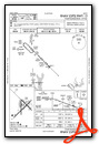
KTYR Airport Diagram

VFR Chart of KTYR
Sectional Charts at SkyVector.com
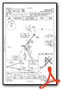
IFR Chart of KTYR
Enroute Charts at SkyVector.com
Location Information for KTYR
Coordinates: N32°21.21' / W95°24.18'Located 03 miles W of Tyler, Texas on 1200 acres of land. View all Airports in Texas.
Surveyed Elevation is 543 feet MSL.
Operations Data
|
|
Airport Communications
| ATIS: | 126.25 |
|---|---|
| ASOS: | Tel. 903-535-9105 |
| POUNDS TOWER: | 120.1 257.8 |
| POUNDS GROUND: | 121.9 |
| LONGVIEW APPROACH: | 128.75 379.15 |
| LONGVIEW DEPARTURE: | 128.75 379.15 |
| EMERG: | 121.5 243.0 |
| UNICOM: | 122.950 |
| CTAF: | 120.100 |
| AWOS-3 at JDD (23.7 N): | 118.9 903-768-3065 |
| AWOS-3PT at F44 (24.4 SW): | 119.6 903-670-1247 |
| AWOS-3 at RFI (30.6 SE): | 119.375 903-657-0384 |
- APCH/DEP SVC PRVDD BY FORT WORTH ARTCC (ZFW) ON FREQS 135.25/279.65 (TYLER RCAG) WHEN LONGVIEW APCH CLSD.
Nearby Navigation Aids
|
| ||||||||||||||||||||||||||||||||||||||||||||||||||||||||||||


Runway 04/22
| Dimensions: | 8334 x 150 feet / 2540 x 46 meters | |
|---|---|---|
| Surface: | Concrete / Grooved in Excellent Condition | |
| Weight Limits: | S-120, D-222, ST-357
PCR VALUE: 640/R/B/W/T
| |
| Edge Lighting: | High Intensity | |
| Runway 04 | Runway 22 | |
| Coordinates: | N32°20.62' / W95°24.80' | N32°21.59' / W95°23.65' |
| Elevation: | 540.3 | 529.5 |
| Traffic Pattern: | Left | Left |
| Runway Heading: | 45° True | 225° True |
| Displaced Threshold: | 600 Feet | |
| Declared Distances: | TORA:8334 TODA:8334 ASDA:7734 LDA:7734 | TORA:8334 TODA:8334 ASDA:8334 LDA:7734 |
| Markings: | Precision Instrument in good condition. | Precision Instrument in good condition. |
| Glide Slope Indicator | P4L (3.00° Glide Path Angle) | P4L (3.00° Glide Path Angle) UNUSBL BYD 9 DEG LEFT AND RIGHT OF RWY CNTRLN. |
| Approach Lights: | MALSR 1,400 Foot Medium-intensity Approach Lighting System with runway alignment indicator lights. | |
| REIL: | Yes | |
| Obstacles: | 28 ft Tree 1146 ft from runway, 80 ft right of center | |
Runway 13/31
| Dimensions: | 5198 x 150 feet / 1584 x 46 meters | |
|---|---|---|
| Surface: | Asphalt / Grooved in Fair Condition | |
| Weight Limits: | S-25, D-40
PCR VALUE: 150/F/D/X/T
| |
| Edge Lighting: | High Intensity | |
| Runway 13 | Runway 31 | |
| Coordinates: | N32°21.67' / W95°24.32' | N32°21.07' / W95°23.61' |
| Elevation: | 515.4 | 542.3 |
| Traffic Pattern: | Left | Left |
| Runway Heading: | 135° True | 315° True |
| Declared Distances: | TORA:5198 TODA:5198 ASDA:5198 LDA:5198 | TORA:5198 TODA:5198 ASDA:5198 LDA:5198 |
| Markings: | Precision Instrument in good condition. | Precision Instrument in good condition. |
| Glide Slope Indicator | V4L (3.00° Glide Path Angle) | |
| Obstacles: | 28 ft Pole 1550 ft from runway, 550 ft right of center | 14 ft Road 600 ft from runway, 520 ft right of center |
Runway 18/36
| Dimensions: | 4832 x 150 feet / 1473 x 46 meters | |
|---|---|---|
| Surface: | Asphalt / Grooved in Good Condition | |
| Weight Limits: | S-109, D-172, ST-289
PCR VALUE: 670/F/C/X/T
| |
| Edge Lighting: | Medium Intensity | |
| Runway 18 | Runway 36 | |
| Coordinates: | N32°21.62' / W95°24.33' | N32°20.82' / W95°24.33' |
| Elevation: | 517.0 | 543.6 |
| Traffic Pattern: | Left | Left |
| Runway Heading: | 180° True | 0 |
| Declared Distances: | TORA:4832 TODA:4832 ASDA:4832 LDA:4832 | TORA:4832 TODA:4832 ASDA:4832 LDA:4832 |
| Markings: | Non-Precision Instrument in good condition. | Non-Precision Instrument in good condition. |
| Obstacles: | 38 ft Tree 1100 ft from runway, 13 ft left of center | 43 ft Tree 1158 ft from runway, 239 ft left of center |
Services Available
| Fuel: | 100LL (blue), Jet-A |
|---|---|
| Transient Storage: | Hangars,Tiedowns |
| Airframe Repair: | MAJOR |
| Engine Repair: | MAJOR |
| Bottled Oxygen: | HIGH |
| Bulk Oxygen: | HIGH |
| Other Services: | AIR FREIGHT SERVICES,CARGO HANDLING SERVICES,CHARTER SERVICE,PILOT INSTRUCTION,AIRCRAFT RENTAL,AIRCRAFT SALES,ANNUAL SURVEYING |
Ownership Information
| Ownership: | Publicly owned | |
|---|---|---|
| Owner: | CITY OF TYLER | |
| PO BOX 2039 | ||
| TYLER, TX 75710 | ||
| 903-531-9825 | ||
| Manager: | STEVE M. THOMPSON | |
| 700 SKYWAY BLVD, SUITE 201 | ||
| TYLER, TX 75704 | ||
| 903-531-2343 | ||
Other Remarks
- HELICOPTERS OPERATING INBOUND OR OUTBOUND TO/FROM THE DOWNTOWN HOSPITALS STATE INTENTION ON 123.075.
- WEST SIDE PSGR TERMINAL RAMP ACCESS RSTD TO ACR.
- NOISE ABATEMENT PROCEDURES IN EFFECT CALL 903-590-3048.
- CONDS NOT MNTD BTN THE HRS OF 9:30 PM AND 6:30 AM LOCAL.
- FOR CD IF UNA TO CTC ON FSS FREQ, CTC FORT WORTH ARTCC AT 817-858-7584.
- WHEN ATCT CLSD ACTVT MALSR RWY 04; REIL RWY 22; HIRL RWY 04/22; MIRL RWY 18/36; TWY LGTS - CTAF. HIRL RWY 13/31 PRESET MED INTST, TO INCR INTST ACTVT - CTAF. PAPI RWYS 04 & 22, VASI RWY 31 OPR CONSLY.
Weather Minimums

Instrument Approach Procedure (IAP) Charts


Nearby Airports with Instrument Procedures
| ID | Name | Heading / Distance | ||
|---|---|---|---|---|
 |
KJDD | Wood County/Collins Field Airport | 348° | 23.8 |
|
07F | Gladewater Municipal Airport | 064° | 24.3 |
|
F44 | Athens Municipal Airport | 242° | 24.4 |
|
KJSO | Cherokee County Airport | 161° | 30.5 |
|
KRFI | Rusk County Airport | 114° | 30.8 |
|
KJXI | Fox Stephens Field/Gilmer Municipal Airport | 048° | 30.9 |
|
KGGG | East Texas Regional Airport | 086° | 35.2 |
|
F51 | Winnsboro Municipal Airport | 010° | 35.6 |
|
KPSN | Palestine Municipal Airport | 204° | 37.7 |
|
KTRL | Terrell Municipal Airport | 296° | 48.7 |
|
KSLR | Sulphur Springs Municipal Airport | 347° | 49.5 |
|
KOSA | Mount Pleasant Regional Airport | 026° | 49.8 |
Fuel Providers

Airport Images

By: ianlor


