Login
Register


6E5
Wilder Airport
Official FAA Data Effective 2026-02-19 0901Z
Chart Supplement

VFR Chart of 6E5
Sectional Charts at SkyVector.com
IFR Chart of 6E5
Enroute Charts at SkyVector.com
Location Information for 6E5
Coordinates: N44°25.98' / W97°33.49'Located 02 miles N of Desmet, South Dakota on 236 acres of land. View all Airports in South Dakota.
Surveyed Elevation is 1730 feet MSL.
Operations Data
|
|
Airport Communications
| AWOS-3P: | 118.150 Tel. 605-860-2233 |
|---|---|
| CTAF: | 122.900 |
| ASOS at HON (28.9 W): | 118.125 605-215-0039 |
| AWOS-3 at MDS (32.2 SE): | 118.35 605-427-9380 |
| AWOS-3PT at BKX (32.7 E): | 119.925 605-692-1809 |
- APCH/DEP SVC PRVDD BY MINNEAPOLIS ARTCC (ZMP) ON FREQ 126.25/339.8 (HURON RCAG).
Nearby Navigation Aids
|
| ||||||||||||||||||||||||||||||||||||||||||||||||||||||||||||


Runway 16/34
| Dimensions: | 3700 x 60 feet / 1128 x 18 meters | |
|---|---|---|
| Surface: | Asphalt in Good Condition | |
| Weight Limits: | S-12 | |
| Edge Lighting: | Medium Intensity | |
| Runway 16 | Runway 34 | |
| Coordinates: | N44°26.27' / W97°33.64' | N44°25.70' / W97°33.34' |
| Elevation: | 1728.5 | 1730.1 |
| Traffic Pattern: | Left | Left |
| Runway Heading: | 160° True | 340° True |
| Markings: | Non-Precision Instrument in good condition. | Non-Precision Instrument in good condition. |
| Glide Slope Indicator | P2L (3.00° Glide Path Angle) | P2L (3.00° Glide Path Angle) |
Services Available
| Fuel: | NONE |
|---|---|
| Transient Storage: | Hangars,Tiedowns |
| Airframe Repair: | NONE |
| Engine Repair: | NONE |
| Bottled Oxygen: | NONE |
| Bulk Oxygen: | NONE |
| Other Services: | CROP DUSTING SERVICES,PILOT INSTRUCTION |
Ownership Information
| Ownership: | Publicly owned | |
|---|---|---|
| Owner: | CITY OF DESMET | |
| PO BOX 70 | ||
| DESMET, SD 57231 | ||
| 605-854-3731 | ||
| Manager: | CASEY HARTY | |
| PO BOX 70 | ||
| DESMET, SD 57231 | ||
| 605-860-0248 | ||
Other Remarks
- FOR CD CTC MINNEAPOLIS ARTCC AT 651-463-5588.
- ACTVT PAPI RWY 16 & 34; MIRL RWY 16/34 - CTAF.
Weather Minimums


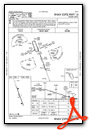
Instrument Approach Procedure (IAP) Charts

Nearby Airports with Instrument Procedures
| ID | Name | Heading / Distance | ||
|---|---|---|---|---|
 |
8D7 | Clark County Airport | 346° | 28.5 |
|
KHON | Huron Regional Airport | 264° | 29.0 |
|
KMDS | Madison Municipal Airport | 140° | 32.3 |
|
KBKX | Brookings Regional Airport | 103° | 32.7 |
|
KATY | Watertown Regional Airport | 030° | 33.6 |
|
KMHE | Mitchell Municipal Airport | 207° | 44.6 |
|
4X4 | Wessington Springs Airport | 242° | 47.5 |
|
KCNB | Myers Field Airport | 071° | 58.2 |
|
KMKA | Miller Municipal Airport | 275° | 60.4 |
|
KPQN | Pipestone Municipal Airport | 116° | 60.6 |
|
KFSD | Joe Foss Field Airport | 145° | 62.1 |
|
1D1 | Milbank Municipal Airport | 041° | 63.9 |
Airport Images
Do you have a recent image of this airport? Upload it here!


