Login
Register


7B2
Northampton Airport
Official FAA Data Effective 2025-11-27 0901Z
Chart Supplement

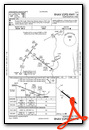
VFR Chart of 7B2
Sectional Charts at SkyVector.com
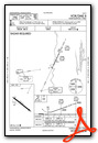
IFR Chart of 7B2
Enroute Charts at SkyVector.com
Location Information for 7B2
Coordinates: N42°19.68' / W72°36.67'Located 01 miles NE of Northampton, Massachusetts on 55 acres of land. View all Airports in Massachusetts.
Surveyed Elevation is 121 feet MSL.
Operations Data
|
|
Airport Communications
| BRADLEY APPROACH: | 125.35 281.5 |
|---|---|
| BRADLEY DEPARTURE: | 125.35 281.5 |
| CLEARANCE DELIVERY: | 133.6 |
| CTAF: | 122.700 |
| UNICOM: | 122.700 |
| ATIS at CEF (8.7 S): | 127.525 |
| ASOS at BAF (11.2 SW): | 127.1 413-568-2267 |
| ATIS at BAF (11.2 SW): | 263.15 |
Nearby Navigation Aids
|
| ||||||||||||||||||||||||||||||||||||||||||||||||||||||||||||


Runway 14/32
| Dimensions: | 3335 x 50 feet / 1017 x 15 meters | |
|---|---|---|
| Surface: | Asphalt in Good Condition | |
| Weight Limits: | S-7 | |
| Edge Lighting: | Medium Intensity | |
| Runway 14 | Runway 32 | |
| Coordinates: | N42°19.85' / W72°36.97' | N42°19.51' / W72°36.38' |
| Elevation: | 121.4 | 118.8 |
| Traffic Pattern: | Left | Left |
| Runway Heading: | 128° True | 308° True |
| Displaced Threshold: | 220 Feet | |
| Markings: | Basic in good condition. | Basic in good condition. |
| Glide Slope Indicator | P4L (4.50° Glide Path Angle) | |
| Obstacles: | 60 ft Trees 600 ft from runway, 210 ft right of center 15 FT ROAD IN PRIM SFC. |
32 ft Trees 1000 ft from runway, 51 ft right of center APCH 38:1 TO DTHR. ROAD IN PRIM SFC 50 FT FM THR. |
Services Available
| Fuel: | 100LL (blue) |
|---|---|
| Transient Storage: | Hangars,Tiedowns |
| Airframe Repair: | MAJOR |
| Engine Repair: | MAJOR |
| Bottled Oxygen: | NONE |
| Bulk Oxygen: | NONE |
| Other Services: | PILOT INSTRUCTION,AIRCRAFT RENTAL |
Ownership Information
| Ownership: | Privately Owned | |
|---|---|---|
| Owner: | SEVEN BRAVO TWO, LLC | |
| 160 OLD FERRY RD | ||
| NORTHAMPTON, MA 01060 | ||
| 413-568-0905 | ||
| Manager: | RICHARD MACISAAC | |
| 160 OLD FERRY RD | ||
| NORTHAMPTON, MA 01060 | ||
| 860-833-7602 | RICHM@FLY7B2.COM | |
Other Remarks
- THIS AIRPORT HAS BEEN SURVEYED BY THE NATIONAL GEODETIC SURVEY.
- (PAY PHONE) PAY PHONE AVAILABLE.
- ARPT CLSD TO ALL ACFT & HEL CRTFYD FOR 12500 LBS & OVR.
- LDG FEE FOR COML ACFT.
- FEE & PPR FOR COML BLN OPS.
- FOR CD CTC BRADLEY APCH AT 860-386-3597.
- GLDR ACT ON & INVOF ARPT MAY-OCT.
- COLD TEMPERATURE AIRPORT. ALTITUDE CORRECTION REQUIRED AT OR BELOW -24C.
- 0LL FUEL IS 24 HR SELF-SERVE.
- ACTVT MIRL RWY 14/32 - CTAF.
Weather Minimums
Instrument Approach Procedure (IAP) Charts
Nearby Airports with Instrument Procedures
| ID | Name | Heading / Distance | ||
|---|---|---|---|---|
 |
KCEF | Westover Arb/Metro Airport | 157° | 8.7 |
|
KBAF | Westfield-Barnes Regional Airport | 204° | 11.2 |
|
0B5 | Turners Falls Airport | 013° | 16.3 |
|
KORE | Orange Municipal Airport | 044° | 20.4 |
|
KBDL | Bradley International Airport | 187° | 23.6 |
|
3B0 | Southbridge Municipal Airport | 117° | 28.9 |
|
KGDM | Gardner Municipal Airport | 063° | 29.6 |
|
KPSF | Pittsfield Municipal Airport | 281° | 30.8 |
|
KORH | Worcester Regional Airport | 096° | 33.0 |
|
KAQW | Harriman-and-West Airport | 311° | 33.2 |
|
KHFD | Hartford-Brainard Airport | 182° | 35.5 |
|
KGBR | Walter J Koladza Airport | 256° | 36.3 |
Airport Images
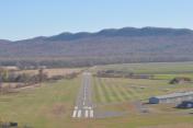
By: Sheagolden


