Login
Register
8MD4
Spiering Airport
Official FAA Data Effective 2025-11-27 0901Z
VFR Chart of 8MD4
Sectional Charts at SkyVector.com
IFR Chart of 8MD4
Enroute Charts at SkyVector.com
Location Information for 8MD4
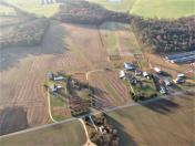
Coordinates: N38°58.83' / W75°46.67'Located 01 miles E of Greensboro, Maryland on 53 acres of land. View all Airports in Maryland.
Estimated Elevation is 55 feet MSL.
Operations Data
|
|
Airport Communications
| AWOS-3 at 33N (16.5 NE): | 120.125 302-571-6012 |
|---|---|
| D-ATIS at DOV (17.1 NE): | 127.825 |
| ATIS at ESN (17.2 SW): | 124.475 |
Nearby Navigation Aids
|
| ||||||||||||||||||||||||||||||||||||||||||||||||||||||||||||
Runway 17/35
| Dimensions: | 2300 x 50 feet / 701 x 15 meters | |
|---|---|---|
| Surface: | Turf in Good Condition | |
| Runway 17 | Runway 35 | |
| Obstacles: | 0 ft Road 50 ft from runway 85 FT TREES, 1498 FT OUT. DIRT DRIVEWAY CROSSES 600 FT S OF RWY 17. |
20 ft Brush 255 ft from runway 85 FT TREE, 118 FT R AND 78 FT L OF BRUSH AREA. |
Ownership Information
| Ownership: | Privately Owned | |
|---|---|---|
| Owner: | MARK D. SPIERING | |
| 26621 BOYCE MILL RD | ||
| GREENSBORO, MD 21639 | ||
| (410) 443-6437 | ||
| Manager: | MARK D. SPIERING | |
| 26621 BOYCE MILL RD | ||
| GREENSBORO, MD 21639 | ||
| (410) 443-6437 | ||
Other Remarks
- FOR CD CTC WASHINGTON ARTCC AT 703-771-3587.
Nearby Airports with Instrument Procedures
| ID | Name | Heading / Distance | ||
|---|---|---|---|---|
 |
KRJD | Gooden Airpark Airport | 261° | 4.2 |
 |
33N | Delaware Airpark Airport | 030° | 16.5 |
 |
KDOV | Dover AFB Airport | 058° | 17.1 |
 |
KESN | Easton/Newnam Field Airport | 232° | 17.3 |
 |
W29 | Bay Bridge Airport | 269° | 25.8 |
 |
KGED | Delaware Coastal Airport | 131° | 26.3 |
 |
N06 | Laurel Airport | 161° | 27.7 |
 |
KCGE | Cambridge-Dorchester Regional Airport | 204° | 29.0 |
 |
KEVY | Summit Airport | 004° | 32.5 |
 |
58M | Claremont Airport | 353° | 35.8 |
 |
KMTN | Martin State Airport | 305° | 36.2 |
 |
KANP | Lee Airport | 266° | 37.1 |


