Login
Register
8MS2
Godspeed Airpark Airport
Official FAA Data Effective 2025-11-27 0901Z
VFR Chart of 8MS2
Sectional Charts at SkyVector.com
IFR Chart of 8MS2
Enroute Charts at SkyVector.com
Location Information for 8MS2
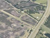
Coordinates: N34°14.03' / W88°30.43'Located 05 miles SW of Fulton, Mississippi on 10 acres of land. View all Airports in Mississippi.
Estimated Elevation is 350 feet MSL.
Operations Data
|
|
Airport Communications
| ASOS at TUP (13.2 W): | 133.525 662-200-1505 |
|---|---|
| AWOS-3P at M40 (21.5 S): | 118.475 662-369-3498 |
| ATIS at CBM (35.5 S): | 115.2T |
Nearby Navigation Aids
|
| ||||||||||||||||||||||||||||||||||||||||||||||||||||||||||||
Runway 09/27
| Dimensions: | 3900 x 90 feet / 1189 x 27 meters | |
|---|---|---|
| Surface: | Turf | |
| Runway 09 | Runway 27 | |
| Coordinates: | N34°14.03' / W88°30.43' | N0°0.00' / E0°0.00' |
| Elevation: | 350.0 | |
Ownership Information
| Ownership: | Privately Owned | |
|---|---|---|
| Owner: | ROBIN E. GRAY | |
| 5421 DORSEY EVERGREEN RD | ||
| FULTON, MS 38843 | ||
| 662-422-2208 | ||
| Manager: | ROBIN E. GRAY | |
| 5421 DORSEY EVERGREEN RD | ||
| FULTON, MS 38843 | ||
| 662-422-2208 | ||
Other Remarks
- FOR CD CTC MEMPHIS ARTCC AT 901-368-8453/8449.
Nearby Airports with Instrument Procedures
| ID | Name | Heading / Distance | ||
|---|---|---|---|---|
 |
KTUP | Tupelo Regional Airport | 279° | 13.2 |
 |
5A4 | Okolona Municipal/Richard Stovall Field Airport | 219° | 17.0 |
 |
M40 | Monroe County Airport | 177° | 21.6 |
 |
8M1 | Booneville/Baldwyn Airport | 341° | 22.6 |
 |
KHAB | Marion County-Rankin Fite Airport | 105° | 26.3 |
 |
M55 | Lamar County Airport | 139° | 30.3 |
 |
M72 | New Albany/Union County Airport | 306° | 31.9 |
 |
KCBM | Columbus AFB Airport | 175° | 35.4 |
 |
15M | Segars Field Airport | 027° | 36.5 |
 |
25M | Ripley Airport | 319° | 38.6 |
 |
M83 | Mccharen Field Airport | 191° | 39.7 |
 |
KCRX | Roscoe Turner Airport | 353° | 41.1 |


