Login
Register


9S3
Lakeside Municipal Airport
Official FAA Data Effective 2026-01-22 0901Z
Chart Supplement

VFR Chart of 9S3
Sectional Charts at SkyVector.com
IFR Chart of 9S3
Enroute Charts at SkyVector.com
Location Information for 9S3
Coordinates: N43°34.99' / W124°10.82'Located 00 miles NW of Lakeside, Oregon on 31 acres of land. View all Airports in Oregon.
Estimated Elevation is 20 feet MSL.
Operations Data
|
|
Airport Communications
| CTAF: | 122.900 |
|---|---|
| AWOS-3PT at OTH (10.4 S): | 135.075 541-756-0135 |
| AWOS-3PT at 6S2 (24.2 N): | 118.225 541-997-8664 |
| ASOS at RBG (41.6 SE): | 135.475 541-673-1483 |
Nearby Navigation Aids
|
| ||||||||||||||||||||||||||||||||||||


Runway 15/33
| Dimensions: | 2150 x 100 feet / 655 x 30 meters | |
|---|---|---|
| Surface: | Turf in Good Condition | |
| Runway 15 | Runway 33 | |
| Traffic Pattern: | Left | Left |
| Obstacles: | 73 ft Trees 560 ft from runway, 70 ft right of center | 69 ft Trees 1324 ft from runway, 45 ft right of center |
Services Available
| Fuel: | NONE |
|---|---|
| Transient Storage: | Tiedowns |
| Airframe Repair: | NONE |
| Engine Repair: | NONE |
| Bottled Oxygen: | NONE |
| Bulk Oxygen: | NONE |
Ownership Information
| Ownership: | Publicly owned | |
|---|---|---|
| Owner: | CITY OF LAKESIDE | |
| 915 NORTH LAKE ROAD, PO BOX L | ||
| LAKESIDE, OR 97449 | ||
| 541-759-3011 | ||
| Manager: | KEN ROBBERS | |
| 155 NORTH TENMILE LAKE ROAD | ||
| LAKESIDE, OR 97449 | ||
| (209) 327-1578 | ||
Other Remarks
- TO DEACTIVATE SPRINKLERS KEY 122.9.
- WILDLIFE ON AND INVOF ARPT.
- FOR CD CTC SEATTLE ARTCC AT 253-351-3694.
- REMOTE CTL ACFT OPRNS AT ARPT.
- RWY 15 /33 RY ENDS MKD WITH WHITE MATS.
Nearby Airports with Instrument Procedures
| ID | Name | Heading / Distance | ||
|---|---|---|---|---|
 |
KOTH | Southwest Oregon Regional Airport | 196° | 10.4 |
|
KRBG | Roseburg Regional Airport | 119° | 41.5 |
|
KEUG | Mahlon Sweet Field Airport | 051° | 53.1 |
|
77S | Hobby Field Airport | 067° | 55.1 |
|
KONP | Newport Municipal Airport | 005° | 60.1 |
|
KCVO | Corvallis Municipal Airport | 034° | 67.0 |
|
4S1 | Gold Beach Municipal Airport | 188° | 70.9 |
|
3S8 | Grants Pass Airport | 151° | 73.2 |
|
S12 | Albany Municipal Airport | 037° | 79.7 |
|
KBOK | Brookings Airport | 183° | 90.7 |
|
KMFR | Rogue Valley International/Medford Airport | 141° | 92.6 |
|
KSLE | Mcnary Field Airport | 032° | 94.4 |
Airport Images
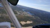
By: skitheo

By: skitheo


