Login
Register


C29
Middleton Municipal/Morey Field Airport
Official FAA Data Effective 2026-02-19 0901Z
Chart Supplement

VFR Chart of C29
Sectional Charts at SkyVector.com
IFR Chart of C29
Enroute Charts at SkyVector.com
Location Information for C29
Coordinates: N43°6.86' / W89°31.90'Located 05 miles NW of Middleton, Wisconsin on 258 acres of land. View all Airports in Wisconsin.
Surveyed Elevation is 928 feet MSL.
Operations Data
|
|
Airport Communications
| AWOS-3: | 118.675 Tel. 608-833-1686 |
|---|---|
| MADISON APPROACH: | 135.45 343.7 |
| MADISON DEPARTURE: | 135.45 343.7 |
| UNICOM: | 123.000 |
| CTAF: | 123.000 |
| ASOS at MSN (8.6 E): | 608-410-1285 |
| ATIS at MSN (8.6 E): | 124.65 |
| AWOS-3 at DLL (26.8 NW): | 118.325 608-356-1071 |
- APCH/DEP SVC PRVDD BY CHICAGO ARTCC ON FREQS 133.3/257.925 (LONE ROCK RCAG) WHEN MADISON APCH CTL CLSD.
Nearby Navigation Aids
|
| ||||||||||||||||||||||||||||||||||||||||||||||||||||||


Runway 10/28
| Dimensions: | 4001 x 100 feet / 1220 x 30 meters | |
|---|---|---|
| Surface: | Asphalt in Fair Condition | |
| Edge Lighting: | Medium Intensity | |
| Runway 10 | Runway 28 | |
| Coordinates: | N43°6.89' / W89°32.44' | N43°6.78' / W89°31.55' |
| Elevation: | 927.9 | 926.8 |
| Traffic Pattern: | Left | |
| Runway Heading: | 100° True | 280° True |
| Markings: | Non-Precision Instrument in fair condition. | Non-Precision Instrument in fair condition. |
| Glide Slope Indicator | P2L (4.00° Glide Path Angle) | P2L (4.00° Glide Path Angle) |
| REIL: | Yes | Yes |
Runway 01/19
| Dimensions: | 1780 x 120 feet / 543 x 37 meters | |
|---|---|---|
| Surface: | Turf in Good Condition | |
| Runway 01 | Runway 19 | |
| Coordinates: | N43°6.77' / W89°31.71' | N43°7.06' / W89°31.66' |
| Elevation: | 926.1 | 927.6 |
| Runway Heading: | 7° True | 187° True |
| Markings: | Non-Standard in fair condition. | Non-Standard in fair condition. |
Services Available
| Fuel: | 100LL (blue), Jet A+ |
|---|---|
| Transient Storage: | Hangars,Tiedowns |
| Airframe Repair: | MAJOR |
| Engine Repair: | MAJOR |
| Bottled Oxygen: | NONE |
| Bulk Oxygen: | HIGH/LOW |
| Other Services: | CHARTER SERVICE,PILOT INSTRUCTION,AIRCRAFT RENTAL |
Ownership Information
| Ownership: | Publicly owned | |
|---|---|---|
| Owner: | CITY OF MIDDLETON | |
| 7426 HUBBARD AVENUE | ||
| MIDDLETON, WI 53562 | ||
| 608-827-1050 | ||
| Manager: | RICHARD MOREY | |
| 8300 AIRPORT ROAD, 7426 HUBBARD AVE | ||
| MIDDLETON, WI 53562 | ||
| 608-836-1711 | ||
Other Remarks
- FOR CD CTC MADISON APP/DEP CON AT 608-249-8240. WHEN MADISON APCH CLSD, FOR CD CTC CHICAGO ARTCC AT 630-906-8921.
- RWY 01/19 CLSD FM NOV 01 THRU APR 30.
- BIRDS ON & INVOF ARPT.
- AVOID NOISE SENSITIVE AREA 1 MI SW; SEE CITY OR MOREY CO WEBSITES FOR DETAILS.
- MKD WITH YELLOW CONES.
- MKD WITH YELLOW CONES.
- MIRL RWY 10/28 PRESET TO LOW SS-SR; TO INCR INTST & ACTVT REIL RWY 10 & 28; MIRL RWY 10/28 - CTAF.
Weather Minimums


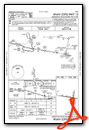
Instrument Approach Procedure (IAP) Charts


Nearby Airports with Instrument Procedures
| ID | Name | Heading / Distance | ||
|---|---|---|---|---|
 |
KMSN | Dane County Regional/Truax Field Airport | 079° | 8.7 |
|
91C | Sauk/Prairie Airport | 318° | 14.8 |
|
87Y | Blackhawk Airfield Airport | 092° | 15.2 |
|
KDLL | Baraboo/Wisconsin Dells Regional Airport | 336° | 26.6 |
|
C47 | Portage Municipal Airport | 004° | 26.8 |
|
KLNR | Tri-County Regional Airport | 281° | 29.1 |
|
KEFT | Monroe Municipal Airport | 184° | 30.1 |
|
C35 | Reedsburg Municipal Airport | 321° | 31.6 |
|
61C | Fort Atkinson Municipal Airport | 105° | 32.7 |
|
KMRJ | Iowa County Airport | 246° | 33.9 |
|
93C | Richland Airport | 287° | 35.1 |
|
KRYV | Watertown Municipal Airport | 084° | 35.7 |
Airport Images
 as seen from the North/Northwest")
By: Pilot Guy Rob

By: wecsam


