Login
Register


C83
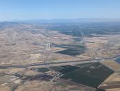
Byron Airport
Official FAA Data Effective 2026-01-22 0901Z
Chart Supplement

VFR Chart of C83
Sectional Charts at SkyVector.com
IFR Chart of C83
Enroute Charts at SkyVector.com
Location Information for C83
Coordinates: N37°49.71' / W121°37.55'Located 02 miles S of Byron, California on 1421 acres of land. View all Airports in California.
Surveyed Elevation is 78 feet MSL.
Operations Data
|
|
Airport Communications
| AWOS-3: | 123.775 Tel. 925-634-0906 |
|---|---|
| NORCAL APPROACH: | 123.85 278.3 |
| NORCAL DEPARTURE: | 123.85 278.3 |
| UNICOM: | 123.050 |
| CTAF: | 123.050 |
| AWOS-3 at TCY (11.9 SE): | 118.375 209-831-4335 |
| ASOS at LVK (12.1 SW): | 925-606-5412 |
| ATIS at LVK (12.3 SW): | 119.65 |
Nearby Navigation Aids
|
| ||||||||||||||||||||||||||||||||||||


Runway 12/30
| Dimensions: | 4500 x 100 feet / 1372 x 30 meters | |
|---|---|---|
| Surface: | Asphalt in Good Condition | |
| Weight Limits: | S-29 | |
| Edge Lighting: | Medium Intensity | |
| Runway 12 | Runway 30 | |
| Coordinates: | N37°50.14' / W121°37.89' | N37°49.61' / W121°37.23' |
| Elevation: | 64.1 | 48.4 |
| Traffic Pattern: | Right | |
| Runway Heading: | 135° True | 315° True |
| Markings: | Non-Precision Instrument in good condition. | Non-Precision Instrument in good condition. |
| Glide Slope Indicator | P2L (3.50° Glide Path Angle) | |
| REIL: | Yes | |
| Obstacles: | 61 ft Pole 1591 ft from runway, 261 ft right of center | 65 ft Hill 3218 ft from runway, 729 ft left of center |
Runway 05/23
| Dimensions: | 3000 x 75 feet / 914 x 23 meters | |
|---|---|---|
| Surface: | Asphalt in Good Condition | |
| Weight Limits: | S-29 | |
| Edge Lighting: | Medium Intensity | |
| Runway 05 | Runway 23 | |
| Coordinates: | N37°49.34' / W121°37.81' | N37°49.56' / W121°37.25' |
| Elevation: | 78.5 | 48.6 |
| Traffic Pattern: | Right | |
| Runway Heading: | 63° True | 243° True |
| Markings: | Basic in good condition. | Basic in good condition. |
| Glide Slope Indicator | P2L (3.50° Glide Path Angle) | |
Services Available
| Fuel: | 100LL (blue) |
|---|---|
| Transient Storage: | Tiedowns |
| Airframe Repair: | NOT AVAILABLE |
| Engine Repair: | NOT AVAILABLE |
| Bottled Oxygen: | NOT AVAILABLE |
| Bulk Oxygen: | NOT AVAILABLE |
| Other Services: | GLIDER SERVICE,PARACHUTE JUMP ACTIVITY,GLIDER TOWING SERVICES |
Ownership Information
| Ownership: | Publicly owned | |
|---|---|---|
| Owner: | CONTRA COSTA COUNTY | |
| 181 JOHN GLENN DR, SUITE 100 | ||
| CONCORD, CA 94520 | ||
| 925-608-8000 | ||
| Manager: | GREG BAER | DIRECTOR OF ARPTS CONTRA COSTA COUNTY. |
| 181 JOHN GLENN DR, SUITE 100 | ||
| CONCORD, CA 94250 | ||
| 925-608-8000 | ||
Other Remarks
- THIS AIRPORT HAS BEEN SURVEYED BY THE NATIONAL GEODETIC SURVEY.
- ULTRALIGHT & SAILPLANE ACTIVITY ON & INVOF ARPT.
- PRCHT ACT AT NW END OF ARPT.
- RISING TERRAIN WITH NUMEROUS WINDMILLS ON RIDGES WEST OF ARPT.
- HANGAR APRON & TIEDOWN APRON 12500 LBS MAX.
- RY 30 CALM WIND RY.
- 200' TOWER 5600 FEET FROM RUNWAY 05.
- 100' TOWER 5100 FEET FROM RUNWAY 23.
- POWER PLANT 2.7 MILES SE OF AIRPORT PRODUCING THERMAL PLUMES; AVOID OVERLFIGHT BELOW 1,500 FT AGL.
- FOR CD CTC NORCAL APCH AT 916-361-0516.
- FREQ UAS DRONE ACT 7.8 NM DIAM ARND FLD UP TO 8000 FT.
- 0LL FUEL AVBL 24 HRS BY CREDIT CARD.
- PCL AVBL SS-SR. ACTVT REIL RWY 30; MIRL RWY 12/30 & 05/23 - CTAF.
Weather Minimums


Instrument Approach Procedure (IAP) Charts

Nearby Airports with Instrument Procedures
| ID | Name | Heading / Distance | ||
|---|---|---|---|---|
 |
KTCY | Tracy Municipal Airport | 133° | 12.1 |
|
KLVK | Livermore Municipal Airport | 228° | 12.3 |
|
KSCK | Stockton Metro Airport | 077° | 18.8 |
|
O88 | Rio Vista Municipal Airport | 350° | 22.2 |
|
KCCR | Buchanan Field Airport | 295° | 22.6 |
|
KHWD | Hayward Exec Airport | 246° | 25.7 |
|
1O3 | Lodi Airport | 036° | 28.1 |
|
KOAK | Oakland San Francisco Bay Airport | 257° | 29.0 |
|
KSUU | Travis AFB Airport | 331° | 29.7 |
|
KRHV | Reid-Hillview of Santa Clara County Airport | 197° | 31.1 |
|
KSJC | Norman Y Mineta San Jose International Airport | 207° | 31.4 |
|
KNUQ | Moffett Federal Airfield Airport | 219° | 31.9 |
Airport Images
By: mhebbar@gmail.com


