Login
Register
1O3
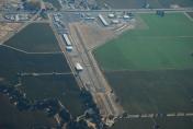
Lodi Airport
Official FAA Data Effective 2026-01-22 0901Z
VFR Chart of 1O3
Sectional Charts at SkyVector.com
IFR Chart of 1O3
Enroute Charts at SkyVector.com
Location Information for 1O3
Coordinates: N38°12.15' / W121°16.15'Located 04 miles N of Lodi, California on 163 acres of land. View all Airports in California.
Surveyed Elevation is 59 feet MSL.
Operations Data
|
|
Airport Communications
| NORCAL APPROACH: | 125.1 363.2 |
|---|---|
| NORCAL DEPARTURE: | 125.1 ;SOUTHBOUND 125.25 ;NORTHBOUND 257.9 ;NORTHBOUND 363.2 ;SOUTHBOUND |
| CTAF: | 122.900 |
| ATIS at SCK (18.6 S): | 118.25 |
| ASOS at SCK (18.9 S): | 209-625-0001 |
| AWOS-AV at O88 (20.6 W): | 127.075 707-374-5396 |
Nearby Navigation Aids
|
| ||||||||||||||||||||||||||||||||||||
Runway 08/26
| Dimensions: | 3547 x 40 feet / 1081 x 12 meters | |
|---|---|---|
| Surface: | Asphalt in Good Condition | |
| Weight Limits: | S-30 | |
| Edge Lighting: | Low Intensity RWY 08/26 NSTD LIRL LCTD 30 FT FM PAVEMENT EDGE. END OF RUNWAY LIGHTS LOCATED AT BOTH DISPLACED THRESHOLDS TO RUNWAY 8/26. | |
| Runway 08 | Runway 26 | |
| Coordinates: | N38°12.19' / W121°16.57' | N38°12.16' / W121°15.83' |
| Elevation: | 55.6 | 59.9 |
| Traffic Pattern: | Left | Right |
| Runway Heading: | 92° True | 272° True |
| Displaced Threshold: | 515 Feet | 388 Feet |
| Markings: | Basic in good condition. | Basic in good condition. |
| Obstacles: | 35 ft Pole 50 ft from runway, 165 ft right of center RWY 8 APCH RATIO 17:1 FROM DSPLCD THR. RWY 8 35 FT POLE 100 FT FM RSY END 165 FT RIGHT. |
30 ft Pole 340 ft from runway, 90 ft left of center APCH RATIO 27:1 FM DSPLCD THR; APCH RATIO FM DSPLCD THR TO +58 FT ANTENNA 1400 FT FM DSPLCD THR 24:1. RY 26 +15' FRONTAGE ROAD 110 FM RY END AND +20' FREEWAY 150' FM RY END. ALL 125' R - 125' L. |
Runway 12/30
| Dimensions: | 1979 x 25 feet / 603 x 8 meters | |
|---|---|---|
| Surface: | Asphalt / Grooved in Good Condition | |
| Weight Limits: | S-30 | |
| Runway 12 | Runway 30 | |
| Coordinates: | N38°12.21' / W121°16.21' | N38°11.98' / W121°15.92' |
| Elevation: | 57.5 | 58.2 |
| Traffic Pattern: | Right | Left |
| Runway Heading: | 135° True | 315° True |
| Displaced Threshold: | 182 Feet | 102 Feet |
| Markings: | Numbers Only in fair condition. | Numbers Only in fair condition. |
| Obstacles: | 35 ft Tree 660 ft from runway, 80 ft right of center RY 12 +15 FT ROAD 125 FT-150 FT FM RWY END 25 FT RIGHT 75 FT LEFT. |
40 ft Tree 750 ft from runway, 160 ft left of center RWY 30 APCH RATIO 20:1 FROM DSPLCD THR. |
Services Available
| Fuel: | 100LL (blue), Jet-A |
|---|---|
| Transient Storage: | Tiedowns |
| Airframe Repair: | MAJOR |
| Engine Repair: | MAJOR |
| Bottled Oxygen: | HIGH |
| Bulk Oxygen: | NONE |
| Other Services: | PILOT INSTRUCTION,PARACHUTE JUMP ACTIVITY,AIRCRAFT RENTAL,AIRCRAFT SALES,ANNUAL SURVEYING |
Ownership Information
| Ownership: | Privately Owned | |
|---|---|---|
| Owner: | ROBERT KUPKA | |
| P.O. BOX 10 | ||
| ACAMPO, CA 95220 | ||
| 209-369-9126 | ||
| Manager: | ROBERT KUPKA | |
| 23987 NORTH HWY 99 | ||
| ACAMPO, CA 95220 | ||
| 209-369-9126 | ||
Other Remarks
- PARACHUTE DROP ZONE LOCATED APPROXIMATLY 1000' SOUTH OF RWY 08/26.
- FOR CD CTC NORCAL APCH AT 916-361-0516.
- 0LL AUTOMATED CREDIT CARD FUEL SYSTEM 24 HRS DAY.
Weather Minimums
Instrument Approach Procedure (IAP) Charts
Nearby Airports with Instrument Procedures
| ID | Name | Heading / Distance | ||
|---|---|---|---|---|
 |
KSCK | Stockton Metro Airport | 175° | 18.5 |
 |
O88 | Rio Vista Municipal Airport | 268° | 20.6 |
 |
KMHR | Sacramento Mather Airport | 356° | 21.2 |
 |
KSAC | Sacramento Exec Airport | 330° | 21.4 |
 |
KJAQ | Westover Field Amador County Airport | 064° | 24.8 |
 |
C83 | Byron Airport | 217° | 28.1 |
 |
KMCC | Mc Clellan Airfield Airport | 347° | 28.6 |
 |
KCPU | Calaveras County/Maury Rasmussen Field Airport | 096° | 29.6 |
 |
KSUU | Travis AFB Airport | 277° | 31.2 |
 |
KEDU | University Airport | 309° | 31.4 |
 |
KTCY | Tracy Municipal Airport | 194° | 31.8 |
 |
KSMF | Sacramento International Airport | 332° | 33.2 |


