Login
Register


CML5
Thunder Bay (Martin's Landing) Airport
VFR Chart of CML5
Sectional Charts at SkyVector.com
IFR Chart of CML5
Enroute Charts at SkyVector.com
Location Information for CML5
Coordinates: N48°17.62' / W89°32.60'View all Airports in Ontario, Canada.
Elevation is 1114 feet MSL.
Magnetic Variation from 2016 is 3° West
Time Zone is UTC-5(4).
Operations Data
|
|
Airport Communications
| Aerodrome Traffic Frequency (ATF) | traffic 122.8 3NM 3200 ASL |
|---|
Nearby Navigation Aids
|
| ||||||||||||||||||||||||||||||||||||||||||||||||||||||


Runway 01/19
| Dimensions: | 2090 x 80 feet. | |
|---|---|---|
| Surface: | ||
| Remarks | GRASS/SNOW | |
| Runway 01 | Runway 19 | |
| Runway Heading: | 010° | 190° |
Runway Conditions Reporting Source
Operator Rwy soft when wet
Services Available
| Oil Available | 20W50, 80, 100 |
|---|---|
| Servicing Available | Storage, Extended Parking, Tie Downs, Plug-in, Pick-up/Drop-off only. No extended term parking |
Flight Planning
| Instructions | Pilots to open/close VFR flt plan with London rdo, FISE or by phone |
|---|---|
| Flight Information Centre (FIC) | London 866-WXBRIEF (Toll free within Canada) or 866-541-4104 (Toll free within Canada & USA) |
Aerodrome Operator
Richard A. Martin 807-344-0071 Reg
PPR
Nearby Airports with Instrument Procedures
| ID | Name | Heading / Distance | ||
|---|---|---|---|---|
 |
CYQT | Thunder Bay Airport | 064° | 10.0 |
|
KCKC | Grand Marais/Cook County Airport | 234° | 43.5 |
|
KCMX | Houghton County Memorial Airport | 150° | 79.9 |
|
KOGM | Ontonagon County/Schuster Field Airport | 178° | 87.2 |
|
KELO | Ely Municipal Airport | 256° | 96.2 |
|
KIWD | Gogebic/Iron County Airport | 195° | 108.7 |
|
KTWM | Richard B Helgeson Airport | 233° | 116.4 |
|
KASX | John F Kennedy Memorial Airport | 211° | 118.8 |
|
KEVM | Eveleth/Virginia Municipal Airport | 250° | 130.2 |
|
CYGQ | Geraldton (Greenstone Regional) Airport | 051° | 136.1 |
|
KDLH | Duluth International Airport | 234° | 138.5 |
|
KDYT | Sky Harbor Airport | 231° | 138.7 |
Airport Images
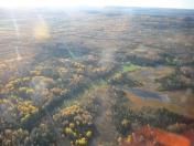
By: ricktech

By: ricktech


