Login
Register


CMX
Houghton County Memorial Airport
Official FAA Data Effective 2026-01-22 0901Z
Chart Supplement

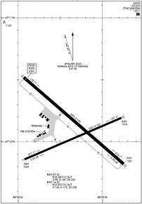
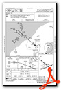
KCMX Airport Diagram
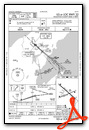
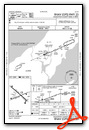
VFR Chart of KCMX
Sectional Charts at SkyVector.com
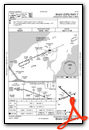
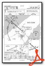
IFR Chart of KCMX
Enroute Charts at SkyVector.com
Location Information for KCMX
Coordinates: N47°10.11' / W88°29.34'Located 04 miles NE of Hancock, Michigan on 1996 acres of land. View all Airports in Michigan.
Surveyed Elevation is 1095 feet MSL.
Operations Data
|
|
Airport Communications
| ASOS: | 125.675 Tel. 906-482-4248 |
|---|---|
| CTAF: | 122.700 |
| UNICOM: | 122.700 |
| AWOS-3PT at SAW (67.0 SE): | 118.375 906-346-5126 |
| AWOS-3PT at IWD (77.6 SW): | 125.175 906-932-4039 |
| AWOS-3 at CKC (86.8 NW): | 119.925 218-387-1971 |
- APCH/DEP SVC PRVDD BY MINNEAPOLIS ARTCC (ZMP) ON FREQS 133.55/379.1 (HANCOCK RCAG).
Nearby Navigation Aids
|
| ||||||||||||||||||||||||||||||

Runway 14/32
| Dimensions: | 6501 x 150 feet / 1982 x 46 meters | |
|---|---|---|
| Surface: | Asphalt / Grooved in Good Condition | |
| Weight Limits: | S-144, D-175, ST-258
PCR VALUE: 470/F/C/X/T
| |
| Edge Lighting: | High Intensity | |
| Runway 14 | Runway 32 | |
| Coordinates: | N47°10.52' / W88°29.93' | N47°9.82' / W88°28.75' |
| Elevation: | 1095.1 | 1060.7 |
| Traffic Pattern: | Left | Left |
| Runway Heading: | 131° True | 311° True |
| Declared Distances: | TORA:6501 TODA:6501 ASDA:6501 LDA:6501 | TORA:6501 TODA:6501 ASDA:6501 LDA:6501 |
| Markings: | Precision Instrument in good condition. | Precision Instrument in good condition. |
| Glide Slope Indicator | P4L (3.00° Glide Path Angle) | P4L (3.00° Glide Path Angle) |
| Approach Lights: | MALSR 1,400 Foot Medium-intensity Approach Lighting System with runway alignment indicator lights. | |
| REIL: | Yes | |
| Obstacles: | 73 ft Trees 1872 ft from runway, 715 ft right of center | |
Runway 07/25
| Dimensions: | 5201 x 100 feet / 1585 x 30 meters | |
|---|---|---|
| Surface: | Asphalt / Grooved in Good Condition | |
| Weight Limits: | S-98, D-149, ST-220
PCR VALUE: 390/F/C/X/T
| |
| Edge Lighting: | Medium Intensity | |
| Runway 07 | Runway 25 | |
| Coordinates: | N47°9.86' / W88°29.93' | N47°10.19' / W88°28.77' |
| Elevation: | 1058.9 | 1074.4 |
| Traffic Pattern: | Left | Left |
| Runway Heading: | 67° True | 247° True |
| Declared Distances: | TORA:5201 TODA:5201 ASDA:5201 LDA:5201 | TORA:5201 TODA:5201 ASDA:5201 LDA:5201 |
| Markings: | Non-Precision Instrument in good condition. | Non-Precision Instrument in good condition. |
| Glide Slope Indicator | P2L (3.00° Glide Path Angle) | P4L (3.00° Glide Path Angle) |
| REIL: | Yes | Yes |
| Obstacles: | 55 ft Trees 1660 ft from runway, 465 ft left of center | 51 ft Trees 1630 ft from runway, 250 ft left of center |
Services Available
| Fuel: | 100LL (blue), Jet-A |
|---|---|
| Transient Storage: | Hangars |
| Airframe Repair: | MAJOR |
| Engine Repair: | MAJOR RPRS AVBL ON REQ - CALL AMGR. |
| Bottled Oxygen: | NOT AVAILABLE |
| Bulk Oxygen: | NOT AVAILABLE |
| Other Services: | PILOT INSTRUCTION |
Ownership Information
| Ownership: | Publicly owned | |
|---|---|---|
| Owner: | HOUGHTON COUNTY | |
| 23810 AIRPARK BLVD STE 113 | ||
| CALUMET, MI 49913-9233 | ||
| 906-482-3970 | ||
| Manager: | DENNIS M HEXT | |
| 23810 AIRPARK BLVD STE 113 | ||
| CALUMET, MI 49913-9233 | ||
| 906-482-3970 | CELL 906-281-0216. | |
Other Remarks
- DEER & GULLS ON & INVOF ARPT.
- AIRFIELD GUIDANCE SIGNS SNOW COVD IN WINTER.
- PAEW ON ARPT MONITOR CTAF. FQT SNOW REMOVAL OPS IN PROGRESS AT VARIOUS TIMES OCT-APR MONITOR CTAF.
- PPR VIA UNICOM FOR PRKG IN FRONT OF AIRLINE TRML.
- FOR CD IF UNA TO CTC ON FSS FREQ, CTC MINNEAPOLIS ARTCC AT 651-463-5588.
- RWY CONDS UNMON DLY 0000-0500.
- ACTVT MALSR RWY 32; REIL RWY 14; PAPI RWY 14 & 32; HIRL RWY 14/32 - CTAF. ACTVT REIL RWY 07 & 25; PAPI RWY 07 & 25; MIRL RWY 07/25; TWY B - CTC CO MAINT VIA CTAF.
Weather Minimums

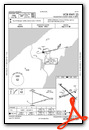
Instrument Approach Procedure (IAP) Charts

Nearby Airports with Instrument Procedures
| ID | Name | Heading / Distance | ||
|---|---|---|---|---|
 |
KOGM | Ontonagon County/Schuster Field Airport | 242° | 40.9 |
|
KSAW | Marquette/Sawyer Regional Airport | 137° | 66.7 |
|
KLNL | Kings Land O' Lakes Airport | 206° | 67.8 |
|
KIWD | Gogebic/Iron County Airport | 240° | 77.8 |
|
CYQT | Thunder Bay Airport | 335° | 79.7 |
|
KEGV | Eagle River Union Airport | 203° | 80.9 |
|
KIMT | Ford Airport | 169° | 82.5 |
|
D25 | Manitowish Waters Airport | 222° | 85.3 |
|
KCKC | Grand Marais/Cook County Airport | 298° | 87.0 |
|
KARV | Lakeland/Noble F Lee Memorial Field Airport | 215° | 90.5 |
|
4R5 | Major Gilbert Field Airport | 257° | 96.0 |
|
Y55 | Crandon/Steve Conway Municipal Airport | 190° | 100.5 |
Airport Images
Do you have a recent image of this airport? Upload it here!


