Login
Register


CXU
Camilla-Mitchell County Airport
Official FAA Data Effective 2025-12-25 0901Z
Chart Supplement

VFR Chart of KCXU
Sectional Charts at SkyVector.com
IFR Chart of KCXU
Enroute Charts at SkyVector.com
Location Information for KCXU
Coordinates: N31°12.79' / W84°14.11'Located 02 miles SW of Camilla, Georgia on 174 acres of land. View all Airports in Georgia.
Surveyed Elevation is 176 feet MSL.
Operations Data
|
|
Airport Communications
| AWOS-3T: | 118.675 Tel. 229-336-0744 |
|---|---|
| CTAF: | 122.800 |
| UNICOM: | 122.800 |
| ATIS at ABY (19.5 N): | 133.05 |
| ASOS at ABY (19.5 N): | 229-434-7494 |
| AWOS-3PT at MGR (23.5 E): | 118.925 229-890-5320 |
- APCH/DEP SVC PRVDD BY JACKSONVILLE ARTCC ON FREQS 125.75/363.075 (ALBANY RCAG).
Nearby Navigation Aids
|
| ||||||||||||||||||||||||||||||||||||||||||||||||||||||||||||


Runway 08/26
| Dimensions: | 5004 x 100 feet / 1525 x 30 meters | |
|---|---|---|
| Surface: | Asphalt in Good Condition | |
| Weight Limits: | S-30, D-52, ST-85 | |
| Edge Lighting: | Medium Intensity | |
| Runway 08 | Runway 26 | |
| Coordinates: | N31°12.71' / W84°14.59' | N31°12.87' / W84°13.64' |
| Elevation: | 167.9 | 176.4 |
| Traffic Pattern: | Left | Left |
| Runway Heading: | 79° True | 259° True |
| Markings: | Non-Precision Instrument in fair condition. | Non-Precision Instrument in fair condition. |
| Glide Slope Indicator | P2L (3.00° Glide Path Angle) | P2L (3.00° Glide Path Angle) |
| REIL: | Yes | Yes |
| Obstacles: | 75 ft Trees 1850 ft from runway, 230 ft left of center | |
Services Available
| Fuel: | 100LL (blue), Jet A+ |
|---|---|
| Transient Storage: | Tiedowns |
| Airframe Repair: | MAJOR |
| Engine Repair: | MINOR |
| Bottled Oxygen: | NONE |
| Bulk Oxygen: | NONE |
| Other Services: | CROP DUSTING SERVICES |
Ownership Information
| Ownership: | Publicly owned | |
|---|---|---|
| Owner: | CITY OF CAMILLA | |
| BOX 328 | ||
| CAMILLA, GA 31730 | ||
| 229-336-2216 | ||
| Manager: | CHERYL FORD | |
| 3907 AIRPORT ROAD | ||
| CAMILLA, GA 31730 | ||
| 229-330-2325 | ||
Other Remarks
- FOR CD CTC JACKSONVILLE ARTCC AT 904-845-1592.
- REIL RWY 08 & 26; PAPI RWY 08 & 26; AND MIRL RWY 08/26 OPR DUSK TO 2130. AFT 2130 ACTVT - CTAF.
Weather Minimums
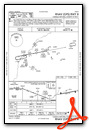
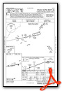
Instrument Approach Procedure (IAP) Charts
Nearby Airports with Instrument Procedures
| ID | Name | Heading / Distance | ||
|---|---|---|---|---|
 |
KABY | Southwest Georgia Regional Airport | 006° | 19.4 |
|
70J | Cairo-Grady County Airport | 167° | 19.9 |
|
KMGR | Moultrie Municipal Airport | 108° | 23.5 |
|
KBGE | Decatur County Industrial Air Park Airport | 235° | 25.2 |
|
KTVI | Thomasville Regional Airport | 135° | 26.1 |
|
17J | Donalsonville Municipal Airport | 249° | 35.3 |
|
KBIJ | Early County Airport | 288° | 35.7 |
|
15J | Cook County Airport | 096° | 40.5 |
|
KTMA | Henry Tift Myers Airport | 071° | 40.5 |
|
2J9 | Quincy Municipal Airport | 204° | 40.4 |
|
4J5 | Quitman Brooks County Airport | 126° | 41.3 |
|
75J | Turner County Airport | 047° | 42.0 |
Airport Images
Do you have a recent image of this airport? Upload it here!


