Login
Register


CYNJ
Langley Regional Airport
VFR Chart of CYNJ
Sectional Charts at SkyVector.com
IFR Chart of CYNJ
Enroute Charts at SkyVector.com
Location Information for CYNJ
Coordinates: N49°6.18' / W122°37.60'View all Airports in British Columbia, Canada.
Elevation is 34 feet MSL.
Magnetic Variation from 2013 is 17° East
Time Zone is UTC-8(7).
Operations Data
|
|
Customs Information
AOE/CAN
Airport Communications
| Automated Terminal Information Service (ATIS) | 124.5 1630-0230Z (DT 1530-0330Z) |
|---|---|
| Ground Control (GND) | 121.9 1630-0230Z (DT 1530-0330Z) |
| Mandatory Frequency (MF) | traffic 119.0 0230-1630Z (DT 0330-1530Z) 3NM 1900 ASL (CAR 602.98) |
| Control Tower (TWR) | 119.0 (V) 1630-0230Z (DT 1530-0330Z) (Emergency only 604-534-9443) |
Nearby Navigation Aids
|
| ||||||||||||||||||||||||||||||||||||||||||||||||||||||||||||


Runway 07/25
| Dimensions: | 2743 x 75 feet. | |
|---|---|---|
| Surface: | ||
| Remarks | ASPH Avbl dur twr oprg hrs only. Ngt ops not auth. | |
| Runway 07 | Runway 25 | |
| Runway Heading: | 075° | 255° |
| Displaced Threshold: | 654 feet | 343 feet |
Runway 01/19
| Dimensions: | 2100 x 75 feet. | |
|---|---|---|
| Surface: | ||
| Remarks | ASPH Rwy 01 preferred rwy when twr clsd. Rwy 01 designated calm wind rwy. | |
| Runway 01 | Runway 19 | |
| Runway Heading: | 015° | 195° |
| Displaced Threshold: | 104 feet | 96 feet |
| Glide Slope Indicator | PAPI for aircraft with eye-to-wheel height up to 10 feet. | APAPI - Abbreviated PAPI for aircraft with eye-to-wheel height up to 10 feet. |
Helipad Information
B - FATO 110' dia ASPH TLOF 28' dia ASPH Safety Area 143' dia
Max heli length 58' (exc with opr appr) 20,500 lbs. Medevac flt only 06-15Z.
C - FATO/TLOF 85' dia ASPH Safety Area 110' dia
Max heli overall length 59' (exc with ops appr). 20,500lbs. Day only.
Parking Pad 1: 31' dia CONC 3600 lbs For temporary prkg and refueling only (100LL
only).
Parking Pads 2-4: 31' dia CONC 3600 lbs Private.
Parking Pads 5 & 6: 66' dia ASPH 14,000lbs Max heli overall length 55'
Runway Conditions Reporting Source
Twr 604-514-9324 RSC 1600-0100Z No win maint Aprt rstd to a max wt of 12,500
lbs exc with Operator auth
Taxiway Information
Twy E uncontrolled west of Twy F.
Apron Information
Apron I & II wing tip clearance less than 50' wide in some areas
Services Available
| Fuel Available | 100LL (self-serve), JA-1 (1530-0100Z by truck, 604-360-2306) |
|---|---|
| Oil Available | All |
| Servicing Available | Storage, Minor Repairs, Major Repairs, Extended Parking, Tie Downs |
Public Facilities
| Location | Facilities | Remarks |
|---|---|---|
| On Aerodrome | Telephone, Food, Taxi | |
| Within 5 NM | Medical Aid, Accomodations, Car Rental |
Flight Planning
| Flight Information Centre (FIC) | Kamloops 866-WXBRIEF (Toll free within Canada) or 866-541-4101 (Toll free within Canada & USA) |
|---|---|
| Area Control Centre (ACC) | Vancouver IFR 604-586-4590/4591; IFR tng flts PPR ctc 604-586-4592; ctc Victoria Tml 604-586-4561 for IFR clnc when TWR clsd. |
| Weather (WX) | LWIS H24 LAWO 1630-0230Z (DT 1530-0330Z) |
| Direct User Access Terminal (DUAT) | APM'S office |
Aerodrome Operator
Township of Langley 604-534-7330 APM
1500-0130Z Cert
Nearby Airports with Instrument Procedures
| ID | Name | Heading / Distance | ||
|---|---|---|---|---|
 |
CYXX | Abbotsford Airport | 096° | 11.5 |
|
KBLI | Bellingham International Airport | 152° | 19.0 |
|
CYVR | Vancouver International Airport | 267° | 22.6 |
|
KORS | Orcas Island Airport | 188° | 26.2 |
|
KFHR | Friday Harbor Airport | 187° | 38.3 |
|
KBVS | Skagit Regional Airport | 150° | 38.8 |
|
CYYJ | Victoria International Airport | 212° | 41.8 |
|
KNUW | Whidbey Island NAS (Ault Field) Airport | 164° | 45.1 |
|
CYCD | Nanaimo Airport | 250° | 49.1 |
|
KOKH | Delaurentis Airport | 165° | 51.2 |
|
KAWO | Arlington Municipal Airport | 144° | 59.6 |
|
KNOW | Port Angeles CGAS Airport | 191° | 65.7 |
Airport Images
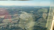
By: cosmar001


