Login
Register


ORS
Orcas Island Airport
Official FAA Data Effective 2025-04-17 0901Z
Chart Supplement

VFR Chart of KORS
Sectional Charts at SkyVector.com
IFR Chart of KORS
Enroute Charts at SkyVector.com
Location Information for KORS
Coordinates: N48°42.50' / W122°54.64'Located 01 miles N of Eastsound, Washington on 64 acres of land. View all Airports in Washington.
Surveyed Elevation is 34 feet MSL.
Operations Data
|
|
Airport Communications
| AWOS-3P: | 135.425 Tel. 360-376-6045 |
|---|---|
| WHIDBEY APPROACH: | 118.2 285.65 132.7 290.8 |
| WHIDBEY DEPARTURE: | 118.2 285.65 132.7 290.8 |
| CTAF: | 128.250 |
| ASOS at FHR (12.1 SW): | 135.675 360-378-8491 |
| ATIS at BLI (15.6 E): | 134.45 |
| ASOS at BLI (15.6 E): | 360-671-8688 |
- APCH/DEP SVC PRVDD BY ATCT NUW (WHIDBEY ISLAND NAS /AULT FIELD/ OAK HARBOR, WA) ON FREQS 118.2/285.65 FOR ACFT ARR AND DEP TO THE SOUTH.
- APCH/DEP SVC PRVDD BY ATCT YYJ (VICTORIA TERMINAL, CN) ON FREQS 132.7/290.8 FOR ACFT ARR AND DEP TO THE NORTH. (604) 586-4560
Nearby Navigation Aids
|
| ||||||||||||||||||||||||||||||||||||||||||||||||||||||||||||


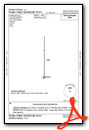
Runway 16/34
RWY 34 CALM WIND RWY. | ||
| Dimensions: | 2901 x 60 feet / 884 x 18 meters | |
|---|---|---|
| Surface: | Asphalt / Aggregate Friction Seal Coated in Good Condition | |
| Weight Limits: | S-12 | |
| Edge Lighting: | Medium Intensity | |
| Runway 16 | Runway 34 | |
| Coordinates: | N48°42.74' / W122°54.63' | N48°42.26' / W122°54.64' |
| Elevation: | 11.2 | 34.8 |
| Traffic Pattern: | Left | Right |
| Runway Heading: | 180° True | 0 |
| Markings: | Non-Precision Instrument in poor condition. | Non-Precision Instrument in poor condition. |
| Glide Slope Indicator | P4R (3.48° Glide Path Angle) | P2L (4.00° Glide Path Angle) PAPI UNSUBL BYD 2 DEGS LEFT OF CNTRLN. |
| REIL: | Yes | Yes |
| Obstacles: | 10 ft Road 387 ft from runway 3 FT SIGN 126 FT L & 19 FT FM THR; DITCH 100 FT R OF THR. |
128 ft Trees 2000 ft from runway, 267 ft left of center |
Services Available
| Fuel: | 100LL (blue) |
|---|---|
| Transient Storage: | Tiedowns |
| Airframe Repair: | NOT AVAILABLE |
| Engine Repair: | NOT AVAILABLE |
| Bottled Oxygen: | NOT AVAILABLE |
| Bulk Oxygen: | NOT AVAILABLE |
| Other Services: | AIR FREIGHT SERVICES,AIR AMBULANCE SERVICES,CHARTER SERVICE,PILOT INSTRUCTION |
Ownership Information
| Ownership: | Publicly owned | |
|---|---|---|
| Owner: | PORT OF ORCAS | |
| P.O. BOX 53 | ||
| EASTSOUND, WA 98245 | ||
| 360-376-5285 | ||
| Manager: | CHIP LONG | |
| PO BOX 53 | ||
| EASTSOUND, WA 98245 | ||
| 360-376-5285 | ||
Other Remarks
- NOISE ABATEMENT PROCS IN EFCT - AMGR.
- ADNL TSNT TURF TIEDOWNS S OF SEGEMENTED CIRCLE.
- DEER ON & INVOF RWY.
- NGT CIRCLING APCH NA FM W SIDE OF RWY.
- GRASS SFC LNDG NA.
- FOR CD FOR DEP FROM RWY 16/34, CTC VICTORIA TRML AT 604-586-4561.
- FADED.
- FADED.
- 0LL CREDIT CARD SELF SVC H24.
- ACTVT REIL RWY 16 & 34; PAPI RWY 16; MIRL RWY 16/34; TWY LGTS - CTAF. REIL RWY 16 & 34 PHOTOCELL NOT AVBL DALGT.
Weather Minimums

Instrument Approach Procedure (IAP) Charts


Departure Procedure (DP) Charts
Nearby Airports with Instrument Procedures
| ID | Name | Heading / Distance | ||
|---|---|---|---|---|
 |
KFHR | Friday Harbor Airport | 202° | 12.1 |
|
KBLI | Bellingham International Airport | 070° | 15.7 |
|
CYYJ | Victoria International Airport | 260° | 20.8 |
|
KNUW | Whidbey Island NAS (Ault Field) Airport | 154° | 23.7 |
|
KBVS | Skagit Regional Airport | 126° | 24.1 |
|
CYXX | Abbotsford Airport | 048° | 28.9 |
|
KOKH | Delaurentis Airport | 160° | 29.0 |
|
CYVR | Vancouver International Airport | 339° | 31.1 |
|
0S9 | Jefferson County International Airport | 174° | 39.5 |
|
KNOW | Port Angeles CGAS Airport | 210° | 39.5 |
|
KCLM | William R Fairchild International Airport | 213° | 42.4 |
|
CYCD | Nanaimo Airport | 299° | 43.3 |
Airport Images
Do you have a recent image of this airport? Upload it here!


