Login
Register


D29
Drayton Municipal Airport
Official FAA Data Effective 2026-02-19 0901Z
Chart Supplement

VFR Chart of D29
Sectional Charts at SkyVector.com
IFR Chart of D29
Enroute Charts at SkyVector.com
Location Information for D29
Coordinates: N48°37.11' / W97°10.55'Located 03 miles N of Drayton, North Dakota on 23 acres of land. View all Airports in North Dakota.
Estimated Elevation is 798 feet MSL.
Operations Data
|
|
Airport Communications
| CTAF: | 122.900 |
|---|---|
| AWOS-3 at HCO (12.3 NE): | 126.475 218-843-2415 |
| AWOS-3 at GAF (14.8 SW): | 118.625 701-352-0581 |
| AWOS-3 at 2C8 (20.6 NW): | 118.275 701-265-8050 |
Nearby Navigation Aids
|
| ||||||||||||||||||||||||||||||||||||||||||||||||


Runway 17/35
| Dimensions: | 2596 x 60 feet / 791 x 18 meters | |
|---|---|---|
| Surface: | Asphalt in Good Condition | |
| Weight Limits: | S-4 | |
| Edge Lighting: | Low Intensity | |
| Runway 17 | Runway 35 | |
| Coordinates: | N48°37.32' / W97°10.55' | N48°36.90' / W97°10.56' |
| Elevation: | 798.0 | 798.0 |
| Traffic Pattern: | Left | |
| Displaced Threshold: | 505 Feet DSPLCD THR - NGT OPNS ONLY. |
|
| Markings: | Basic in poor condition. | Basic in poor condition. |
Services Available
| Fuel: | NONE |
|---|---|
| Transient Storage: | Tiedowns |
| Airframe Repair: | NOT AVAILABLE |
| Engine Repair: | NOT AVAILABLE |
| Bottled Oxygen: | NOT AVAILABLE |
| Bulk Oxygen: | NOT AVAILABLE |
| Other Services: | CROP DUSTING SERVICES |
Ownership Information
| Ownership: | Publicly owned | |
|---|---|---|
| Owner: | DRAYTON AIRPORT AUTHORITY | |
| PO BOX 280 | ||
| DRAYTON, ND 58225 | ||
| 701-454-3590 | ||
| Manager: | ROB BOLL | ADDNL CTC IS CITY HALL AT 701-454-3590 OR TROY GEORGESON AT 701-454-6588. |
| BOX 280 | ||
| DRAYTON, ND 58225 | ||
| 701-520-1219 | AMGR 701-454-3317. | |
Other Remarks
- CFM WINTER CONDS AND SN REMOVAL BFR USE, CALL 701-454-3590 OR 701-454-6588.
- FOR CD CTC MINNEAPOLIS ARTCC AT 651-463-5588.
- RWY 17 CULTIVATED FLD 20 FT FM THR.
- MKGS HEAVILY WORN & FADED.
- MKGS HEAVILY WORN & FADED.
- LIRL RY 17/35 OPER DUSK-2400; AFTER 2400 HR ACTVT LIRL RWY 17/35-CTAF
Nearby Airports with Instrument Procedures
| ID | Name | Heading / Distance | ||
|---|---|---|---|---|
 |
KHCO | Hallock Municipal Airport | 048° | 12.3 |
|
KGAF | Hutson Field Airport | 211° | 15.0 |
|
KPMB | Pembina Municipal Airport | 352° | 19.6 |
|
2C8 | Cavalier Municipal Airport | 298° | 20.7 |
|
D37 | Warren Municipal Airport | 143° | 31.7 |
|
96D | Walhalla Municipal Airport | 304° | 34.7 |
|
KGFK | Grand Forks International Airport | 179° | 40.3 |
|
KRDR | Grand Forks AFB Airport | 192° | 40.5 |
|
D55 | Robertson Field Airport | 279° | 49.1 |
|
KTVF | Thief River Falls Regional Airport | 129° | 51.7 |
|
KCKN | Crookston Municipal/Kirkwood Field Airport | 154° | 51.7 |
|
4V4 | Northwood Municipal/Vince Field Airport | 197° | 56.2 |
Airport Images
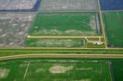
By: winglet714


