Login
Register


D55
Robertson Field Airport
Official FAA Data Effective 2026-01-22 0901Z
Chart Supplement

VFR Chart of D55
Sectional Charts at SkyVector.com
IFR Chart of D55
Enroute Charts at SkyVector.com
Location Information for D55
Coordinates: N48°45.19' / W98°23.63'Located 01 miles WSW of Langdon, North Dakota on 100 acres of land. View all Airports in North Dakota.
Surveyed Elevation is 1608 feet MSL.
Operations Data
|
|
Airport Communications
| AWOS-3: | 118.225 Tel. 701-256-2121 |
|---|---|
| CTAF: | 122.800 |
| UNICOM: | 122.800 |
| AWOS-3PT at 96D (22.4 NE): | 118.175 701-549-3402 |
| AWOS-3 at 2C8 (30.2 E): | 118.275 701-265-8050 |
| AWOS-3 at 9D7 (37.2 SW): | 118.325 701-968-3625 |
- APCH/DEP SVC PRVDD BY MINNEAPOLIS ARTCC ON FREQS 132.15/269.6 ( GRAND FORKS RCAG).
Nearby Navigation Aids
|
| ||||||||||||||||||||||||||||||||||||||||||


Runway 14/32
| Dimensions: | 3600 x 60 feet / 1097 x 18 meters | |
|---|---|---|
| Surface: | Asphalt in Good Condition | |
| Weight Limits: | S-12 | |
| Edge Lighting: | Medium Intensity | |
| Runway 14 | Runway 32 | |
| Coordinates: | N48°45.38' / W98°23.96' | N48°44.92' / W98°23.38' |
| Elevation: | 1602.9 | 1608.4 |
| Runway Heading: | 139° True | 319° True |
| Markings: | Non-Precision Instrument in good condition. | Non-Precision Instrument in good condition. |
| Glide Slope Indicator | P2L (3.00° Glide Path Angle) | P2L (3.00° Glide Path Angle) |
Runway 08/26
| Dimensions: | 1930 x 100 feet / 588 x 30 meters | |
|---|---|---|
| Surface: | Turf in Good Condition | |
| Runway 08 | Runway 26 | |
| Coordinates: | N48°45.26' / W98°23.78' | N48°45.26' / W98°23.30' |
| Elevation: | 1600.5 | 1601.0 |
| Traffic Pattern: | Left | Left |
| Runway Heading: | 89° True | 269° True |
| Markings: | None | None |
| Obstacles: | 14 ft Road 265 ft from runway +334 FT TWR 6550 FT FM THLD, 230 FT R OF EXTDD CNTRLN. |
|
Services Available
| Fuel: | 100LL (blue) |
|---|---|
| Transient Storage: | Hangars,Tiedowns |
| Airframe Repair: | NONE |
| Engine Repair: | NONE |
| Bottled Oxygen: | NONE |
| Bulk Oxygen: | NONE |
| Other Services: | CROP DUSTING SERVICES |
Ownership Information
| Ownership: | Publicly owned | |
|---|---|---|
| Owner: | LANGDON ARPT AUTHORITY | |
| 1310 12TH ST | ||
| LANGDON, ND 58249 | ||
| 701-370-2076 | JOHN BOE, CHAIRMAN OF ARPT AUTH, ADDNL PHONE 701-370-2076. | |
| Manager: | RYAN HOWATT | |
| 1228 15TH AVE | ||
| LANGDON, ND 58249 | ||
| (701) 370-9710 | ||
Other Remarks
- RY 08/26 CLOSED WINTERS DUE TO LACK OF SNOW REMOVAL.
- LARGE BIRDS AND DEER ON & INVOF ARPT APR-NOV.
- CFM WINTER CONDS/SNOW REMOVAL WITH AMGR 701-370-9710.
- NOISE SENSITIVE AREA NW QUADRANT OF FIELD; AVOID OVERFLIGHT.
- FOR CD CTC MINNEAPOLIS ARTCC AT 651-463-5588.
- COLD TEMPERATURE AIRPORT. ALTITUDE CORRECTION REQUIRED AT OR BELOW -35C.
- 0LL SELF SVC FUEL AVBL 24 HR WITH CREDIT CARD.
- ACTVT PAPI RWY 14 & 32; MIRL RWY 14/32 - CTAF.
Weather Minimums


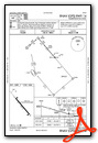
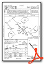
Instrument Approach Procedure (IAP) Charts
Nearby Airports with Instrument Procedures
| ID | Name | Heading / Distance | ||
|---|---|---|---|---|
 |
96D | Walhalla Municipal Airport | 059° | 22.5 |
|
2C8 | Cavalier Municipal Airport | 086° | 30.3 |
|
9D7 | Cando Municipal Airport | 244° | 37.3 |
|
KDVL | Devils Lake Regional Airport | 208° | 43.4 |
|
5L0 | Lakota Municipal Airport | 176° | 43.6 |
|
KGAF | Hutson Field Airport | 116° | 45.8 |
|
KPMB | Pembina Municipal Airport | 075° | 47.1 |
|
06D | Rolla Municipal/Leonard Krech Field Airport | 279° | 49.3 |
|
KHCO | Hallock Municipal Airport | 089° | 57.6 |
|
KRDR | Grand Forks AFB Airport | 139° | 62.0 |
|
KRUG | Rugby Municipal Airport | 252° | 68.5 |
|
KGFK | Grand Forks International Airport | 134° | 68.7 |
Airport Images
Do you have a recent image of this airport? Upload it here!


