Login
Register


D73
Cy Nunnally Memorial Airport
Official FAA Data Effective 2026-02-19 0901Z
Chart Supplement

VFR Chart of D73
Sectional Charts at SkyVector.com
IFR Chart of D73
Enroute Charts at SkyVector.com
Location Information for D73
Coordinates: N33°46.95' / W83°41.57'Located 01 miles SE of Monroe, Georgia on 70 acres of land. View all Airports in Georgia.
Surveyed Elevation is 875 feet MSL.
Operations Data
|
|
Airport Communications
| AWOS-3PT: | 120.825 Tel. 678-635-3668 |
|---|---|
| ATLANTA APPROACH: | 126.975 239.275 |
| ATLANTA DEPARTURE: | 126.975 239.275 |
| WRGNZ STAR: | 128.575 343.675 |
| BOKRT STAR: | 119.8 354.125 |
| CTAF: | 122.900 |
| AWOS-3 at CVC (11.9 SW): | 118.725 770-385-7057 |
| AWOS-3 at WDR (12.1 N): | 118.575 770-868-0642 |
| ATIS at LZU (17.8 NW): | 132.275 |
Nearby Navigation Aids
|
| ||||||||||||||||||||||||||||||||||||||||||||||||||||||||||||


Runway 03/21
| Dimensions: | 5000 x 75 feet / 1524 x 23 meters | |
|---|---|---|
| Surface: | Asphalt in Excellent Condition | |
| Weight Limits: | S-14, D-18 | |
| Edge Lighting: | Medium Intensity | |
| Runway 03 | Runway 21 | |
| Coordinates: | N33°46.60' / W83°41.83' | N33°47.30' / W83°41.31' |
| Elevation: | 875.2 | 824.1 |
| Traffic Pattern: | Left | Left |
| Runway Heading: | 31° True | 211° True |
| Markings: | Non-Precision Instrument in good condition. | Non-Precision Instrument in good condition. |
| Glide Slope Indicator | P2L (4.00° Glide Path Angle) | P2L (3.50° Glide Path Angle) |
| Obstacles: | 86 ft Trees 874 ft from runway, 326 ft right of center 1'-4' FT BERM, 1'-200' FROM THRESHOLD, 240' RIGHT OF CENTERLINE |
21 ft Trees 243 ft from runway, 253 ft left of center |
Services Available
| Fuel: | 100LL (blue) |
|---|---|
| Transient Storage: | Tiedowns |
| Airframe Repair: | MAJOR |
| Engine Repair: | MAJOR |
| Bottled Oxygen: | NONE |
| Bulk Oxygen: | NONE |
| Other Services: | GLIDER SERVICE,PILOT INSTRUCTION,PARACHUTE JUMP ACTIVITY |
Ownership Information
| Ownership: | Publicly owned | |
|---|---|---|
| Owner: | CITY OF MONROE | |
| CITY HALL, PO BOX 1249 | ||
| MONROE, GA 30655 | ||
| 770-267-7536 | ||
| Manager: | CHRIS CROY | |
| 215 NORTH BROAD STREET | ||
| MONROE, GA 30655 | ||
| 770-266-5172 | ||
Other Remarks
- GLIDER OPS 10 NM RADIUS SFC - 5000 FT.
- DEER ON & INVOF ARPT.
- FOR CD CTC ATLANTA APCH AT 678-364-6131.
- DUSK-2200. MIRL RY 03/21 PRESET LOW INTST DUSK-2200; TO INCR INTST & ACTVT MIRL RY 03/21 AND PAPI RYS 03 & 21 AFTER 2200 - CTAF.
Weather Minimums


Standard Terminal Arrival (STAR) Charts


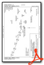

Instrument Approach Procedure (IAP) Charts

Nearby Airports with Instrument Procedures
| ID | Name | Heading / Distance | ||
|---|---|---|---|---|
 |
KCVC | Covington Municipal Airport | 220° | 11.8 |
|
KWDR | Barrow County Airport | 006° | 12.1 |
|
52A | Madison Municipal Airport | 131° | 15.5 |
|
KLZU | Gwinnett County/Briscoe Field Airport | 311° | 17.8 |
|
KAHN | Athens/Ben Epps Airport | 061° | 20.9 |
|
KJCA | Jackson County Airport | 015° | 24.5 |
|
KCPP | Greene County Regional Airport | 111° | 29.9 |
|
KGVL | Lee Gilmer Memorial Airport | 346° | 30.1 |
|
KPDK | Dekalb-Peachtree Airport | 280° | 31.0 |
|
KATL | Hartsfield/Jackson Atlanta International Airport | 256° | 37.8 |
|
KHMP | Atlanta Speedway Airport | 233° | 39.7 |
|
KFTY | Fulton County Exec/Charlie Brown Field Airport | 269° | 41.4 |
Airport Images
Do you have a recent image of this airport? Upload it here!


