Login
Register


CPP
Greene County Regional Airport
Official FAA Data Effective 2026-01-22 0901Z
Chart Supplement

VFR Chart of KCPP
Sectional Charts at SkyVector.com
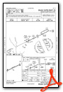
IFR Chart of KCPP
Enroute Charts at SkyVector.com
Location Information for KCPP
Coordinates: N33°35.88' / W83°8.30'Located 03 miles NE of Greensboro, Georgia on 200 acres of land. View all Airports in Georgia.
Surveyed Elevation is 688 feet MSL.
Operations Data
|
|
Airport Communications
| AWOS-3: | 124.525 Tel. 706-453-0017 |
|---|---|
| ATLANTA APPROACH: | 132.475 ;0615-2200 291.1 ;0615-2200 |
| ATLANTA DEPARTURE: | 132.475 ;0615-2200 291.1 ;0615-2200 |
| CTAF: | 122.800 |
| UNICOM: | 122.800 |
| AWOS-3 at IIY (19.4 NE): | 118.375 706-678-3647 |
| ASOS at AHN (23.0 NW): | 132.875 706-363-3481 |
| AWOS-3 at MLJ (27.2 S): | 120.925 478-445-7718 |
- APCH/DEP SVC PRVDD BY ATLANTA TRACON 0615-2200 ON FREQS 132.475/291.1 OTHER TIMES BY ATLANTA ARTCC ON FREQS 127.5/316.05 (ATHENS RCAG).
Nearby Navigation Aids
|
| ||||||||||||||||||||||||||||||||||||||||||||||||||||||||||||


Runway 07/25
| Dimensions: | 5500 x 100 feet / 1676 x 30 meters | |
|---|---|---|
| Surface: | Asphalt in Good Condition | |
| Weight Limits: | S-33, D-50, ST-80 | |
| Edge Lighting: | High Intensity | |
| Runway 07 | Runway 25 | |
| Coordinates: | N33°35.68' / W83°8.78' | N33°36.08' / W83°7.81' |
| Elevation: | 677.7 | 688.5 |
| Traffic Pattern: | Left | Left |
| Runway Heading: | 64° True | 244° True |
| Displaced Threshold: | 99 Feet | |
| Declared Distances: | TORA:5500 TODA:5500 ASDA:5500 LDA:5401 | TORA:5500 TODA:5500 ASDA:5500 LDA:5500 |
| Markings: | Non-Precision Instrument in good condition. | Non-Precision Instrument in good condition. |
| Glide Slope Indicator | P2L (3.00° Glide Path Angle) | P4L (3.00° Glide Path Angle) |
| Obstacles: | 27 ft Trees 201 ft from runway, 215 ft right of center APCH RATIO 20:1 TO DSPLCD THR, TREES 240 FT OUT, 200 FT RIGHT. FENCE 20 FT TREES 100 FT FM E.O.R, 200 FT RIGHT. |
65 ft Trees 1110 ft from runway, 359 ft right of center |
Services Available
| Fuel: | 100LL (blue), Jet A+ |
|---|---|
| Transient Storage: | Tiedowns |
| Airframe Repair: | NONE |
| Engine Repair: | NONE |
| Bottled Oxygen: | NONE |
| Bulk Oxygen: | NONE |
| Other Services: | PILOT INSTRUCTION,AIRCRAFT RENTAL |
Ownership Information
| Ownership: | Publicly owned | |
|---|---|---|
| Owner: | GREENE COUNTY | |
| 1034 SILVER DRIVE | ||
| GREENSBORO, GA 30642 | ||
| 706-453-7716 | ||
| Manager: | BYRON LOMBARD | |
| 1034 SILVER DRIVE | ||
| GREENSBORO, GA 30642 | ||
| (706) 453-2715 | FAX 706-453-7108. | |
Other Remarks
- GCO AVBL ON FREQ 121.725 ATL APP OR 678-364-6131 (PREFERRED).
- DEER ON & INVOF ARPT.
- 0LL SELF FUEL WITH CREDIT CARD AVBL 0800-1700, FULL SVC AVBL 0800-1700, AFTER HOURS CALL 706-453-2715 OR 706-817-8226.
- HIRL RWY 07/25 PRESET MED INTST DUSK-DAWN. TO INCR INTST OR ACTVT PAPI RWY 07 & 25; HIRL RWY 07/25 - CTAF.
Weather Minimums

Instrument Approach Procedure (IAP) Charts


Nearby Airports with Instrument Procedures
| ID | Name | Heading / Distance | ||
|---|---|---|---|---|
 |
52A | Madison Municipal Airport | 273° | 16.2 |
|
KIIY | Washington/Wilkes County Airport | 056° | 19.5 |
|
KAHN | Athens/Ben Epps Airport | 335° | 23.0 |
|
KMLJ | Baldwin County Regional Airport | 191° | 27.1 |
|
D73 | Cy Nunnally Memorial Airport | 291° | 29.9 |
|
KHQU | Thomson/Mcduffie County Airport | 097° | 31.4 |
|
KEBA | Elbert County-Patz Field Airport | 028° | 33.8 |
|
KWDR | Barrow County Airport | 311° | 35.1 |
|
KCVC | Covington Municipal Airport | 273° | 35.6 |
|
KJCA | Jackson County Airport | 328° | 40.6 |
|
KOKZ | Kaolin Field Airport | 158° | 40.7 |
|
18A | Franklin-Hart Airport | 000° | 44.5 |
Airport Images
Do you have a recent image of this airport? Upload it here!


