Login
Register


WDR
Barrow County Airport
Official FAA Data Effective 2026-02-19 0901Z
Chart Supplement

VFR Chart of KWDR
Sectional Charts at SkyVector.com
IFR Chart of KWDR
Enroute Charts at SkyVector.com
Location Information for KWDR
Coordinates: N33°58.96' / W83°40.03'Located 03 miles E of Winder, Georgia on 374 acres of land. View all Airports in Georgia.
Surveyed Elevation is 934 feet MSL.
Operations Data
|
|
Airport Communications
| AWOS-3: | 118.575 Tel. 770-868-0642 |
|---|---|
| ATLANTA APPROACH: | 132.475 ;0615-2200 291.1 ;0615-2200 |
| ATLANTA DEPARTURE: | 132.475 ;0615-2200 291.1 ;0615-2200 |
| UNICOM: | 123.000 |
| CTAF: | 123.000 |
| AWOS-3PT at D73 (12.1 S): | 120.825 678-635-3668 |
| AWOS-3PT at JCA (12.7 NE): | 118.125 706-387-6477 |
| AWOS-3PT at LZU (14.7 W): | 770-339-7753 |
- APCH/DEP SVC PRVDD BY ATLANTA TRACON 0615-2200 ON FREQS 132.475/291.1 OTHER TIMES BY ATLANTA ARTCC ON FREQS 127.5/316.05 (ATHENS RCAG).
Nearby Navigation Aids
|
| ||||||||||||||||||||||||||||||||||||||||||||||||||||||||||||


Runway 13/31
| Dimensions: | 5202 x 100 feet / 1586 x 30 meters | |
|---|---|---|
| Surface: | Asphalt in Good Condition | |
| Weight Limits: | S-20 | |
| Edge Lighting: | High Intensity | |
| Runway 13 | Runway 31 | |
| Coordinates: | N33°59.29' / W83°40.37' | N33°58.75' / W83°39.56' |
| Elevation: | 932.8 | 907.7 |
| Traffic Pattern: | Left | Left |
| Runway Heading: | 129° True | 309° True |
| Displaced Threshold: | 602 Feet | |
| Declared Distances: | TORA:5202 TODA:5202 ASDA:5100 LDA:5100 | TORA:5202 TODA:5202 ASDA:5202 LDA:4600 |
| Markings: | Non-Precision Instrument in fair condition. | Precision Instrument in fair condition. |
| Glide Slope Indicator | P4L (3.00° Glide Path Angle) | P4L (3.00° Glide Path Angle) |
| Approach Lights: | MALSR 1,400 Foot Medium-intensity Approach Lighting System with runway alignment indicator lights. | |
| Obstacles: | 27 ft Pole 687 ft from runway, 366 ft left of center CTLG OBSTN EXCEEDS A 45 DEG SLP. |
15 ft Railroad 201 ft from runway, 270 ft left of center RWY 31 APCH RATIO 50:1 TO DSPLCD THR. RAILROAD BETWEEN 350-500 FT LEFT FROM 0-200 FT FROM RWY END. TREES 315 FT LEFT AT RWY END. |
Runway 05/23
| Dimensions: | 3607 x 100 feet / 1099 x 30 meters | |
|---|---|---|
| Surface: | Asphalt in Fair Condition | |
| Weight Limits: | S-20 | |
| Edge Lighting: | Medium Intensity | |
| Runway 05 | Runway 23 | |
| Coordinates: | N33°58.67' / W83°40.39' | N33°59.08' / W83°39.87' |
| Elevation: | 934.3 | 916.3 |
| Traffic Pattern: | Left | Left |
| Runway Heading: | 46° True | 226° True |
| Markings: | Non-Precision Instrument in fair condition. | Non-Precision Instrument in fair condition. |
| Glide Slope Indicator | P2L (3.00° Glide Path Angle) | P2L (3.00° Glide Path Angle) |
| Obstacles: | 46 ft Trees 1067 ft from runway, 313 ft right of center | 38 ft Trees 642 ft from runway, 313 ft left of center |
Services Available
| Fuel: | 100LL (blue), Jet A+ |
|---|---|
| Transient Storage: | Tiedowns |
| Airframe Repair: | MAJOR |
| Engine Repair: | MAJOR |
| Bottled Oxygen: | NONE |
| Bulk Oxygen: | NONE |
| Other Services: | AVIONICS,PILOT INSTRUCTION,AIRCRAFT RENTAL |
Ownership Information
| Ownership: | Publicly owned | |
|---|---|---|
| Owner: | BARROW COUNTY ARPT AUTH. | |
| 841 RONALD WOOD ROAD | ||
| WINDER, GA 30680 | ||
| 770-307-3013 | ||
| Manager: | STONEY BANGERT | |
| 841 RONALD WOOD RD | ||
| WINDER, GA 30680 | ||
| 770-307-3013 | ||
Other Remarks
- DEER ON AND INVOF ARPT.
- CTC NG OPS 242.4.
- FOR CD CTC ATLANTA APCH AT 678-346-6131, WHEN APCH CLSD CTC ATLANTA ARTCC AT 770-210-7696.
- MAX CLIMB, TURN OUT EARLIER IF POSS TO MINIMIZE NOISE OVER RESIDENTIAL AREAS.
- HIRL RWY 13/31 PRESET LOW INTST. TO INCREASE INTST & ACTVT MALSR RWY 31; PAPI RWYS 05, 13, 23 & 31; MIRL RWY 05/23; AND TWY LGTS - CTAF.
Weather Minimums


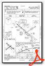
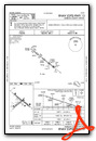
Instrument Approach Procedure (IAP) Charts


Nearby Airports with Instrument Procedures
| ID | Name | Heading / Distance | ||
|---|---|---|---|---|
 |
D73 | Cy Nunnally Memorial Airport | 186° | 12.1 |
|
KJCA | Jackson County Airport | 024° | 12.7 |
|
KLZU | Gwinnett County/Briscoe Field Airport | 269° | 14.7 |
|
KAHN | Athens/Ben Epps Airport | 096° | 17.2 |
|
KGVL | Lee Gilmer Memorial Airport | 334° | 19.2 |
|
KCVC | Covington Municipal Airport | 203° | 22.8 |
|
52A | Madison Municipal Airport | 154° | 24.5 |
|
KAJR | Habersham County Airport | 010° | 31.5 |
|
KPDK | Dekalb-Peachtree Airport | 258° | 32.3 |
|
18A | Franklin-Hart Airport | 051° | 34.2 |
|
KCPP | Greene County Regional Airport | 130° | 35.1 |
|
KTOC | Toccoa Rg Letourneau Field Airport | 026° | 40.9 |
Airport Images
Do you have a recent image of this airport? Upload it here!


