Login
Register


DRM
Drummond Island Airport
Official FAA Data Effective 2025-12-25 0901Z
Chart Supplement

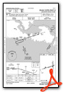
VFR Chart of KDRM
Sectional Charts at SkyVector.com
IFR Chart of KDRM
Enroute Charts at SkyVector.com
Location Information for KDRM
Coordinates: N46°0.56' / W83°44.64'Located 01 miles SW of Drummond Island, Michigan on 60 acres of land. View all Airports in Michigan.
Surveyed Elevation is 668 feet MSL.
Operations Data
|
|
Airport Communications
| AWOS-3: | 118.325 Tel. 906-493-6410 |
|---|---|
| UNICOM: | 122.800 |
| CTAF: | 122.800 |
| AWOS-3PT at CIU (33.6 NW): | 127.575 906-495-1156 |
| AWOS-3 at PZQ (36.3 S): | 118.125 989-734-7419 |
| AWOS-3 at MCD (38.3 W): | 118.275 906-847-3778 |
- APCH/DEP SVC PRVDD BY TORONTO CENTRE ON 132.65/344.5.
Nearby Navigation Aids
|
| ||||||||||||||||||||||||||||||||||||||||||||||||


Runway 08/26
| Dimensions: | 4000 x 75 feet / 1219 x 23 meters | |
|---|---|---|
| Surface: | Asphalt in Fair Condition | |
| Edge Lighting: | Medium Intensity | |
| Runway 08 | Runway 26 | |
| Coordinates: | N46°0.42' / W83°45.24' | N46°0.62' / W83°44.34' |
| Elevation: | 659.4 | 657.4 |
| Traffic Pattern: | Left | Left |
| Runway Heading: | 72° True | 252° True |
| Displaced Threshold: | 650 Feet | 170 Feet |
| Markings: | Non-Precision Instrument in good condition. | Non-Precision Instrument in good condition. |
| Glide Slope Indicator | P2L (3.00° Glide Path Angle) | P2L (3.00° Glide Path Angle) |
| Obstacles: | 30 ft Trees 200 ft from runway, 175 ft left of center APCH RATIO 1:1 TO DTHR OVR 80 FT TREES, 0 FT DIST, 250 FT L. +4 FT FENCE, 20 FT DIST; +10 FT HILL, 10 FT DIST, 50 FT L; +18 FT BLDG, 97 FT DIST, 50 FT R; +50 FT TREES, 20 FT DIST, 90 FT L/R. |
15 ft Road 200 ft from runway, 125 ft right of center APCH RATIO 4:1 TO DTHR OVR 75 FT TREE, 321 FT DIST, 247 FT L. +6 FT FENCE, 54 FT DIST; +15 FT ROAD, 112 FT DIST; +20 FT BLDG, 0 FT DIST, 200 FT R. |
Runway 01/19
| Dimensions: | 2500 x 150 feet / 762 x 46 meters | |
|---|---|---|
| Surface: | Asphalt-Turf in Fair Condition CNTR 20 FT OF RWY FM INT RWY 08/26 NORTH TO THE HNGR LINE IS ASPH, RMNDR OF RWY TURF. | |
| Runway 01 | Runway 19 | |
| Coordinates: | N46°0.42' / W83°44.38' | N46°0.83' / W83°44.40' |
| Traffic Pattern: | Left | Left |
| Runway Heading: | 358° True | 178° True |
| Obstacles: | 59 ft Trees 0 ft from runway, 125 ft right of center | 71 ft Trees 0 ft from runway, 121 ft left of center |
Services Available
| Fuel: | 100LL (blue), Automotive Gasoline |
|---|---|
| Transient Storage: | Tiedowns |
| Airframe Repair: | NOT AVAILABLE |
| Engine Repair: | NOT AVAILABLE |
| Bottled Oxygen: | NOT AVAILABLE |
| Bulk Oxygen: | NOT AVAILABLE |
| Other Services: | AIRCRAFT SALES |
Ownership Information
| Ownership: | Publicly owned | |
|---|---|---|
| Owner: | DRUMMOND TOWNSHIP | |
| PO BOX 245 | ||
| DRUMMOND ISLAND, MI 49726-0245 | ||
| 906-493-5321 | ||
| Manager: | JAMES BAILEY | |
| 34264 S TOWNLINE RD | ||
| DRUMMOND ISLAND, MI 49726-9636 | ||
| 906-493-5411 | ||
Other Remarks
- THIS AIRPORT HAS BEEN SURVEYED BY THE NATIONAL GEODETIC SURVEY.
- GOLF CARTS & PEDESTRIANS XNG RWY 08/26 DUE TO GOLF CRS ON BOTH SIDES.
- BIRDS & DEER ON & INVOF ARPT.
- D22 SPB LCTD 1.5 NM NORTH.
- FOR CD CTC MINNEAPOLIS ARTCC AT 651-463-5588.
- 3 FT YELLOW CONES.
- 3 FT YELLOW CONES.
- ACTVT PAPI RWY 08 & 26; MIRL RWY 08/26 - CTAF.
Weather Minimums

Instrument Approach Procedure (IAP) Charts

Nearby Airports with Instrument Procedures
| ID | Name | Heading / Distance | ||
|---|---|---|---|---|
 |
CPF2 | Bar River Airport | 329° | 28.7 |
|
KCIU | Chippewa County International Airport | 295° | 33.7 |
|
6Y1 | Bois Blanc Island Airport | 245° | 35.0 |
|
KPZQ | Presque Isle County Airport | 184° | 36.3 |
|
KMCD | Mackinac Island Airport | 257° | 38.4 |
|
KANJ | Sault Ste Marie Municipal/Sanderson Field Airport | 317° | 38.4 |
|
KSLH | Cheboygan County Airport | 237° | 38.9 |
|
83D | Mackinac County Airport | 260° | 42.2 |
|
CYAM | Sault Ste Marie Airport | 312° | 42.8 |
|
KPLN | Pellston Regional/Emmet County Airport | 239° | 51.4 |
|
KAPN | Alpena County Regional Airport | 172° | 56.4 |
|
KMGN | Harbor Springs Airport | 234° | 60.4 |
Airport Images
Do you have a recent image of this airport? Upload it here!


