Login
Register


DSV
Dansville Municipal Airport
Official FAA Data Effective 2026-02-19 0901Z
Chart Supplement

VFR Chart of KDSV
Sectional Charts at SkyVector.com
IFR Chart of KDSV
Enroute Charts at SkyVector.com
Location Information for KDSV
Coordinates: N42°34.23' / W77°42.80'Located 01 miles NW of Dansville, New York on 162 acres of land. View all Airports in New York.
Surveyed Elevation is 659 feet MSL.
Operations Data
|
|
Airport Communications
| ASOS: | 118.325 Tel. 585-335-2380 |
|---|---|
| ROCHESTER APPROACH: | 123.7 322.3 |
| ROCHESTER DEPARTURE: | 123.7 322.3 |
| UNICOM: | 123.000 |
| CTAF: | 123.000 |
| AWOS-3 at HTF (11.4 S): | 118.475 607-324-9138 |
| AWOS-2 at 01G (18.0 NW): | 118.525 585-237-0235 |
| AWOS-3P at IUA (26.5 NE): | 118.675 585-396-5861 |
Nearby Navigation Aids
|
| ||||||||||||||||||||||||||||||||||||||||||||||||||||||||||||


Runway 14/32
| Dimensions: | 3500 x 100 feet / 1067 x 30 meters | |
|---|---|---|
| Surface: | Asphalt in Good Condition | |
| Weight Limits: | S-30
MIN SFC AND BASE REQRMTS NOT MET FOR DUAL AND DUAL TANDEM GWTS RWY 14-32.
| |
| Edge Lighting: | Medium Intensity | |
| Runway 14 | Runway 32 | |
| Coordinates: | N42°34.41' / W77°43.10' | N42°34.05' / W77°42.49' |
| Elevation: | 635.3 | 659.8 |
| Traffic Pattern: | Left | Left |
| Runway Heading: | 128° True | 308° True |
| Markings: | Basic in fair condition. | Basic in fair condition. |
| Glide Slope Indicator | V2L (3.00° Glide Path Angle) | V4L (4.00° Glide Path Angle) |
| Obstacles: | 6 ft Fence 215 ft from runway, 250 ft right of center RWY 14, 15 FT RD, 220 FT DSTC, 250 FT R; 35 FT POLE, 282 FT DSTC, 262 FT R, 2:1; 60 FT UNLGTD CRANES, 700 FT DSTC. 4 FT FENCE & 40 FT TREES IN THE APCH. |
15 ft Road 201 ft from runway, 200 ft right of center ACES ROAD W/FENCE 230 FT RIGHT. |
Services Available
| Fuel: | 100LL (blue) |
|---|---|
| Transient Storage: | Hangars,Tiedowns |
| Airframe Repair: | NONE |
| Engine Repair: | NONE |
| Bottled Oxygen: | NONE |
| Bulk Oxygen: | NONE |
| Other Services: | GLIDER SERVICE,PILOT INSTRUCTION,GLIDER TOWING SERVICES |
Ownership Information
| Ownership: | Publicly owned | |
|---|---|---|
| Owner: | TOWN OF NORTH DANSVILLE | |
| TOWN HALL, 14 CLARA BARTON ST | ||
| DANSVILLE, NY 14437 | ||
| 585-335-2330 | ||
| Manager: | RICK LAFFORD | |
| 176 FRANKLIN STREET | ||
| DANSVILLE, NY 14437 | ||
| 585-451-3316 | AMGR CELL 585-451-3316 | |
Other Remarks
- EXTSV GLIDER ACTVTY. GLIDER USE RIGHT PAT FOR THE TURF AREA RIGHT OF RWY 32 & LEFT PAT FOR THE TURF AREA LEFT OF RWY 14.
- FOR CD CTC CLEVELAND ARTCC AT 440-774-0490.
- RWY 14 90 FT RELCTD THLD.
- 0LL 24 HR SELF SVC.
- ACTVT VASI RWY 14 & 32; MIRL RWY 14/32 - CTAF.
Weather Minimums


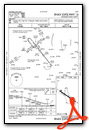
Instrument Approach Procedure (IAP) Charts

Nearby Airports with Instrument Procedures
| ID | Name | Heading / Distance | ||
|---|---|---|---|---|
 |
KHTF | Hornell Municipal Airport | 173° | 11.4 |
|
5G0 | Le Roy Airport | 338° | 26.5 |
|
KIUA | Canandaigua Airport | 040° | 26.6 |
|
KPEO | Penn Yan/Yates County Airport | 082° | 29.5 |
|
KELZ | Wellsville Municipal/Tarantine Field Airport | 204° | 30.3 |
|
KROC | Frederick Douglass/Greater Rochester International Airport | 003° | 33.0 |
|
KGVQ | Genesee County Airport | 324° | 34.2 |
|
KOLE | Cattaraugus County-Olean Airport | 236° | 35.3 |
|
7G0 | Ledgedale Airpark Airport | 346° | 37.7 |
|
9G3 | Akron/Jesson Field Airport | 308° | 43.4 |
|
9G6 | Pine Hill Airport | 325° | 43.8 |
|
KELM | Elmira/Corning Regional Airport | 123° | 44.1 |
Airport Images
Do you have a recent image of this airport? Upload it here!


Comments
Fuel at DSV
24/7 100LL fuel is available with the new credit card system.