Login
Register
E36
Georgetown Airport
Official FAA Data Effective 2026-01-22 0901Z
VFR Chart of E36
Sectional Charts at SkyVector.com
IFR Chart of E36
Enroute Charts at SkyVector.com
Location Information for E36
Coordinates: N38°55.27' / W120°51.89'Located 02 miles NW of Georgetown, California on 148 acres of land. View all Airports in California.
Surveyed Elevation is 2624 feet MSL.
Operations Data
|
|
Airport Communications
| CTAF: | 123.050 |
|---|---|
| UNICOM: | 123.050 |
| AWOS-3 at AUN (10.6 W): | 119.375 530-888-8934 |
| AWOS-3 at PVF (13.0 S): | 128.125 530-622-5698 |
| AWOS-3P at O61 (15.3 S): | 120.0 530-677-5392 |
Nearby Navigation Aids
|
| ||||||||||||||||||||||||||||||||||||
Runway 16/34
| Dimensions: | 2979 x 62 feet / 908 x 19 meters | |
|---|---|---|
| Surface: | Asphalt in Good Condition | |
| Weight Limits: | S-22 | |
| Edge Lighting: | Medium Intensity | |
| Runway 16 | Runway 34 | |
| Coordinates: | N38°55.51' / W120°51.88' | N38°55.02' / W120°51.89' |
| Elevation: | 2624.9 | 2623.8 |
| Traffic Pattern: | Left | Left |
| Runway Heading: | 181° True | 1° True |
| Displaced Threshold: | 190 Feet | |
| Markings: | Basic in fair condition. | Basic in fair condition. |
| Glide Slope Indicator | P2L (3.00° Glide Path Angle) | |
| Obstacles: | 45 ft Trees 465 ft from runway, 140 ft right of center | 30 ft Trees 365 ft from runway, 140 ft left of center |
Services Available
| Fuel: | 100LL (blue) |
|---|---|
| Transient Storage: | Tiedowns |
| Airframe Repair: | MAJOR |
| Engine Repair: | MINOR |
| Bottled Oxygen: | NONE |
| Bulk Oxygen: | NONE |
| Other Services: | CHARTER SERVICE,PILOT INSTRUCTION,AIRCRAFT RENTAL |
Ownership Information
| Ownership: | Publicly owned | |
|---|---|---|
| Owner: | COUNTY OF EL DORADO | |
| 330 FAIR LANE | ||
| PLACERVILLE, CA 95667 | ||
| (530) 622-0459 | ||
| Manager: | SHERRIE BUSBY | |
| 3501 AIRPORT ROAD | ||
| PLACERVILLE, CA 95667 | ||
| (530) 622-0459 | ||
Other Remarks
- RWY 16 POLES AT EDGE OF TREE LINE 145'-165' R ARE OBSTRUCTION LGTD.
- RY 34 POLES AT THE EDGE OF TREE LINE 145 FT L ARE OBTSTRUCTION LGTD.
- TREES 800 FT SW OF RWY 16/34 2723 FT MSL (100 FT AGL) NOT LGTD .
- FOR CD CTC NORCAL APCH AT 916-361-6874.
- ACTVT PAPI RWY 16; MIRL RWY 16/34 - CTAF.
Nearby Airports with Instrument Procedures
| ID | Name | Heading / Distance | ||
|---|---|---|---|---|
 |
KAUN | Auburn Municipal Airport | 281° | 10.4 |
 |
KPVF | Placerville Airport | 156° | 12.9 |
 |
KGOO | Nevada County Airport | 340° | 19.3 |
 |
KLHM | Lincoln Regional/Karl Harder Field Airport | 268° | 22.8 |
 |
KMCC | Mc Clellan Airfield Airport | 239° | 29.4 |
 |
KBAB | Beale AFB Airport | 295° | 29.7 |
 |
KMHR | Sacramento Mather Airport | 222° | 29.9 |
 |
KJAQ | Westover Field Amador County Airport | 174° | 32.8 |
 |
KMYV | Yuba County Airport | 288° | 34.6 |
 |
KSMF | Sacramento International Airport | 248° | 36.6 |
 |
KSAC | Sacramento Exec Airport | 230° | 38.3 |
 |
KTVL | Lake Tahoe Airport | 092° | 40.8 |


Comments
Good Camping at E36
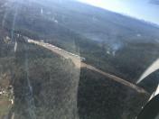
There is a nice campground on the west side of the runway. There is an asphalt picking spot on near the campground off the runway but you can also park near the restrooms but you'll have to haul your gear over to the campground. This is a nice quiet airport. About 2 miles into town. No courtesy cars at the airport.