Login
Register
E45
Pine Mountain Lake Airport
Official FAA Data Effective 2025-11-27 0901Z
VFR Chart of E45
Sectional Charts at SkyVector.com
IFR Chart of E45
Enroute Charts at SkyVector.com
Location Information for E45
Coordinates: N37°51.70' / W120°10.71'Located 03 miles NE of Groveland, California on 52 acres of land. View all Airports in California.
Surveyed Elevation is 2932 feet MSL.
Operations Data
|
|
Airport Communications
| CTAF: | 122.900 |
|---|---|
| AWOS-3 at O22 (15.1 NW): | 124.65 209-536-9384 |
| AWOS-3 at MPI (22.0 S): | 135.6 209-966-2912 |
| AWOS-3P at CPU (27.9 NW): | 118.525 209-736-2523 |
- APCH/DEP CTL SVC PRVDD BY OAKLAND ARTCC (ZOA) ON FREQS 121.25/327.0 (ANGELS CAMP RCAG).
Nearby Navigation Aids
|
| ||||||||||||||||||||||||||||||||||||
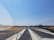
Runway 09/27
| Dimensions: | 3624 x 50 feet / 1105 x 15 meters 200 FT GRVL RY SAFETY AREA WEST END; 100 FT GRVL RY SAFETY AREA EAST END. | |
|---|---|---|
| Surface: | Asphalt in Good Condition | |
| Weight Limits: | S-12 | |
| Edge Lighting: | Medium Intensity | |
| Runway 09 | Runway 27 | |
| Coordinates: | N37°51.80' / W120°11.07' | N37°51.60' / W120°10.36' |
| Elevation: | 2895.1 | 2932.6 |
| Traffic Pattern: | Right | |
| Runway Heading: | 110° True | 290° True |
| Markings: | Non-Precision Instrument in good condition. | Non-Precision Instrument in good condition. |
| Glide Slope Indicator | V2L (4.50° Glide Path Angle) | P2L (4.00° Glide Path Angle) PAPI RY 27 UNUSABLE BYD 7 DEG LEFT AND RIGHT OF CENTERLINE. |
| Obstacles: | 10 ft Trees 420 ft from runway, 25 ft left of center | 35 ft Trees 980 ft from runway |
Services Available
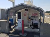
| Fuel: | 100LL (blue) |
|---|---|
| Transient Storage: | Tiedowns |
| Airframe Repair: | NONE |
| Engine Repair: | NONE |
| Bottled Oxygen: | NONE |
| Bulk Oxygen: | NONE |
Ownership Information
| Ownership: | Publicly owned | |
|---|---|---|
| Owner: | TULOUMNE COUNTY | |
| 2 SOUTH GREEN ST. | ||
| SONORA, CA 95370 | ||
| 209-533-5685 | ||
| Manager: | TONYA SCHEFTNER | |
| 10723 AIRPORT RD | ||
| COLUMBIA, CA 95310 | ||
| 209-533-5685 | OFFICE AT COLUMBIA, CA ARPT. | |
Other Remarks
- THIS AIRPORT HAS BEEN SURVEYED BY THE NATIONAL GEODETIC SURVEY.
- TRANSIENT PARKING AVBL.
- FEE FOR OVERNIGHT PARKING.
- (E81) RWY EXIT LGTS.
- DEER ON & INVOF ARPT AT ALL TIMES.
- FOR CD CTC OAKLAND ARTCC AT 510-745-3380.
- SAYWEATHER ADZY WX SYS AVBL. NOT AN FAA AWOS. CTAF ACTIVATION: 5 CLICKS FOR RWY LGTS, 4 CLICKS FOR FULL WX, 3 CLICKS FOR WINDS.
- 0LL FUEL 24 HR SELF-SERVICE.
- ACTVT MIRL RY 09/27 - CTAF.
Weather Minimums
Instrument Approach Procedure (IAP) Charts
Nearby Airports with Instrument Procedures
| ID | Name | Heading / Distance | ||
|---|---|---|---|---|
 |
O22 | Columbia Airport | 312° | 15.1 |
 |
KMPI | Mariposa-Yosemite Airport | 162° | 22.0 |
 |
KCPU | Calaveras County/Maury Rasmussen Field Airport | 307° | 28.0 |
 |
O27 | Oakdale Airport | 258° | 30.2 |
 |
O15 | Turlock Municipal Airport | 227° | 33.5 |
 |
KMER | Castle Airport | 212° | 34.3 |
 |
KMCE | Merced Yosemite Regional Airport | 204° | 38.1 |
 |
KMOD | Modesto City-County-Harry Sham Field Airport | 249° | 39.5 |
 |
KJAQ | Westover Field Amador County Airport | 316° | 42.5 |
 |
KSCK | Stockton Metro Airport | 272° | 50.4 |
 |
KMAE | Madera Municipal Airport | 176° | 52.4 |
 |
1O3 | Lodi Airport | 291° | 55.6 |


