Login
Register
F10
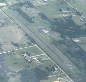
Henryetta Municipal Airport
Official FAA Data Effective 2025-11-27 0901Z
VFR Chart of F10
Sectional Charts at SkyVector.com
IFR Chart of F10
Enroute Charts at SkyVector.com
Location Information for F10
Coordinates: N35°24.41' / W96°0.95'Located 03 miles SW of Henryetta, Oklahoma on 160 acres of land. View all Airports in Oklahoma.
Surveyed Elevation is 849 feet MSL.
Operations Data
|
|
Airport Communications
| UNICOM: | 122.800 |
|---|---|
| CTAF: | 122.800 |
| AWOS-3PT at OKM (16.2 N): | 118.225 918-756-9502 |
| AWOS-3 at SRE (33.3 W): | 118.625 405-382-0111 |
| ASOS at MLC (33.5 S): | 120.425 918-426-7674 |
- APCH/DEP CTL SVC PRVDD BY FORT WORTH ARTCC (ZFW) ON FREQS 132.2/338.35 (MC ALESTER RCAG).
Nearby Navigation Aids
|
| ||||||||||||||||||||||||||||||||||||||||||||||||||||||||||||
Runway 18/36
| Dimensions: | 3501 x 50 feet / 1067 x 15 meters | |
|---|---|---|
| Surface: | Asphalt in Fair Condition | |
| Weight Limits: | S-12 | |
| Edge Lighting: | Medium Intensity | |
| Runway 18 | Runway 36 | |
| Coordinates: | N35°24.70' / W96°0.95' | N35°24.12' / W96°0.95' |
| Elevation: | 830.0 | 849.0 |
| Traffic Pattern: | Left | Left |
| Runway Heading: | 180° True | 360° True |
| Markings: | Basic in poor condition. | Non-Precision Instrument in poor condition. |
| Glide Slope Indicator | PSIL (3.50° Glide Path Angle) | |
| Obstacles: | 45 ft Trees 330 ft from runway, 140 ft left of center | 27 ft Trees 332 ft from runway, 230 ft right of center 26 FT TREE 120 FT FM RWY 36 END 154 FT LEFT OF APCH. |
Services Available
| Fuel: | NONE |
|---|---|
| Transient Storage: | Tiedowns |
| Airframe Repair: | NONE |
| Engine Repair: | NONE |
| Bottled Oxygen: | NONE |
| Bulk Oxygen: | NONE |
Ownership Information
| Ownership: | Publicly owned | |
|---|---|---|
| Owner: | CITY OF HENRYETTA | |
| CITY HALL, 115 S. 4TH ST | ||
| HENRYETTA, OK 74437 | ||
| 918-652-3348 | ||
| Manager: | DAVID BOLLARD | |
| PO BOX 608, 10249 LOBLOLLY RD. | ||
| HENRYETTA, OK 74437 | ||
| 918-652-3348 | ||
Other Remarks
- THIS AIRPORT HAS BEEN SURVEYED BY THE NATIONAL GEODETIC SURVEY.
- FOR CD CTC FORT WORTH ARTCC AT 817-858-7584.
- MARKINGS SEVERELY FADED.
- MARKINGS SEVERELY FADED.
- DUSK-DAWN. ACTVT MIRL RY 18/36 - CTAF.
Weather Minimums
Instrument Approach Procedure (IAP) Charts
Nearby Airports with Instrument Procedures
| ID | Name | Heading / Distance | ||
|---|---|---|---|---|
 |
KOKM | Okmulgee Regional/Paul and Betty Abbott Field Airport | 011° | 16.0 |
 |
F99 | Holdenville Municipal Airport | 225° | 27.5 |
 |
3F7 | Jones Memorial Airport | 320° | 31.1 |
 |
KSRE | Seminole Municipal Airport | 256° | 33.3 |
 |
KMLC | Mc Alester Regional Airport | 159° | 33.4 |
 |
O47 | Prague Municipal Airport | 277° | 34.7 |
 |
KMKO | Muskogee-Davis Regional Airport | 064° | 35.4 |
 |
KRVS | Tulsa Riverside Airport | 002° | 37.9 |
 |
KCQB | Chandler Regional Airport | 295° | 43.7 |
 |
KSNL | Shawnee Regional Airport | 266° | 45.6 |
 |
KGZL | Stigler Regional Airport | 098° | 45.8 |
 |
KOWP | William R Pogue Municipal Airport | 351° | 46.5 |


