Login
Register


F31
Lake Texoma State Park Airport
Official FAA Data Effective 2025-11-27 0901Z
Chart Supplement

VFR Chart of F31
Sectional Charts at SkyVector.com
IFR Chart of F31
Enroute Charts at SkyVector.com
Location Information for F31
Coordinates: N33°59.46' / W96°38.56'Located 04 miles E of Kingston, Oklahoma on 50 acres of land. View all Airports in Oklahoma.
Estimated Elevation is 693 feet MSL.
Operations Data
|
|
Airport Communications
| CTAF: | 122.800 |
|---|---|
| UNICOM: | 122.800 |
| AWOS-3 at DUA (12.7 E): | 124.175 580-931-3790 |
| AWOS-3PT at GYI (16.7 S): | 118.775 903-786-7790 |
| ATIS at GYI (16.7 S): | 118.775 |
Nearby Navigation Aids
|
| ||||||||||||||||||||||||||||||||||||||||||||||||||||||


Runway 18/36
| Dimensions: | 3000 x 50 feet / 914 x 15 meters | |
|---|---|---|
| Surface: | Asphalt in Fair Condition | |
| Weight Limits: | S-4 | |
| Edge Lighting: | Medium Intensity | |
| Runway 18 | Runway 36 | |
| Coordinates: | N33°59.71' / W96°38.53' | N33°59.22' / W96°38.59' |
| Traffic Pattern: | Left | Left |
| Runway Heading: | 186° True | 6° True |
| Markings: | Basic in fair condition. | Basic in fair condition. |
| Obstacles: | 36 ft Trees 272 ft from runway, 19 ft left of center RISING TRRN 90 FT FM THR. |
|
Services Available
| Fuel: | NONE |
|---|---|
| Transient Storage: | Tiedowns |
| Airframe Repair: | NOT AVAILABLE |
| Engine Repair: | NOT AVAILABLE |
| Bottled Oxygen: | NOT AVAILABLE |
| Bulk Oxygen: | NOT AVAILABLE |
Ownership Information
| Ownership: | Publicly owned | |
|---|---|---|
| Owner: | CORP OF ENGINEERS | |
| OK DEP OF TOURISM & REC, LESSEE, PO BOX 52002 | ||
| OKLAHOMA CITY, OK 73105 | ||
| (580) 564-2566 | ||
| Manager: | KEVIN NUNNELEE | |
| 11500 PARK OFFICE RD, 1988 STATE PARK RD. | ||
| KINGSTON, OK 73439 | ||
| 580-564-2566 | AFT HR - 580-564-5515. | |
Other Remarks
- DEER & GEESE ON & INVOF RWY.
- FOR CD CTC FORT WORTH ARTCC AT 817-858-7584.
- ACTVT MIRL RWY 18/36 - CTAF. MIRL RWY 18/36 PRESET LOW INTST; INCR INTST - CTAF.
Nearby Airports with Instrument Procedures
| ID | Name | Heading / Distance | ||
|---|---|---|---|---|
 |
1F4 | Madill Municipal Airport | 316° | 12.3 |
|
KDUA | Durant Regional/Eaker Field Airport | 103° | 12.7 |
|
KGYI | North Texas Regional/Perrin Field Airport | 185° | 16.7 |
|
KSWI | Sherman Municipal Airport | 172° | 22.2 |
|
1F0 | Ardmore Downtown Exec Airport | 291° | 25.7 |
|
KADM | Ardmore Municipal Airport | 314° | 26.6 |
|
F00 | Jones Field Airport | 134° | 32.4 |
|
KGLE | Gainesville Municipal Airport | 233° | 34.4 |
|
KADH | Ada Regional Airport | 358° | 48.7 |
|
KTKI | Mckinney Ntl Airport | 176° | 48.8 |
|
80F | Antlers Municipal Airport | 075° | 50.9 |
|
KPVJ | Pauls Valley Municipal Airport | 326° | 51.8 |
Airport Images
By: Magendo

By: Magendo


Comments
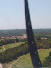
Runway 18 obstacles
Rising terrain and trees immediately off of runway 18.