Login
Register


FFX
Fremont Municipal Airport
Official FAA Data Effective 2026-02-19 0901Z
Chart Supplement

VFR Chart of KFFX
Sectional Charts at SkyVector.com
IFR Chart of KFFX
Enroute Charts at SkyVector.com
Location Information for KFFX
Coordinates: N43°26.36' / W85°59.69'Located 03 miles SW of Fremont, Michigan on 105 acres of land. View all Airports in Michigan.
Surveyed Elevation is 771 feet MSL.
Operations Data
|
|
Airport Communications
| AWOS-3P: | 118.775 Tel. 231-928-0715 |
|---|---|
| GREAT LAKES APPROACH: | 119.8 290.35 |
| GREAT LAKES DEPARTURE: | 119.8 290.35 |
| CLEARANCE DELIVERY: | 118.25 |
| UNICOM: | 123.000 |
| CTAF: | 123.000 |
| AWOS-AV at C04 (19.0 NW): | 122.7 231-861-7415 |
| ASOS at MKG (19.3 SW): | 231-246-4419 |
| ATIS at MKG (19.4 SW): | 124.3 |
- APCH/DEP SVC PRVDD BY CHICAGO ARTCC ON FREQS 128.5/273.525 (PULLMAN RCAG) WHEN GREAT LAKES APCH CTL CLSD.
Nearby Navigation Aids
|
| ||||||||||||||||||||||||||||||||||||||||||||||||||||||||||||


Runway 01/19
| Dimensions: | 6501 x 100 feet / 1982 x 30 meters | |
|---|---|---|
| Surface: | Asphalt / Porous Friction Course in Good Condition | |
| Weight Limits: | S-81, D-118, DT-186
PCR VALUE: 320/F/C/X/T
| |
| Edge Lighting: | Medium Intensity | |
| Runway 01 | Runway 19 | |
| Coordinates: | N43°25.68' / W85°59.79' | N43°26.75' / W85°59.80' |
| Elevation: | 753.3 | 769.4 |
| Traffic Pattern: | Left | Left |
| Runway Heading: | 360° True | 180° True |
| Markings: | Non-Precision Instrument in fair condition. | Non-Precision Instrument in fair condition. |
| Glide Slope Indicator | V2L (3.00° Glide Path Angle) | P4L (3.00° Glide Path Angle) |
| REIL: | Yes | Yes |
| Obstacles: | 50 ft Tree 1850 ft from runway, 452 ft left of center | 40 ft Trees 1285 ft from runway, 379 ft left of center ALSO 39 FT MKD PLINE, 1500 FT DIST. |
Runway 10/28
| Dimensions: | 3502 x 75 feet / 1067 x 23 meters | |
|---|---|---|
| Surface: | Asphalt in Good Condition | |
| Weight Limits: | S-16 | |
| Edge Lighting: | Medium Intensity | |
| Runway 10 | Runway 28 | |
| Coordinates: | N43°26.63' / W85°59.90' | N43°26.62' / W85°59.11' |
| Elevation: | 766.7 | 769.5 |
| Traffic Pattern: | Left | Left |
| Runway Heading: | 91° True | 271° True |
| Markings: | Non-Precision Instrument in fair condition. | Non-Precision Instrument in fair condition. |
| Glide Slope Indicator | P4L (3.50° Glide Path Angle) | |
Services Available
| Fuel: | 100LL (blue), Jet-A, Jet A+ |
|---|---|
| Transient Storage: | Hangars,Tiedowns |
| Airframe Repair: | MAJOR |
| Engine Repair: | MAJOR |
| Bottled Oxygen: | NONE |
| Bulk Oxygen: | NONE |
| Other Services: | AIR AMBULANCE SERVICES OPRD BY GERBER HOSPITAL. |
Ownership Information
| Ownership: | Publicly owned | |
|---|---|---|
| Owner: | CITY OF FREMONT | |
| 101 E MAIN ST | ||
| FREMONT, MI 49412-1287 | ||
| 231-924-2101 | ||
| Manager: | LORI LAYNE | |
| 7756 W 60TH ST | ||
| FREMONT, MI 49412-8128 | ||
| 231-924-7080 | ||
Other Remarks
- SEAPLANE ACT ON ADJ LAKE 0.5 NM NE OF ARPT.
- TRML BLDG ACES 5-3-2-1.
- FOR CD WHEN GREAT LAKES APCH CLSD CTC CHICAGO ARTCC AT 630-906-8921.
- 0LL 100LL AVBL SELF SVC.
- JET A AVBL FULL SVC VIA TRUCK DLVY.
- ICING INHIBITOR AVBL UPON REQ.
- ACTVT REIL RWY 01 & 19; PAPI RWY 19 & 28; VASI RWY 01; MIRL RWY 01/19 & 10/28 - CTAF.
Weather Minimums


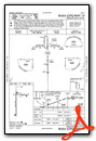
Instrument Approach Procedure (IAP) Charts

Nearby Airports with Instrument Procedures
| ID | Name | Heading / Distance | ||
|---|---|---|---|---|
 |
C04 | Oceana County Airport | 309° | 19.0 |
|
KMKG | Muskegon County Airport | 212° | 19.4 |
|
8D4 | Paul C Miller/Sparta Airport | 143° | 23.3 |
|
3GM | Grand Haven Memorial Airpark Airport | 200° | 25.9 |
|
7D3 | Baldwin Municipal Airport | 014° | 27.0 |
|
KRQB | Roben-Hood Airport | 051° | 27.3 |
|
13C | Lakeview/Griffith Field Airport | 088° | 31.9 |
|
KLDM | Mason County Airport | 330° | 36.2 |
|
6D6 | Greenville Municipal Airport | 118° | 37.0 |
|
KGRR | Gerald R Ford International Airport | 148° | 39.4 |
|
KBIV | West Michigan Regional Airport | 186° | 42.1 |
|
Y70 | Ionia County Airport | 125° | 50.9 |
Airport Images
Do you have a recent image of this airport? Upload it here!


