Login
Register


GDK
Greene County/Lewis A Jackson Regional Airport
Official FAA Data Effective 2026-01-22 0901Z
Chart Supplement

VFR Chart of KGDK
Sectional Charts at SkyVector.com
IFR Chart of KGDK
Enroute Charts at SkyVector.com
Location Information for KGDK
Coordinates: N39°41.44' / W83°59.57'Located 10 miles E of Dayton, Ohio on 277 acres of land. View all Airports in Ohio.
Surveyed Elevation is 948 feet MSL.
Operations Data
|
|
Airport Communications
| AWOS-3: | 118.525 Tel. 937-372-4668 |
|---|---|
| COLUMBUS APPROACH: | 118.85 269.275 |
| COLUMBUS DEPARTURE: | 118.85 269.275 |
| IC: | 269.275 |
| UNICOM: | 122.725 |
| CTAF: | 122.725 |
| ATIS at FFO (8.5 N): | 269.9 |
| AWOS-3PT at SGH (11.1 NE): | 134.975 937-324-4532 |
| ASOS at MGY (12.3 SW): | 118.375 937-885-2171 |
Nearby Navigation Aids
|
| ||||||||||||||||||||||||||||||||||||||||||||||||||||||||||||


Runway 07/25
| Dimensions: | 5004 x 75 feet / 1525 x 23 meters | |
|---|---|---|
| Surface: | Asphalt in Good Condition | |
| Weight Limits: | S-30 | |
| Edge Lighting: | Medium Intensity | |
| Runway 07 | Runway 25 | |
| Coordinates: | N39°41.26' / W84°0.04' | N39°41.63' / W83°59.09' |
| Elevation: | 909.5 | 948.5 |
| Traffic Pattern: | Left | Left |
| Runway Heading: | 63° True | 243° True |
| Markings: | Non-Precision Instrument in good condition. | Non-Precision Instrument in good condition. |
| Glide Slope Indicator | P2L (3.50° Glide Path Angle) | P2L (3.50° Glide Path Angle) |
| REIL: | Yes | Yes |
Services Available
| Fuel: | 100LL (blue), Jet-A |
|---|---|
| Transient Storage: | Hangars,Tiedowns PRIOR CDN RQRD FOR TSNT HNGR. |
| Airframe Repair: | MAJOR |
| Engine Repair: | MAJOR |
| Bottled Oxygen: | NONE |
| Bulk Oxygen: | HIGH |
| Other Services: | PILOT INSTRUCTION,AIRCRAFT RENTAL |
Ownership Information
| Ownership: | Publicly owned | |
|---|---|---|
| Owner: | GREENE COUNTY RGNL ARPT AUTH | |
| 140 N VALLEY RD | ||
| XENIA, OH 45385-9301 | ||
| 937-376-8107 | ||
| Manager: | ALEXANDREA BARRETT | |
| 140 N VALLEY RD | ||
| XENIA, OH 45385-9301 | ||
| 937-376-8107 | ||
Other Remarks
- DEER, BIRDS, & OTR WILDLIFE ON & INVOF ARPT.
- FOR CD CTC COLUMBUS APCH AT 614-338-8537.
- EXTSV FLT TRG ACT.
- 0LL 100LL & JET A AVBL H24 SELF SVC VIA CREDIT CARD.
- ANTI-ICING AVBL AT NOZZLE.
- ACTVT REIL RWY 07 & 25; MIRL RWY 07/25 - CTAF. PAPI RWY 07 & 25 OPR CONSLY.
Weather Minimums


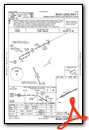
Instrument Approach Procedure (IAP) Charts

Nearby Airports with Instrument Procedures
| ID | Name | Heading / Distance | ||
|---|---|---|---|---|
 |
KFFO | Wright-Patterson AFB Airport | 343° | 8.5 |
|
KSGH | Springfield/Beckley Municipal Airport | 038° | 11.4 |
|
I73 | Moraine Air Park Airport | 267° | 11.5 |
|
KMGY | Dayton/Wright Brothers Airport | 240° | 12.4 |
|
I66 | Clinton Field Airport | 151° | 12.8 |
|
KDAY | James M Cox Dayton International Airport | 320° | 16.5 |
|
I68 | Warren County/John Lane Field Airport | 221° | 18.2 |
|
KILN | Wilmington Air Park Airport | 149° | 18.3 |
|
KMWO | Middletown Regional/Hook Field Airport | 243° | 21.0 |
|
3I7 | Dayton/Phillipsburg Airport | 305° | 23.1 |
|
I23 | Fayette County Airport | 105° | 27.5 |
|
KUYF | Madison County Airport | 059° | 28.5 |
Airport Images

By: Springer Photography

By: Springer Photography


