Login
Register


I68
Warren County/John Lane Field Airport
Official FAA Data Effective 2026-01-22 0901Z
Chart Supplement

VFR Chart of I68
Sectional Charts at SkyVector.com
IFR Chart of I68
Enroute Charts at SkyVector.com
Location Information for I68
Coordinates: N39°27.73' / W84°15.11'Located 03 miles NW of Lebanon, Ohio on 120 acres of land. View all Airports in Ohio.
Surveyed Elevation is 897 feet MSL.
Operations Data
|
|
Airport Communications
| AWOS-3PT: | 120.55 Tel. 513-934-5500 |
|---|---|
| COLUMBUS APPROACH: | 118.85 269.275 |
| COLUMBUS DEPARTURE: | 118.85 269.275 |
| IC: | 269.275 |
| CLEARANCE DELIVERY: | 119.4 |
| CTAF: | 123.075 |
| UNICOM: | 123.075 |
| ASOS at MGY (7.7 N): | 118.375 937-885-2171 |
| AWOS-3PT at MWO (7.9 NW): | 120.025 513-422-3505 |
| ASOS at HAO (13.9 SW): | 121.425 513-863-6137 |
Nearby Navigation Aids
|
| ||||||||||||||||||||||||||||||||||||||||||||||||||||||||||||


Runway 01/19
| Dimensions: | 4505 x 75 feet / 1373 x 23 meters | |
|---|---|---|
| Surface: | Asphalt / Grooved in Good Condition | |
| Edge Lighting: | Medium Intensity | |
| Runway 01 | Runway 19 | |
| Coordinates: | N39°27.36' / W84°15.15' | N39°28.10' / W84°15.08' |
| Elevation: | 883.9 | 897.9 |
| Traffic Pattern: | Left | Left |
| Runway Heading: | 4° True | 184° True |
| Displaced Threshold: | 99 Feet | |
| Markings: | Non-Precision Instrument in good condition. | Non-Precision Instrument in good condition. |
| Glide Slope Indicator | P4R (3.20° Glide Path Angle) | P4L (3.50° Glide Path Angle) |
| REIL: | Yes | Yes |
| Obstacles: | 8 ft Crops 201 ft from runway, 230 ft left of center +5-15 FT BRUSH ALONG FENCE LINE 300 FT FM 90 FT R TO 270 FT L. OBST CLNC SLP 0:1 TO DTHR. +8 FT CROPS 200 FT FM EXTDNG TO DTHLD 230 FT R. |
15 ft Brush 300 ft from runway, 90 ft right of center |
Services Available
| Fuel: | 100LL (blue), Jet A+ |
|---|---|
| Transient Storage: | Hangars,Tiedowns TNST HNGR PPR. |
| Airframe Repair: | MAJOR |
| Engine Repair: | MAJOR |
| Bottled Oxygen: | LOW |
| Bulk Oxygen: | LOW |
| Other Services: | PILOT INSTRUCTION,AIRCRAFT RENTAL |
Ownership Information
| Ownership: | Publicly owned | |
|---|---|---|
| Owner: | WARREN COUNTY AIRPORT AUTHORITY | |
| 2460 GREENTREE RD | ||
| LEBANON, OH 45036-9604 | ||
| 513-932-7966 | ||
| Manager: | ALAN WOLFSON | ADNL CTC: 513-932-7966, FBO@WARRENCOUNTYAIRPORT.NET. |
| 2460 GREENTREE RD | ||
| LEBANON, OH 45036-9604 | ||
| 513-932-7966 | ||
Other Remarks
- PAEW ADJ RWY & TWY INDEFLY.
- FOR CD CTC COLUMBUS APCH AT 614-338-8537.
- HOT AIR BLN OPS PSBL AT SR AND 1-2 HRS PRIOR TO SS.
- PFFD CALM WIND <5 KTS RWY 01
- RWY 01 PREFFERED CALM WIND LESS THAN 5 KTS.
- 0LL 100LL FULL SVC DURG ATNDD HRS; AVBL H24 SELF SVC VIA CREDIT CARD.
- JET A FULL SVC DURG ATNDD HRS.
- ACTVT REIL RWY 01 & 19; MIRL RWY 01/19 - 7 CLICKS CTAF.
Weather Minimums


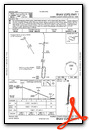
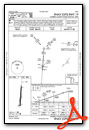
Instrument Approach Procedure (IAP) Charts
Nearby Airports with Instrument Procedures
| ID | Name | Heading / Distance | ||
|---|---|---|---|---|
 |
KMGY | Dayton/Wright Brothers Airport | 009° | 7.7 |
|
KMWO | Middletown Regional/Hook Field Airport | 301° | 7.9 |
|
I73 | Moraine Air Park Airport | 002° | 13.2 |
|
KHAO | Butler County Regional/Hogan Field Airport | 244° | 13.9 |
|
I66 | Clinton Field Airport | 082° | 18.2 |
|
KGDK | Greene County/Lewis A Jackson Regional Airport | 041° | 18.2 |
|
KILN | Wilmington Air Park Airport | 095° | 21.5 |
|
KLUK | Cincinnati Municipal/Lunken Field Airport | 199° | 22.9 |
|
I69 | Clermont County Airport | 175° | 23.1 |
|
KFFO | Wright-Patterson AFB Airport | 023° | 23.8 |
|
KOXD | Miami University Airport | 275° | 24.9 |
|
KDAY | James M Cox Dayton International Airport | 003° | 26.4 |
Airport Images
 from the northwest")
By: keeganm

By: tshiverd


