Login
Register


HMY
Muldrow AHP Heliport
Official FAA Data Effective 2026-01-22 0901Z
Chart Supplement

VFR Chart of KHMY
Sectional Charts at SkyVector.com
IFR Chart of KHMY
Enroute Charts at SkyVector.com
Location Information for KHMY
Coordinates: N35°1.58' / W97°13.90'Located 04 miles E of Lexington, Oklahoma on 250 acres of land. View all Airports in Oklahoma.
Surveyed Elevation is 1091 feet MSL.
Operations Data
|
|
Airport Communications
| OKE CITY APPROACH: | 124.2 336.4 |
|---|---|
| OKE CITY DEPARTURE: | 124.2 336.4 |
| AWOS-3PT at OUN (17.6 NW): | 119.55 405-325-7302 |
| AWOS-1 at WX2 (17.7 NW): | 119.55 817-222-4247 |
| AWOS-3 at PVJ (19.0 S): | 118.675 405-238-4452 |
- MULDROW OPS (ADVSY SVS ONLY) - 139.425 227.200 46.90 (CTAF).
Nearby Navigation Aids
|
| ||||||||||||||||||||||||||||||||||||||||||||||||||||||||||||


Runway 18/36
| Dimensions: | 2005 x 75 feet / 611 x 23 meters | |
|---|---|---|
| Surface: | Concrete in Fair Condition | |
| Edge Lighting: | Low Intensity | |
| Runway 18 | Runway 36 | |
| Coordinates: | N35°1.75' / W97°13.89' | N35°1.42' / W97°13.90' |
| Elevation: | 1091.3 | 1089.0 |
| Markings: | Basic in fair condition. | Basic in fair condition. |
| Obstacles: | 15 ft Road 100 ft from runway | 15 ft Road 420 ft from runway |
Helipad H1
DSGND NORTHPAD. | ||
| Dimensions: | 75 x 75 feet / 23 x 23 meters | |
|---|---|---|
| Surface: | Concrete in Fair Condition | |
| Edge Lighting: | Perimeter | |
| Coordinates: | N35°1.66' / W97°13.95' | N0°0.00' / E0°0.00' |
| Elevation: | 1091.0 | |
| Markings: | Basic in fair condition. | |
Helipad H2
DSGND SOUTHPAD. | ||
| Dimensions: | 75 x 75 feet / 23 x 23 meters | |
|---|---|---|
| Surface: | Concrete in Fair Condition | |
| Edge Lighting: | Perimeter | |
| Coordinates: | N35°1.53' / W97°13.95' | N0°0.00' / E0°0.00' |
| Elevation: | 1080.0 | |
| Markings: | Basic in fair condition. | |
Services Available
| Fuel: | A++ |
|---|---|
| Transient Storage: | NONE |
| Airframe Repair: | NOT AVAILABLE |
| Engine Repair: | NOT AVAILABLE |
| Bottled Oxygen: | NOT AVAILABLE |
| Bulk Oxygen: | NOT AVAILABLE |
Ownership Information
| Ownership: | Owned by the Army | |
|---|---|---|
| Owner: | OKLAHOMA ARMY NATIONAL GUARD | |
| HIGHWAY 39E & 144TH AVE | ||
| LEXINGTON, OK 73051 | ||
| 405-217-8101 | ||
| Manager: | CYRUS HAINES | |
| HIGHWAY 39E & 144TH AVE | ||
| LEXINGTON, OK 73051 | ||
| 572-247-7378 | 572-247-7378. | |
Other Remarks
- CTN: HEL PRKG RAMP HAS PERIMETER FENCE.
- RSTD: PPR FOR TSNT FUEL, PRK & NGT OPS - D628-8101/C572-247-7303.
- SERVICE: FLUID - SP OIL.
- SERVICE: JASU - 1, AGPU F.
- FOR CD CTC OKC CITY APCH AT 405-681-5683.
- TSNT FUEL, PRKG, AND NGT OPS FONE 572-247-7303.
- ACTVT LIRL RWY 17/35; PERIMETER LGTS; H1 & H2; TWY LGTS - C572-247-7303.
- ROTG BCN - 572-247-7303.
Weather Minimums

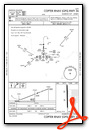
Instrument Approach Procedure (IAP) Charts

Nearby Airports with Instrument Procedures
| ID | Name | Heading / Distance | ||
|---|---|---|---|---|
 |
1K4 | David Jay Perry Airport | 303° | 14.1 |
|
KOUN | University of Oklahoma Westheimer Airport | 318° | 17.7 |
|
KPVJ | Pauls Valley Municipal Airport | 178° | 19.0 |
|
KSNL | Shawnee Regional Airport | 035° | 24.4 |
|
KTIK | Tinker AFB Airport | 341° | 24.5 |
|
KOKC | Okc Will Rogers International Airport | 320° | 28.5 |
|
KADH | Ada Regional Airport | 115° | 30.7 |
|
KSRE | Seminole Municipal Airport | 061° | 31.1 |
|
KCHK | Chickasha Municipal Airport | 276° | 36.5 |
|
KPWA | Wiley Post Airport | 326° | 36.6 |
|
O47 | Prague Municipal Airport | 042° | 37.1 |
|
KRCE | Clarence E Page Municipal Airport | 313° | 40.1 |
Airport Images
Do you have a recent image of this airport? Upload it here!


